- Home
- :
- All Communities
- :
- Developers
- :
- Python
- :
- Python Questions
- :
- Raster to Polyline Problem
- Subscribe to RSS Feed
- Mark Topic as New
- Mark Topic as Read
- Float this Topic for Current User
- Bookmark
- Subscribe
- Mute
- Printer Friendly Page
- Mark as New
- Bookmark
- Subscribe
- Mute
- Subscribe to RSS Feed
- Permalink
- Report Inappropriate Content
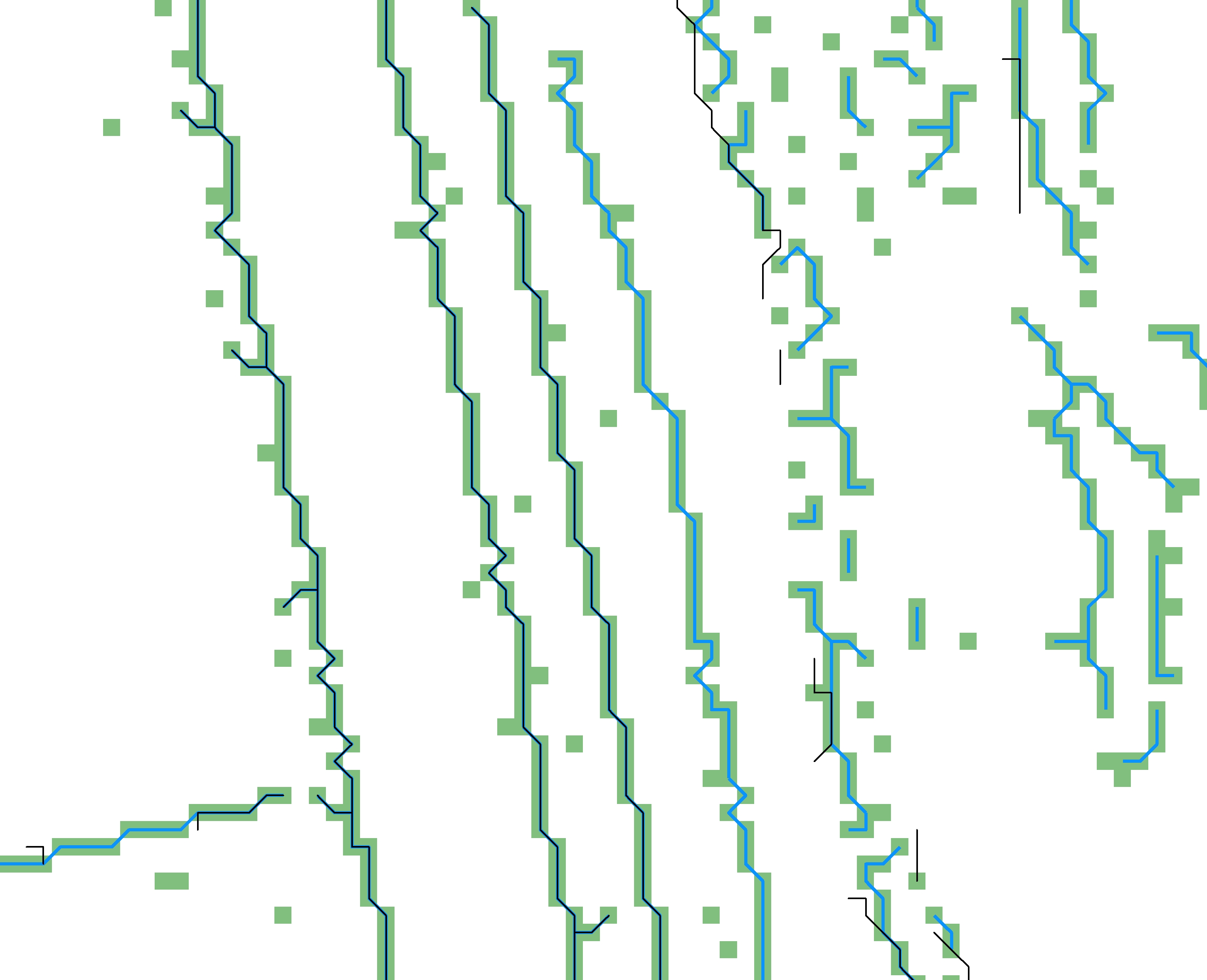
I am using raster to polyline in a python script, and it is not generating the results I would expect. When I run the toolbox raster to polyline with the same parameters, I get the results I expect. In the attached image, the green shows the input raster cells (cell value of 1), the blue line shows the toolbox results and the black line shows my script results. Any ideas as to what would be causing the difference in the line output when the input and the parameters are exactly the same?
Here is the raster to polyline command in the script:
arcpy.RasterToPolyline_conversion(Filter3, breaklinesFull, "ZERO", cellSize*1.42, "NO_SIMPLIFY")Solved! Go to Solution.
Accepted Solutions
- Mark as New
- Bookmark
- Subscribe
- Mute
- Subscribe to RSS Feed
- Permalink
- Report Inappropriate Content
I would guess the environment settings at runtime in the Python session are different from those that are set in ArcMap when you run the tool interactively.
In Python, make sure the environment extent, cellSize, snapRaster, and outputCoordinateSystem are the same as they were for your ArcMap interactive processing.