State and Local - Environment and Natural Resources Blog

cancel
Showing results for 
Show  only  | Search instead for 
Did you mean: 

Latest Activity

(14 Posts)
MichaelBialousz
Esri Contributor

We had an awesome Environment and Natural Resources Special Interest Group (SIG) meeting at the 2020 User Conference with some great presentations from natural resources agencies in Missouri, South Dakota and South Carolina!  We had over 550 participants during the live event and we received a lot of excellent feedback.  To that end, we have been asked by several folks if the recording could be made available and we are all in luck as we were able to obtain it and post to YouTube!  The links are below for the full event as well as the individual agency presentations.  Enjoy and please connect with us if you have any questions or would like more info.  Also, if you haven't done so already please join the Environment and Natural Resources Community via this story map as this is a way for us to continue connecting and collaborating.  

more
0 0 489
Sunny_Esri
Esri Contributor

Fresh off last week’s R3 Forum, fall is just around the corner, and more folks than ever are exploring their public lands… We're feeling energized about what this means for the broader conservation community and how we can begin asking questions about who is heading outdoors and how can we fully maximize this opportunity that’s in front of us?

One of the major themes around this year’s virtual R3 symposium was around marketing, and UNDERSTANDING your audience: who, what, why and WHERE.

Esri worked with a handful of states to develop solutions for R3 – the first step being this baseline understanding that was a prominent focus of the R3 Symposium. We want to provide agencies with the “Easy Button” to be able to deploy a solution out of the box, with all the technical components wired up and ready to go. South Dakota has already taken advantage of them with subtle configurations to meet their needs.

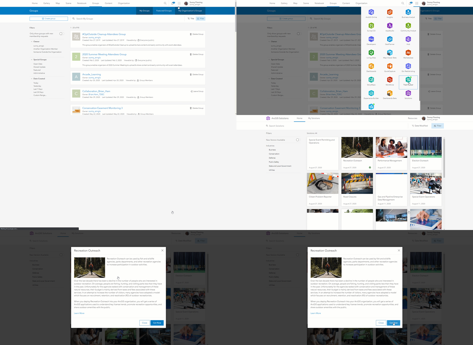
Initially these were deployed via the Solutions Deployment Tool in ArcGIS Pro, but we wanted a way to make it even EASIER. Enter: The Solutions App in ArcGIS Online.

Through the Solutions App, you can browse many of Esri’s Solutions and deploy them directly from your organization, to your organization, bypassing the initial deployment through ArcGIS Pro.
Out

With the Outdoor Recreation Solution, you get not only the R3 license dashboard, but also a new Hub Template to conduct outreach! This includes our locators for parks, license retailers, boating/fishing/hunting and can be configured to meet your unique needs.   

The better we understand our audiences and provide them with an intuitive place for all their outdoor information, the better we position conservation for a sustainable future. We look forward to seeing how you all deploy and configure these solutions!

ArcGIS SolutionsStateNatural Resources‌ 

more
0 0 1,063
MichaelBialousz
Esri Contributor

ArcGIS technology is applied in many ways in support of Recruitment, Retention and Reactivation (R3) strategies and initiatives at all levels.  Check out the following resources:

Case Studies:

Key Solution Offerings and Examples:

Readily Available Content:

more
0 0 515
MichaelBialousz
Esri Contributor

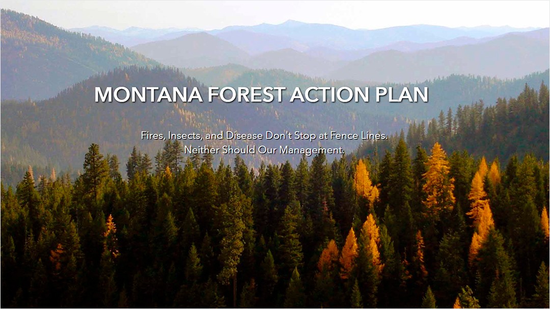
ArcGIS Hub offers a tremendous amount of potential for engaging with the public and partners at all scales around natural resources initiatives, and bringing together the key resources needed by all these folks.  Check out this user story of how this approach was put into action with the leadership of the Montana Department of Natural Resources and Conservation (DNRC) for the 2020 update of the Montana Forest Action Plan.  Collaboration was critical to not only the support and success of developing the plan, but also ensuring this success for the long term.  Hub has been essential to this and as pointed out in the article: "Hub has enabled us to reduce the friction between data and the people that need to be informed by it. We’ve removed some of the technical knowledge and staff power needed to leverage and access geospatial information on Montana's forests."

more
0 0 365
Sunny_Esri
Esri Contributor

I am sure you have all seen the news of unsolicited seeds turning up in many states across the US which is creating obvious concern. 
State Agriculture Departments are responding in various ways, including soliciting for emails or phone calls. Others have leveraged the Esri platform, realizing this as a perfect use case for Survey123. 
States such as Ohio and Alabama have stood up their own Survey123 forms. In Ohio, they let us know that as of noon today, they received 300 reports since standing up the survey Monday afternoon! They are able to easily report this directly to USDA on a daily basis. 
To this end, we've made a little generic form as food-for-thought. If you have any questions or need any support, feel free to reach out to Sunny Fleming or Mike Bialousz.

Natural Resources ArcGIS Survey123 State and Local - Environment and Natural Resources 

more
0 1 1,195
MichaelBialousz
Esri Contributor

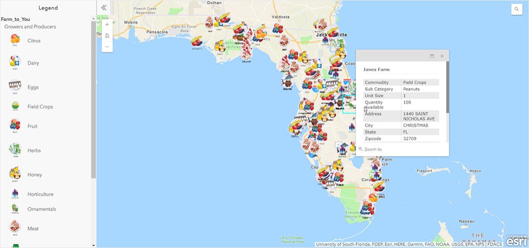
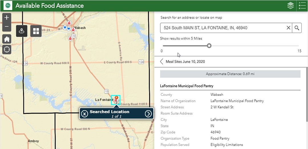
Check out these two recent Case Studies from Florida and Indiana highlighting the role of GIS in support of the collaboration and dissemination of food security and access resources.  The Agricultural community has been hit hard by the pandemic and GIS is a vital tool in the response, as well as navigating through these ever-changing conditions.  

more
0 0 417
Sunny_Esri
Esri Contributor

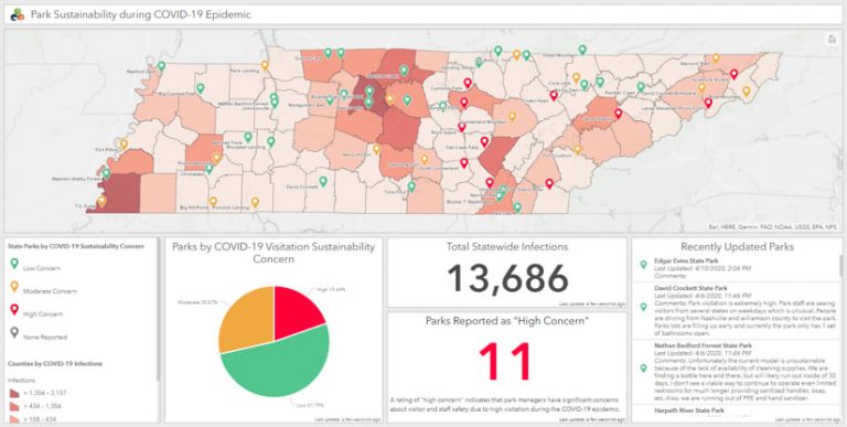
If you missed it, Esri recently published this case study highlighting how Tennessee State Parks and Massachusetts Dept. of Conservation and Recreation used the Esri platform in unprecedented circumstances. How has Covid affected your Environmental agency?

TN State Parks Covid 19 Dashboard

covid19 response #stateparks#conservation‌ environment

more
0 0 523
MichaelBialousz
Esri Contributor

At this year's Esri User Conference (UC), we will be having a new Special Interest Group (SIG) meeting.  If you are attending the UC, please join us to explore GIS for environmental and natural resources government agencies. This is a unique opportunity to hear from your peers and Esri subject matter experts regarding the latest technological advancements and tips and tricks to improve your everyday work. The agenda includes lightning talks from users working in various environmental and natural resources agencies.

Topics to be discussed include:
• integrated field mobility approaches for species management
• real-time wildlife tracking for enhanced conservation decision-making
• approaches to usability of configured versus custom recreation applications
• aligning agricultural business objectives with Esri tools
• collaborative approaches to the communication of harmful algal bloom (HAB) detections


We will also provide the opportunity to ask questions, as well connect with other folks from this diverse community.  The SIG will take place on Wednesday July 10th 11:30 -12:30 in SDCC, Room 24C.  We hope to see you at this event!

https://userconference2019.schedule.esri.com/schedule/16874346

more
3 0 391
24 Subscribers