Last week the ArcGIS for Telecommunications site was updated. This August release included an enhancement to the Antenna Structures Information Model as well as two NEW solution templates. ArcGIS for Telecommunications is a series of free and easy to deploy solution templates, web maps, and apps for adding telecom specific configurations to the ArcGIS platform. Listed below is the update to the Antenna Structures Information Model and information on the two new solution templates, Serviceability Lookup App and Service Request GeoForm.
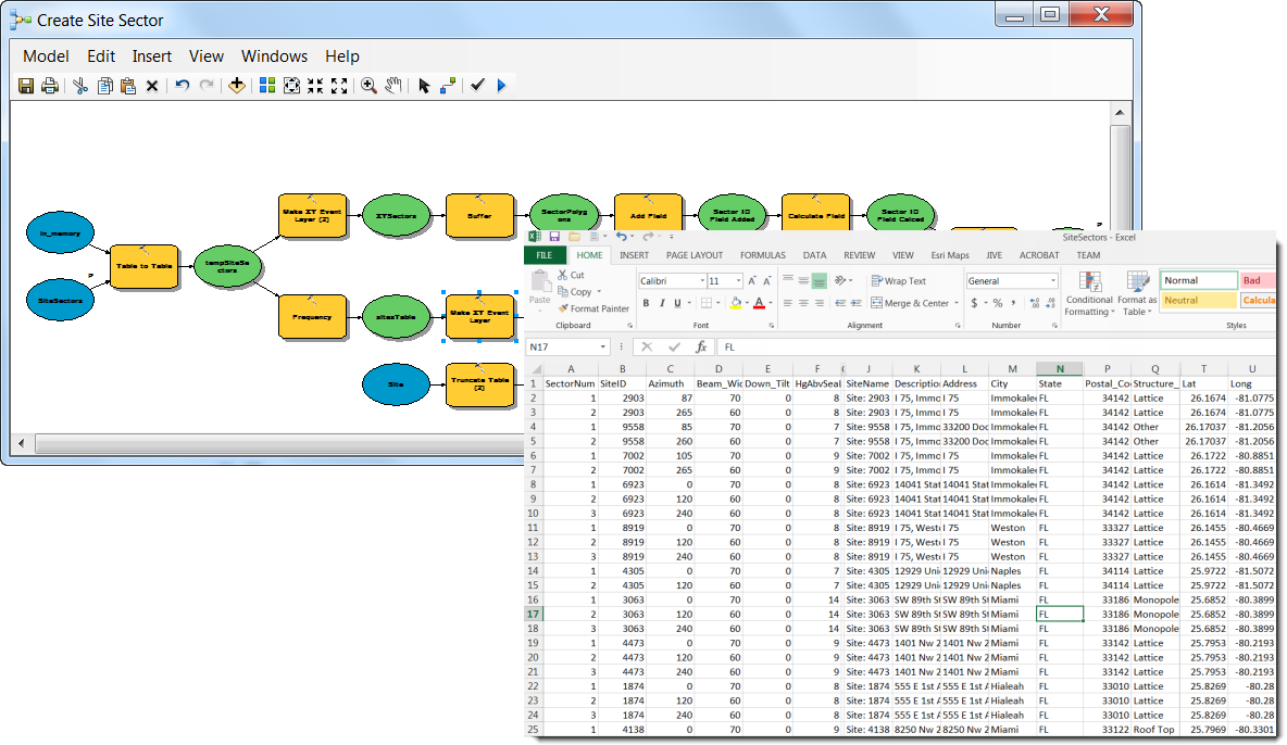
An additional model has been added to the Antenna Structures Information Model to allow for cell site and sector feature class creation from a csv file. Once the site and sector data is in feature class format, the update site and sector script can be run to generate pie slice shaped geometries to represent the sectors. These sectors can then be hooked up to live sector KPI data using GeoEvent Processor in order to track sector KPI’s.
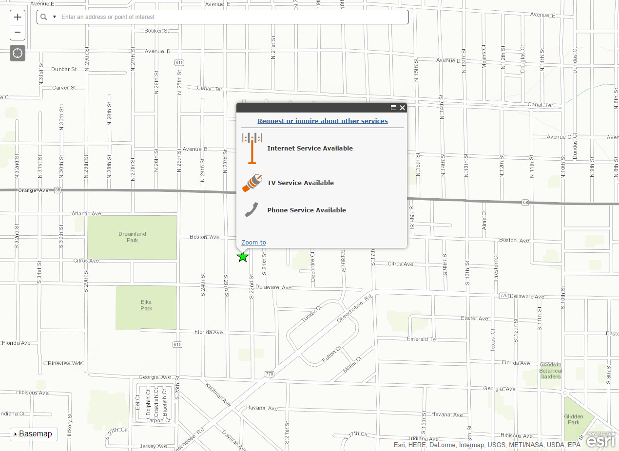
The Serviceability Lookup app is a configuration of ArcGIS Online for the public to view available services for a given location. This app is designed to be embedded on the company's website or as a standalone app.
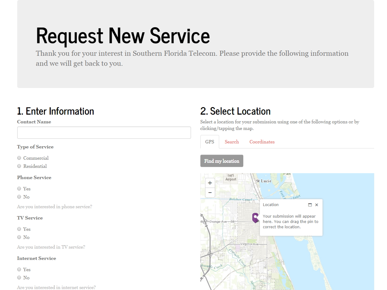
The Service Request app is a configuration of ArcGIS Online to allow the public to request service information. The app allows a user to complete a service request form and submit the location for service using an input address, current location, or coordinates. The requests can then be used by customer service to contact these potential new customers.