Turn on suggestions
Auto-suggest helps you quickly narrow down your search results by suggesting possible matches as you type.
Cancel
- Home
- :
- All Communities
- :
- Industries
- :
- Water Resources
- :
- Water Resources Questions
- :
- Fill aggressively fills in real canyon
Options
- Subscribe to RSS Feed
- Mark Topic as New
- Mark Topic as Read
- Float this Topic for Current User
- Bookmark
- Subscribe
- Mute
- Printer Friendly Page
Fill aggressively fills in real canyon
Subscribe
2377
1
03-01-2012 01:28 PM
03-01-2012
01:28 PM
- Mark as New
- Bookmark
- Subscribe
- Mute
- Subscribe to RSS Feed
- Permalink
- Report Inappropriate Content
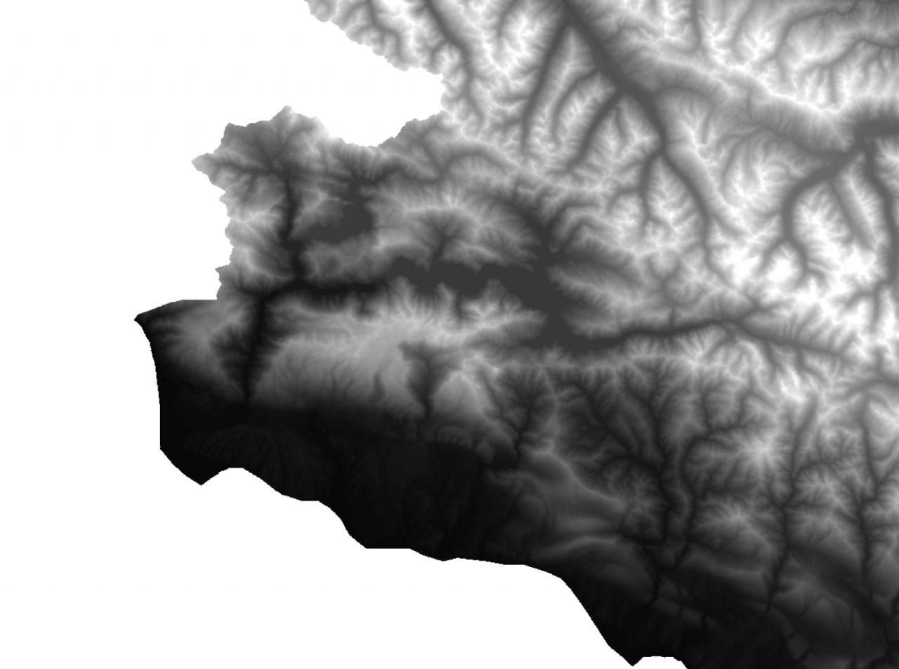
I am trying to extract longitudinal profiles for a series of rivers in mountainous terrain from SRTM 90 data. In places where there are deep, relatively narrow canyons, using Fill within the Spatial Analyst - Hydrology tools fills these canyons, making them instead large flat areas. I've attached an example of my original dem, the result after filling, and the resultant flow accumulation grid (with only cells greater than 1000 colored). The relief is relatively extreme ( in excess of 2000 meters of elevation change within 1 to 2 kilometers of map distance). Is there a work around for this error? I need the flow accumulation grid as an input for another program that extracts longitudinal profiles and allows me to calculate river concavity, etc. so ideally I need a way for the flow accumulation grid to be accurate.
1 Reply
03-02-2012
07:01 AM
- Mark as New
- Bookmark
- Subscribe
- Mute
- Subscribe to RSS Feed
- Permalink
- Report Inappropriate Content
If I wanted the profile, I would not use the fil raster; I would use the rawdem raster. However, if the canyon is getting filled and it shouldn't be, there may be something "blocking the flow" at the end of canyon when you run the fill sinks tool.
Do this. In the Layer Properties for the rawdem, under the Symbology tab, make sure the you are using the streched option. Then, scroll down the statistics settings. Change the drop down option to "For Current Display Extent". With this setting, when you zoom in the stretched color ramp uses the current display extent to set the colors for each grid. This gives you more resolution and you can see the nuances in the dem. Change the color ramp to something with several colors to add variability.
Now, zoom to the end of the canyon and. You should be able to clearly see what is "blocking" the flow and causing the canyon to fill. To remedy this, you can put a line (agreestream) in at that location and use it to "burn" in the stream just at that crossing using the DEM reconditioning step. When you run the fill sinks tool, the canyon should not fill. The burned in stream, which likely burns the dem below the canyon bottom, should fill in to match the lower end of the agreestream line. Then you can go through and create the drain lines and use those to do your profile in conjunction with the rawdem.