Turn on suggestions
Auto-suggest helps you quickly narrow down your search results by suggesting possible matches as you type.
Cancel
- Home
- :
- All Communities
- :
- Products
- :
- Mapping and Charting Solutions
- :
- Mapping and Charting Questions
- :
- Problem in Rounding-Off and Light Characteristics
Options
- Subscribe to RSS Feed
- Mark Topic as New
- Mark Topic as Read
- Float this Topic for Current User
- Bookmark
- Subscribe
- Mute
- Printer Friendly Page
Problem in Rounding-Off and Light Characteristics
Subscribe
2557
7
08-22-2013 12:52 AM
08-22-2013
12:52 AM
- Mark as New
- Bookmark
- Subscribe
- Mute
- Subscribe to RSS Feed
- Permalink
- Report Inappropriate Content
I have a Problem in Obstrucion I input in VALSOU 18.8 but in ArcMAP it appears 19 how to solve this rounding off and my Light Characteristics didn't appear how to view this
[ATTACH=CONFIG]26874[/ATTACH][ATTACH=CONFIG]26873[/ATTACH]
[ATTACH=CONFIG]26874[/ATTACH][ATTACH=CONFIG]26873[/ATTACH]
7 Replies
by
Anonymous User
Not applicable
08-22-2013
02:47 PM
- Mark as New
- Bookmark
- Subscribe
- Mute
- Subscribe to RSS Feed
- Permalink
- Report Inappropriate Content
Original User: crai3945
Hello Ruel,
We discovered a bug in how the decimeter values were being rounded. This has been resolved and will be available in the next patch of 10.2, which should be available next week.
Also keep in mind that depths are rounded according to the logic contained under B-412 of the IHO Paper Chart standard, S-4. So, although the rounding you were seeing was a bug, there will still be some rounding applied to VALSOU and DEPTH attributes.
Please let me know if you have further questions.
08-22-2013
05:05 PM
- Mark as New
- Bookmark
- Subscribe
- Mute
- Subscribe to RSS Feed
- Permalink
- Report Inappropriate Content
Hello Ruel,
We discovered a bug in how the decimeter values were being rounded. This has been resolved and will be available in the next patch of 10.2, which should be available next week.
Also keep in mind that depths are rounded according to the logic contained under B-412 of the IHO Paper Chart standard, S-4. So, although the rounding you were seeing was a bug, there will still be some rounding applied to VALSOU and DEPTH attributes.
Please let me know if you have further questions.
Yes Sir I read that in S4 other Obstruction Valsou like 4.5, 8.9, 7.3 etc... but anyway thanks Sir!
My other Question is why may Light Characteristics didn't show up how do I can appear my Light Characteristics?
Sorry for my English hope you understand.
Thanks...
by
Anonymous User
Not applicable
08-23-2013
09:36 AM
- Mark as New
- Bookmark
- Subscribe
- Mute
- Subscribe to RSS Feed
- Permalink
- Report Inappropriate Content
Original User: crai3945
Oops, sorry, I only answered the first part of your question.
The light labels are stored in fields on the AidsToNavigationP feature class. You can use the Paper Chart View from the Nautical Symbology toolbar, and this will set all labels in the mxd, it will also set the labels to the correct position relative to the features (sets soundings on point, for example), and it will set the label formatting (italic, font size, color, for example). It does other things as well, like making sure that all layers in TOC are in correct order.
It looks like you either already have some of your labels turned on, or maybe you already have created some annotation. If that is the case, you can also just use the Label Manager tool to turn on the labels for the fields in AidsToNavigationP that have an "_TXT" appended to them.
Again, let me know if you have more questions, I am happy to answer them for you, so please do not hesitate to ask more.
Thanks.
08-27-2013
09:37 PM
- Mark as New
- Bookmark
- Subscribe
- Mute
- Subscribe to RSS Feed
- Permalink
- Report Inappropriate Content
Oops, sorry, I only answered the first part of your question.
The light labels are stored in fields on the AidsToNavigationP feature class. You can use the Paper Chart View from the Nautical Symbology toolbar, and this will set all labels in the mxd, it will also set the labels to the correct position relative to the features (sets soundings on point, for example), and it will set the label formatting (italic, font size, color, for example). It does other things as well, like making sure that all layers in TOC are in correct order.
It looks like you either already have some of your labels turned on, or maybe you already have created some annotation. If that is the case, you can also just use the Label Manager tool to turn on the labels for the fields in AidsToNavigationP that have an "_TXT" appended to them.
Again, let me know if you have more questions, I am happy to answer them for you, so please do not hesitate to ask more.
Thanks.
I did your suggestion but still it didn't appear the bottom characteristics
08-27-2013
09:44 PM
- Mark as New
- Bookmark
- Subscribe
- Mute
- Subscribe to RSS Feed
- Permalink
- Report Inappropriate Content
by
Anonymous User
Not applicable
08-28-2013
07:31 AM
- Mark as New
- Bookmark
- Subscribe
- Mute
- Subscribe to RSS Feed
- Permalink
- Report Inappropriate Content
Original User: crai3945
Sorry, I thought you were missing light characteristics. Bottom characteristics are in SeabedP, the label field is SeabedP_TXT.
I did your suggestion but still it didn't appear the bottom characteristics
Sorry, I thought you were missing light characteristics. Bottom characteristics are in SeabedP, the label field is SeabedP_TXT.
08-28-2013
07:49 AM
- Mark as New
- Bookmark
- Subscribe
- Mute
- Subscribe to RSS Feed
- Permalink
- Report Inappropriate Content
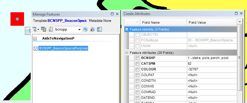
Sir Craig I have another question I creat a Stake and the symbol I got is this?
Sorry for another question! Thanks
[ATTACH=CONFIG]27039[/ATTACH]
Is this using a chart database? If so, you need to run the Calculate (Selected Set) option from the Symbology dropdown on the Nautical Symbology toolbar. Just make sure you have the feature selected that you want to symbolize.
In chart products the edit extension does not automatically update the symbology of features. The reason for this is to allow the cartographer to pick whichever symbol they need for a cartograhpic override, without the edit extension automatically firing and changing the symbol back to what the specification dictates is should be.
In the NIS and in ENC products, the symbology should automatically update when you create and encode the object and click Apply.
If you are in the Enterprise editing environment, you would only insert features in the NIS though, not in the chart. The new features would then be passed to all the relevant products through Replication.
I would also like to know what release you are on. We recently made some changes/fixes to the specification related to NAVAIDS, specifically for BCNSHP. It is possible that you are impacted by this change (in that you may not have it in your specification).
Thanks