- Home
- :
- All Communities
- :
- Products
- :
- 3D
- :
- 3D Questions
- :
- LAS Dataset to Raster tool results in linear artif...
- Subscribe to RSS Feed
- Mark Topic as New
- Mark Topic as Read
- Float this Topic for Current User
- Bookmark
- Subscribe
- Mute
- Printer Friendly Page
LAS Dataset to Raster tool results in linear artifacts (using Natural Neighbor interpolation)
- Mark as New
- Bookmark
- Subscribe
- Mute
- Subscribe to RSS Feed
- Permalink
- Report Inappropriate Content
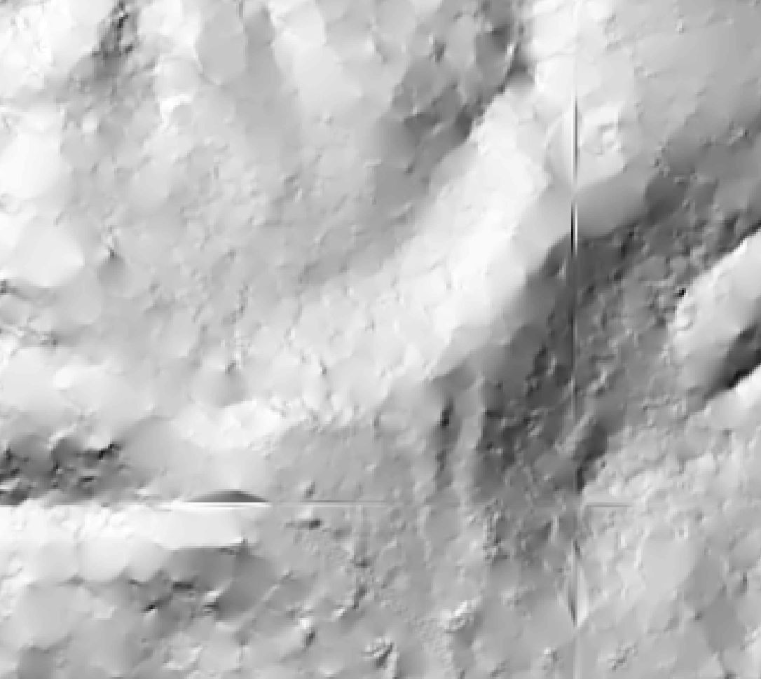
This year I attended an ESRI-led session at the User Conference on LiDAR and GIS and noted the recommendation to use Triangulation-->Natural Neighbor interpolation as the preferred method to convert LAS ground points to raster. So we switched up our workflow, which involves converting LAS datasets to various raster products.
We're running into an issue though: there are linear artifacts resulting from using Natural Neighbor interpolation. They are totally unrelated to the LAS tiling scheme or Lidar ground point elevation and show up in areas where dense vegetation results in more sparse ground point distribution. (See attachments--showing hillshade and Lidar ground points)
We can switch to a more complicated workflow involving creating a Terrain from the lidar points and then converting that to a raster, but it would be great to be able to get an accurate surface using the LAS Dataset-->Raster tool. Does anyone have experience/recommendations relating to this process?
Thank you!
- Mark as New
- Bookmark
- Subscribe
- Mute
- Subscribe to RSS Feed
- Permalink
- Report Inappropriate Content
What did you use for Cell Assignment Methods prior to using natural neighbour? There are recommendations in this
http://desktop.arcgis.com/en/desktop/latest/manage-data/las-dataset/lidar-solutions-creating-raster-... regarding settings and choices of source for three methods