- Home
- :
- All Communities
- :
- Products
- :
- Mapping
- :
- Mapping Questions
- :
- Polygons
- Subscribe to RSS Feed
- Mark Topic as New
- Mark Topic as Read
- Float this Topic for Current User
- Bookmark
- Subscribe
- Mute
- Printer Friendly Page
Polygons
- Mark as New
- Bookmark
- Subscribe
- Mute
- Subscribe to RSS Feed
- Permalink
- Report Inappropriate Content
Hello there,
Do you know an easy way to increase the size of a polygon uniformly and maintain its shape? I am using ArcMap 10.2 version.
- Mark as New
- Bookmark
- Subscribe
- Mute
- Subscribe to RSS Feed
- Permalink
- Report Inappropriate Content
You can use the top-secret Scale editing tool, which is in the Editor category of tools, although not added to the Editor toolbar by default. Follow the instructions on the Scaling a feature help page to add the button.
- Mark as New
- Bookmark
- Subscribe
- Mute
- Subscribe to RSS Feed
- Permalink
- Report Inappropriate Content
Thank you for this great tip.
Sorry but I did not place the right question, this is my case:
I drawn a polygon following an hydro survey sheet, said polygon ends with 15.0 acres of land. Now I have to adjust the polygon shape from 15.0 acres of land to 14.0 acres of water rights, do you think this is possible in ArcGIS?
Thank you in advance for any help you can provide
- Mark as New
- Bookmark
- Subscribe
- Mute
- Subscribe to RSS Feed
- Permalink
- Report Inappropriate Content
Could you visualize what you are trying to obtain? There are possibly many ways that could provide what you are looking for, spatial adjustment, buffer, etc, but a picture would help to understand the specifics of your question.
- Mark as New
- Bookmark
- Subscribe
- Mute
- Subscribe to RSS Feed
- Permalink
- Report Inappropriate Content
Thank you for your advice. Basically, I am trying to reduce an existing polygon area from 15 acres to 14 acres at the same time I need to keep its shape. See the attached image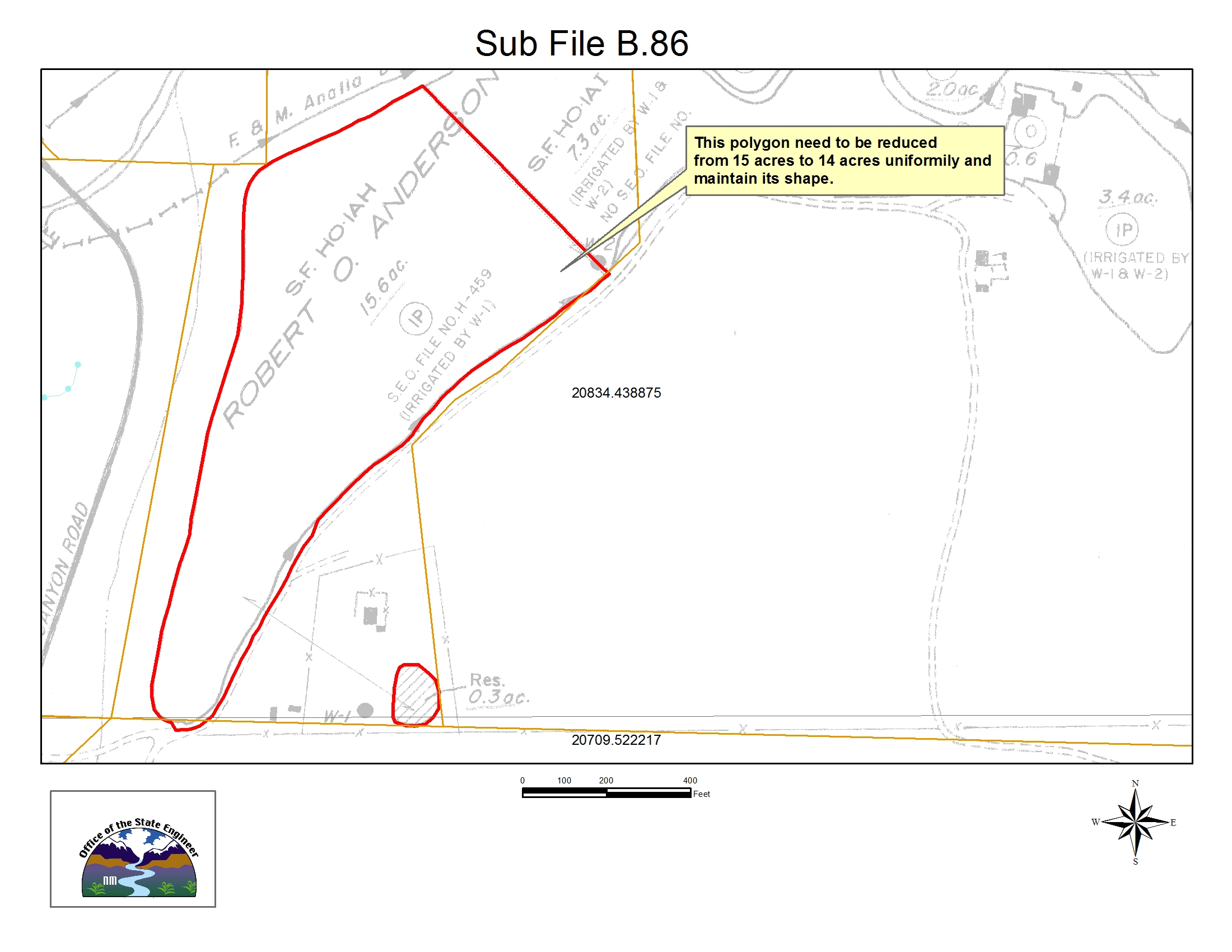
- Mark as New
- Bookmark
- Subscribe
- Mute
- Subscribe to RSS Feed
- Permalink
- Report Inappropriate Content
as what has been said by Xander and Darren...particular since you imply a spatial shift in the land to water mention. Is the land adjacent to the water ?(not mention, perhaps implied) Does water rights mean surficial water of subsurface water?
- Mark as New
- Bookmark
- Subscribe
- Mute
- Subscribe to RSS Feed
- Permalink
- Report Inappropriate Content
Thank you for your advice. Basically, I am trying to reduce an existing polygon area from 15 acres to 14 acres at the same time I need to keep its shape. See the attached image
- Mark as New
- Bookmark
- Subscribe
- Mute
- Subscribe to RSS Feed
- Permalink
- Report Inappropriate Content
A negative buffer by area should keep the shape the same as one would have to do in the field by producing normals to the original outline and then connecting the points. The trick is to find the offset distance which produces an area reduction of the desired size. This has to be done iteratively since it isn't a regular geometric shape. In fact if the buffer size is large relative to the original shape, you can collapse the polygon in on itself so that the original shape will be unrecognizable. I can't find any references to current tools except this one
http://www.arcgis.com/home/item.html?id=10b2645c4fcd4daf97100720d417424c
but I am not sure if it does negative buffere
- Mark as New
- Bookmark
- Subscribe
- Mute
- Subscribe to RSS Feed
- Permalink
- Report Inappropriate Content
Thank you Dan!