- Home
- :
- All Communities
- :
- Products
- :
- Geoprocessing
- :
- Geoprocessing Questions
- :
- Question about aggregating polygons
- Subscribe to RSS Feed
- Mark Topic as New
- Mark Topic as Read
- Float this Topic for Current User
- Bookmark
- Subscribe
- Mute
- Printer Friendly Page
Question about aggregating polygons
- Mark as New
- Bookmark
- Subscribe
- Mute
- Subscribe to RSS Feed
- Permalink
- Report Inappropriate Content
I have a shapefile that has numerous polygons. I would like to combine polygons that have the same values for some characteristic into larger polygons. I don't think the dissolve function will work because the polygons are not necessarily contiguous (Think parcels of land with streets in between. I want to get a district that contains multiple parcels that may or may not be contiguous.) I don't think aggregate polygons would work either as there are potentially hundreds of these districts in my data set. Any ideas? Thanks.
- Mark as New
- Bookmark
- Subscribe
- Mute
- Subscribe to RSS Feed
- Permalink
- Report Inappropriate Content
If i understand what your after correctly i think dissolve will get you want you want it will combine all the polygons contiguous or not and create a single polygon.
- Mark as New
- Bookmark
- Subscribe
- Mute
- Subscribe to RSS Feed
- Permalink
- Report Inappropriate Content
Dissolve should work for you:
Dissolve—Help | ArcGIS for Desktop
It will create multi-part polygons for you by default, which means you can dissolve by a field, or multiple fields, with the same attribute(s) - the polygons are not required to be contiguous.
- Mark as New
- Bookmark
- Subscribe
- Mute
- Subscribe to RSS Feed
- Permalink
- Report Inappropriate Content
Dissolve is fine if there is some need to adjoin adjacent land parcels...for instance, same landuse and/or owner etc etc. I generally recommend against this since I is far simpler to have singlepart poly* features than multipart. In fact, many geoprocessing functions only work properly when you have singlepart features (ie determining the centre of a polygon or simply counting the number of one type.
So do you have a particular reason to do this. Is it to save file size? Have you considered that a layer could be split based upon its attributes rather than aggregating geometry? (ie group residential land use into one layer...). Any insight into why you need/want to do this might provide some suggestions on how it affects your workflow and how you might benefit from alternates yet maintain the integrity of the geometry and its attributes.
- Mark as New
- Bookmark
- Subscribe
- Mute
- Subscribe to RSS Feed
- Permalink
- Report Inappropriate Content
Thanks for the advice. What I am trying to do is create polygons for different special tax assessment zones. These are not currently geo-coded. So I am trying to aggregate separate land parcels (not contiguous) into one assessment zone. I then want to do some geoprocessing with the larger assessment zones. Does this make sense?
- Mark as New
- Bookmark
- Subscribe
- Mute
- Subscribe to RSS Feed
- Permalink
- Report Inappropriate Content
When you run the dissolve you will be asked where to save the new feature class, so you wont be hurting anything to test. Give it a test and see what happens.
- Mark as New
- Bookmark
- Subscribe
- Mute
- Subscribe to RSS Feed
- Permalink
- Report Inappropriate Content
Why not simply query for the assessment zone attribute, which I assume you have. Once queries, you can save the selection to its own layer and not have to worry about that criterion again since any operations will apply to it. When you are done, you can simply delete it. The advantage is that you don't have to worry about going to the trouble of limiting the operation to that class. Currently, I can't see any geoprocessing function which would be advantaged by consolidating the geometry. Also what do you do about the cases that the primary class is one type but the secondary, tertiary.... are different types? How do you plan to accommodate for that when you geoprocessing operation changes to something else?
- Mark as New
- Bookmark
- Subscribe
- Mute
- Subscribe to RSS Feed
- Permalink
- Report Inappropriate Content
Hi Dan:
Bear with me here if you will. I tried using dissolve, and got the multipart polygon. I can see why that is an issue and it does not solve my question. So I could certainly split the data into multiple layers based on each tax assessment district. But what I would get is hundreds of parcels in each layer with the same tax assessment district number, but as distinct polygons. How would I go about constructing the district itself. For instance, I would like the centroid of the district or the area of the district.
Thanks,
Andrew
- Mark as New
- Bookmark
- Subscribe
- Mute
- Subscribe to RSS Feed
- Permalink
- Report Inappropriate Content
Andrew... try my Split Layers by attribute
http://www.arcgis.com/home/item.html?id=15ca63aebb4647a4b07bc94f3d051da5
It is a convention toolbox, which you load in ArcToolbox and run it from there, not ArcCatalog.
Porting it over to ArcGIS Pro and File Geodatabases is ongoing. Now let me know if you can get to that link...it isn't visible from ArcScripts 2.0 Beta for some reasons that are too difficult to explain.
In any event, you can split your big file into subfiles, based upon a common attribute...which I presume is a District field in your table. If you read carefully, you will get outputs that are separated. Cavaets, the inputs must be a shapefile (long story) so export any featureclass to a shapefile and process all your results in a folder. This will produce a number of unique shapefiles which you can bring in as feature classes as you need them, or simply create a file geodatabase solely for this purpose and load the stuff up...do your processing and the rest of your projects are intact and undisturbed. Let me know
- Mark as New
- Bookmark
- Subscribe
- Mute
- Subscribe to RSS Feed
- Permalink
- Report Inappropriate Content
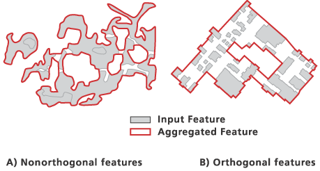
Since you mention Aggregating polygons and that Dissolve doesn't work, I assume you've tried the Aggregate tool...? Does it produce the results you're after, and you're looking for a way to automate cycling through each district, or does it not produce the results you want at all?
Is this the situation you're describing?: