- Home
- :
- All Communities
- :
- Products
- :
- ArcGIS Pro
- :
- ArcGIS Pro Questions
- :
- autocad 3d to arcgis pro
- Subscribe to RSS Feed
- Mark Topic as New
- Mark Topic as Read
- Float this Topic for Current User
- Bookmark
- Subscribe
- Mute
- Printer Friendly Page
autocad 3d to arcgis pro
- Mark as New
- Bookmark
- Subscribe
- Mute
- Subscribe to RSS Feed
- Permalink
- Report Inappropriate Content
Is it possible to export a 3d building model from auto cad 3d to arcgis for data management?
- Mark as New
- Bookmark
- Subscribe
- Mute
- Subscribe to RSS Feed
- Permalink
- Report Inappropriate Content
It depends on the geometry used to model the building information in AutoCAD. ArcGIS does a pretty good job of using 3D polylines and 3DFACES directly from AutoCAD files and or converting those CAD objects to MULTIPATCH features.
- Mark as New
- Bookmark
- Subscribe
- Mute
- Subscribe to RSS Feed
- Permalink
- Report Inappropriate Content
Yes but it may take some work to fine tune how you do this to get the data out in the best format.
first challenge is georefferencing. Then you may have to export as a dxf to simplify new more complicated objects in AutoCAD. Or just have to save the file in AutoCAD with the proxigraphics setting set to 1 to simplify the new advanced objects to GIS compatible. Once you have the file in GIS it is a matter of filtering out the objects that are not meaningful to your final goal.
I am in the middle of automating a BIM conversion from a CAD-like program. Best of luck.
- Mark as New
- Bookmark
- Subscribe
- Mute
- Subscribe to RSS Feed
- Permalink
- Report Inappropriate Content
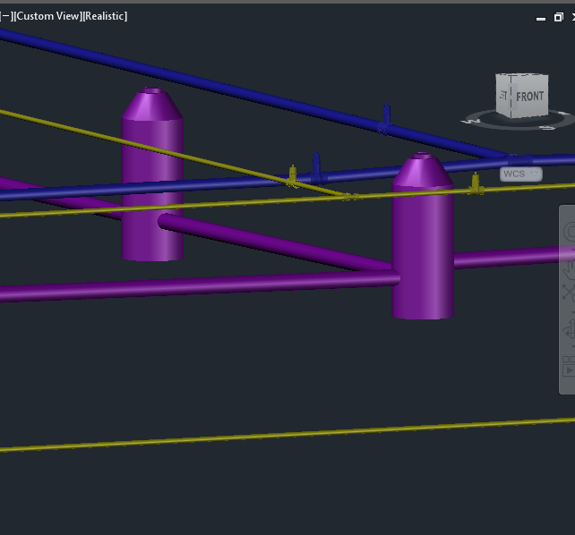
I am having a similar issue. I have a bunch of polylines in civil saved as a .dwg (2013 version) which has been correctly imported into ArcPro. In AutoCAD Civil 3D they are created into 3D model/blocks (a network of pipes and valves). When I import the new .dwg into ArcPro, nothing is displayed and the features contain no attributes. It seems like there is some issue wen the polylines were converted to 3D models? I have tried saving as a dxf and dwf as well with nothing working. Any Ideas?
- Mark as New
- Bookmark
- Subscribe
- Mute
- Subscribe to RSS Feed
- Permalink
- Report Inappropriate Content
Zachary,
ArcGIS Desktop doesn’t support all of the 3D entities of AutoCAD, and currently does not support Civil 3D custom AEC objects.
You may find that if you demote the objects to something like an AutoCAD MESH within AutoCAD ArcGIS Pro can see them. You might also have more capabilities in the data interoperability extension to read more of the attributes of Civil 3D objects.
-Don
- Mark as New
- Bookmark
- Subscribe
- Mute
- Subscribe to RSS Feed
- Permalink
- Report Inappropriate Content
Thanks for your response. That must be the issue. I will try a work around and converting the data to different 3D types. Thanks!
- Mark as New
- Bookmark
- Subscribe
- Mute
- Subscribe to RSS Feed
- Permalink
- Report Inappropriate Content
In civil3d try turning proxygraphics to a 1 in the command line then save.
You should see the file size get absolutely huge. That will be autocad
storing all the contours as polylines instead of calculating them from the
surface stored in the file.
If that doesn't work it is likely that the surface is a reference. If that
is the case in the command line open the properties box by typing mo,
select the contours/surface and run explode in the command line. Select
again and it should be a block in the properties window. Explode until you
select a polyline. Save and open in arc map.
The other issue you might be having is civil/survey guys love to work in
meaningless coordinate systems when it comes to GIS. If that is the case
you will want to get with the project surveyor to get scale and rotation
information.
Hope this helps.
- Mark as New
- Bookmark
- Subscribe
- Mute
- Subscribe to RSS Feed
- Permalink
- Report Inappropriate Content
I turned the proxygraphics to 1 and am getting the same results. I followed your instructions for using the Explode tool. The valves and manholes come in, but not whole, and the pipes are completely missing. The features were created in state-plane and were accurately located and scaled. Any other thoughts?

Thanks!
- Mark as New
- Bookmark
- Subscribe
- Mute
- Subscribe to RSS Feed
- Permalink
- Report Inappropriate Content
Try saving back to autocad 2000. That is pre civil3d and it usually
explodes everything.
- Mark as New
- Bookmark
- Subscribe
- Mute
- Subscribe to RSS Feed
- Permalink
- Report Inappropriate Content
Still no luck... As a work around, I am converting my 3D AutoCAD model to a REVIT Model which I know will work they way I want it to.
Thanks for the tips.
Zach