- Home
- :
- All Communities
- :
- Developers
- :
- JavaScript Maps SDK
- :
- JavaScript Maps SDK Questions
- :
- The shape has been changed while publish a feature...
- Subscribe to RSS Feed
- Mark Topic as New
- Mark Topic as Read
- Float this Topic for Current User
- Bookmark
- Subscribe
- Mute
- Printer Friendly Page
The shape has been changed while publish a feature service using shapefiles
- Mark as New
- Bookmark
- Subscribe
- Mute
- Subscribe to RSS Feed
- Permalink
- Report Inappropriate Content
I got a route (polyline feature) return by network analysis. I publish the feature service using ArcGIS Online - add item. The url is https://services6.arcgis.com/3xMWKvHmHKRqJGse/arcgis/rest/services/Route12/FeatureServer/0
And I confused about the path difference between shapefile and graphics added on the map.
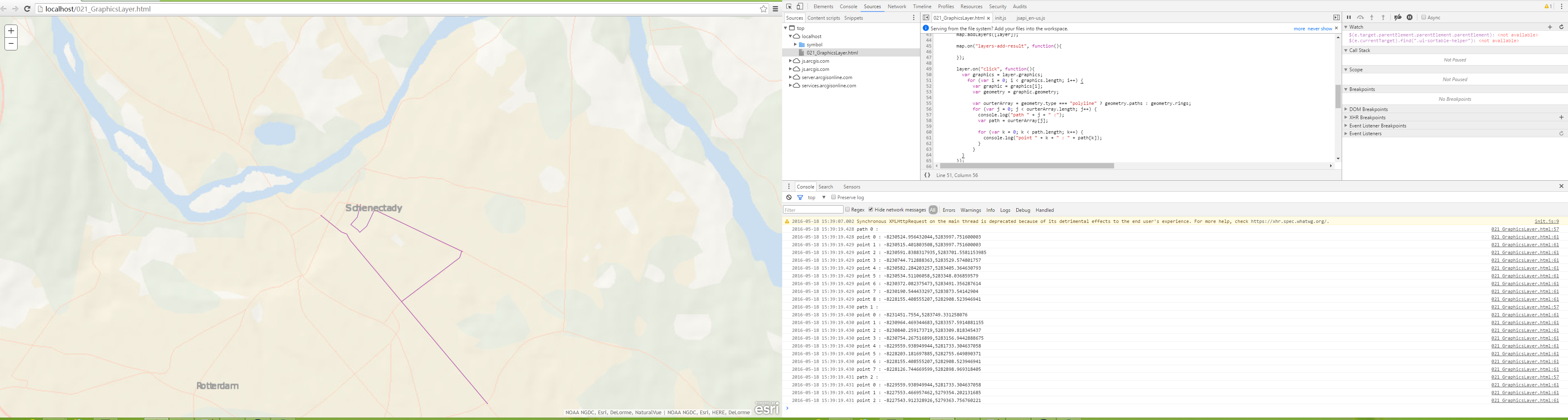
In the arcmap, the polyline has a path with 28 points, while the graphics layer return 3 paths and 20 points.
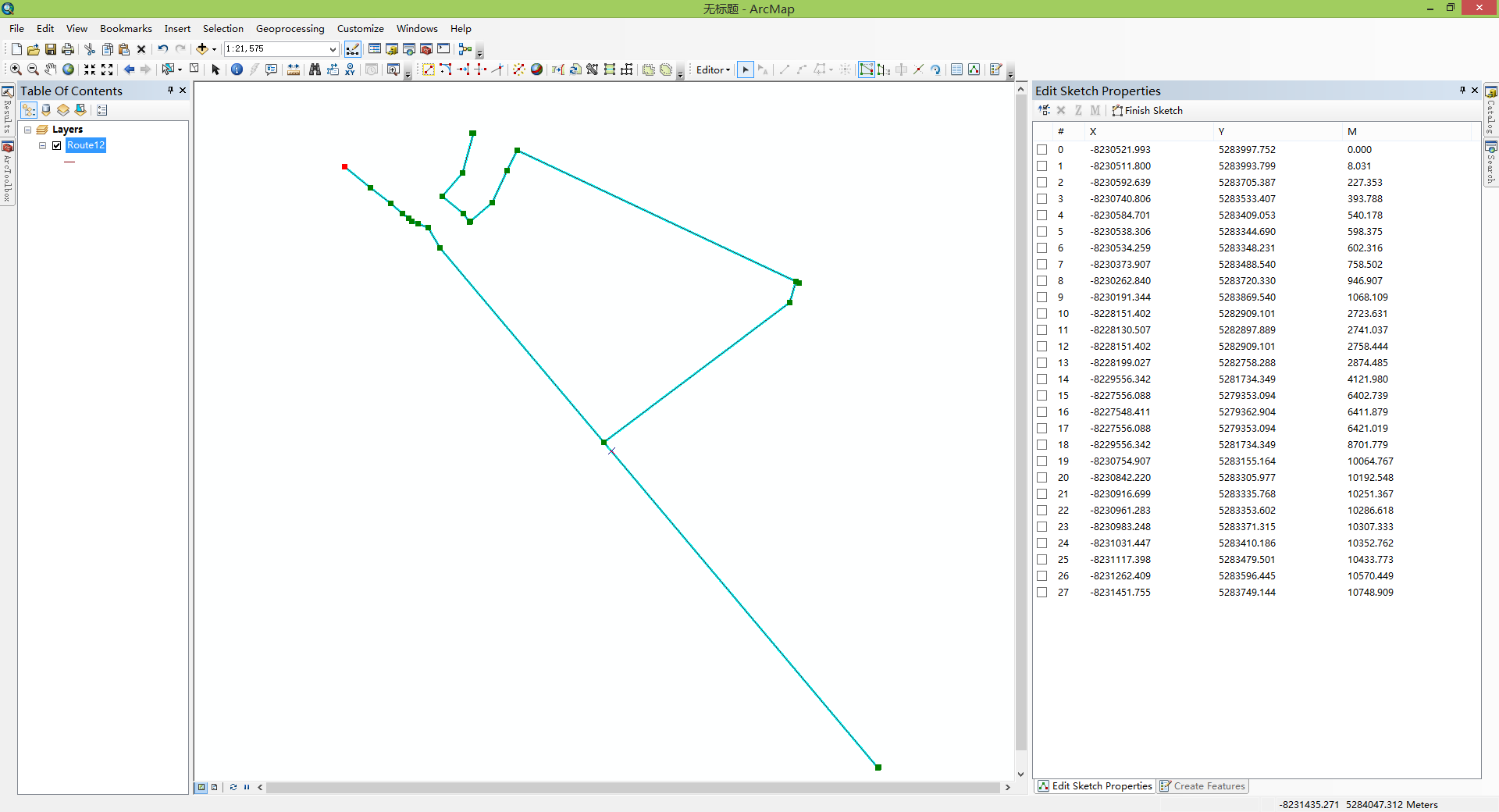
It seems that my data has been changed. but I can't figout the reason.
The attachment is my data(*.shp) and the scripts, please help me, thanks!
Solved! Go to Solution.
Accepted Solutions
- Mark as New
- Bookmark
- Subscribe
- Mute
- Subscribe to RSS Feed
- Permalink
- Report Inappropriate Content
The problem is that the upload features has a topology error of self-intersection. The arcgis online will auto repair the geometry. So the results geometry on the feature services may have multiple paths.
- Mark as New
- Bookmark
- Subscribe
- Mute
- Subscribe to RSS Feed
- Permalink
- Report Inappropriate Content
The same question appears while add the RouteResult.route to the feature layer. The polyline geometry also been changed. The results geometry of route only has one path, however the graphic stored has multiple paths. How to solve this problem?
- Mark as New
- Bookmark
- Subscribe
- Mute
- Subscribe to RSS Feed
- Permalink
- Report Inappropriate Content
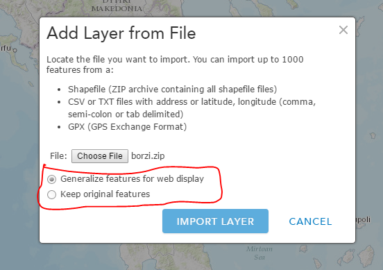
during the upload what did you select for the generalization?
- Mark as New
- Bookmark
- Subscribe
- Mute
- Subscribe to RSS Feed
- Permalink
- Report Inappropriate Content
Hi, Panagiotis:
Where is the "Add Layer from File"? I'm using the arcgis online and using "My Content" --> Add Item --> From my computer.
- Mark as New
- Bookmark
- Subscribe
- Mute
- Subscribe to RSS Feed
- Permalink
- Report Inappropriate Content
I found it. It's at New map -> Add...
- Mark as New
- Bookmark
- Subscribe
- Mute
- Subscribe to RSS Feed
- Permalink
- Report Inappropriate Content
Using the arcgis online -> New Map -> Add layer from file then save. Finally, I got a published web mapservices. How to get the feature services using original features?
- Mark as New
- Bookmark
- Subscribe
- Mute
- Subscribe to RSS Feed
- Permalink
- Report Inappropriate Content
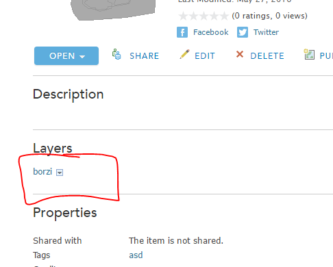
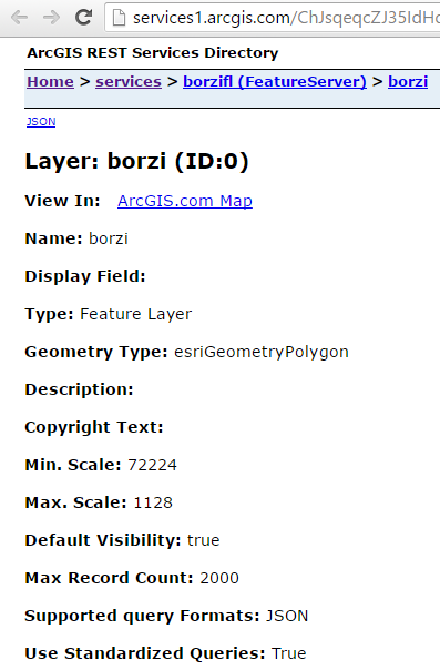
Save the Layer you have uploaded
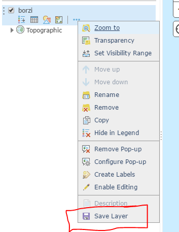
see item details and Publish this item
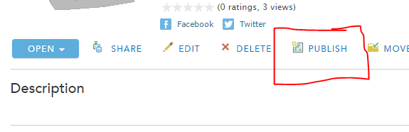
after that a hosted feature layer created and you can access the rest end point
- Mark as New
- Bookmark
- Subscribe
- Mute
- Subscribe to RSS Feed
- Permalink
- Report Inappropriate Content
Hi, Panagiotis:
 This solve the multiple paths question. However, the points of the paths is not equal each other. Is there any way to set the tolerence of the layer upload to the arcgis online?
- Mark as New
- Bookmark
- Subscribe
- Mute
- Subscribe to RSS Feed
- Permalink
- Report Inappropriate Content
I not sure about that. See from the Rest end point if any other properties are available.
- Mark as New
- Bookmark
- Subscribe
- Mute
- Subscribe to RSS Feed
- Permalink
- Report Inappropriate Content
The problem is that the upload features has a topology error of self-intersection. The arcgis online will auto repair the geometry. So the results geometry on the feature services may have multiple paths.