- Home
- :
- All Communities
- :
- Products
- :
- ArcGIS Drone2Map
- :
- ArcGIS Drone2Map Questions
- :
- How to fix image calibration?
- Subscribe to RSS Feed
- Mark Topic as New
- Mark Topic as Read
- Float this Topic for Current User
- Bookmark
- Subscribe
- Mute
- Printer Friendly Page
How to fix image calibration?
- Mark as New
- Bookmark
- Subscribe
- Mute
- Subscribe to RSS Feed
- Permalink
- Report Inappropriate Content
Just testing out Drone2Map for the first time with images from a DJI phantom. Finding that only a portion of my mission area is processed, which appears to be because only a selection of the images were calibrated...Its not clear to me what to do to fix this? Processing the same images through the Maps Made Easy service results in full coverage orthomosaic. In Drone2Map processing report I see: "31 out of 50 images calibrated (62%), all images enabled". Any ideas on what to do differently?
- Mark as New
- Bookmark
- Subscribe
- Mute
- Subscribe to RSS Feed
- Permalink
- Report Inappropriate Content
I would like to know this too....but it looks like there won't be an answer.
I get the following error message: "Processing Failed: No Blocks Computed No Calibrated Cameras"
I have no idea what that means.
- Mark as New
- Bookmark
- Subscribe
- Mute
- Subscribe to RSS Feed
- Permalink
- Report Inappropriate Content
This is typically caused by poor image quality (blurry or lack of texture) or insufficient overlap between the images.
If you are able to share the images, I am happy to have a look and help figure out what is happening.
Thanks
Tony
- Mark as New
- Bookmark
- Subscribe
- Mute
- Subscribe to RSS Feed
- Permalink
- Report Inappropriate Content
I just ran into the same issue. Only 3 images of a rooftop taken manually with DJI P4 and guessing 50% overlap approximate. Let me know where to send the images because I can't find a tool to upload them here.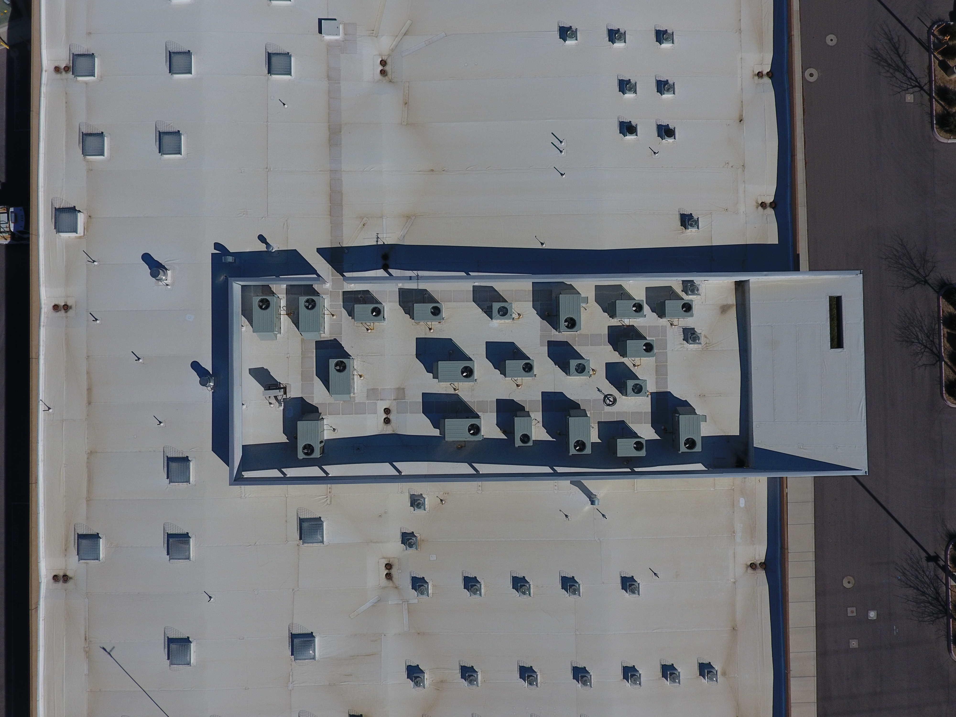
- Mark as New
- Bookmark
- Subscribe
- Mute
- Subscribe to RSS Feed
- Permalink
- Report Inappropriate Content

- Mark as New
- Bookmark
- Subscribe
- Mute
- Subscribe to RSS Feed
- Permalink
- Report Inappropriate Content
Hi Kalvan Hone,
That message is indicative of either poor image quality or insufficient overlap. We recommend 75% frontal overlap and 60% side overlap. Please try adding additional images with the recommended overlap and run processing again.
Thank you.
Jeremy
- Mark as New
- Bookmark
- Subscribe
- Mute
- Subscribe to RSS Feed
- Permalink
- Report Inappropriate Content
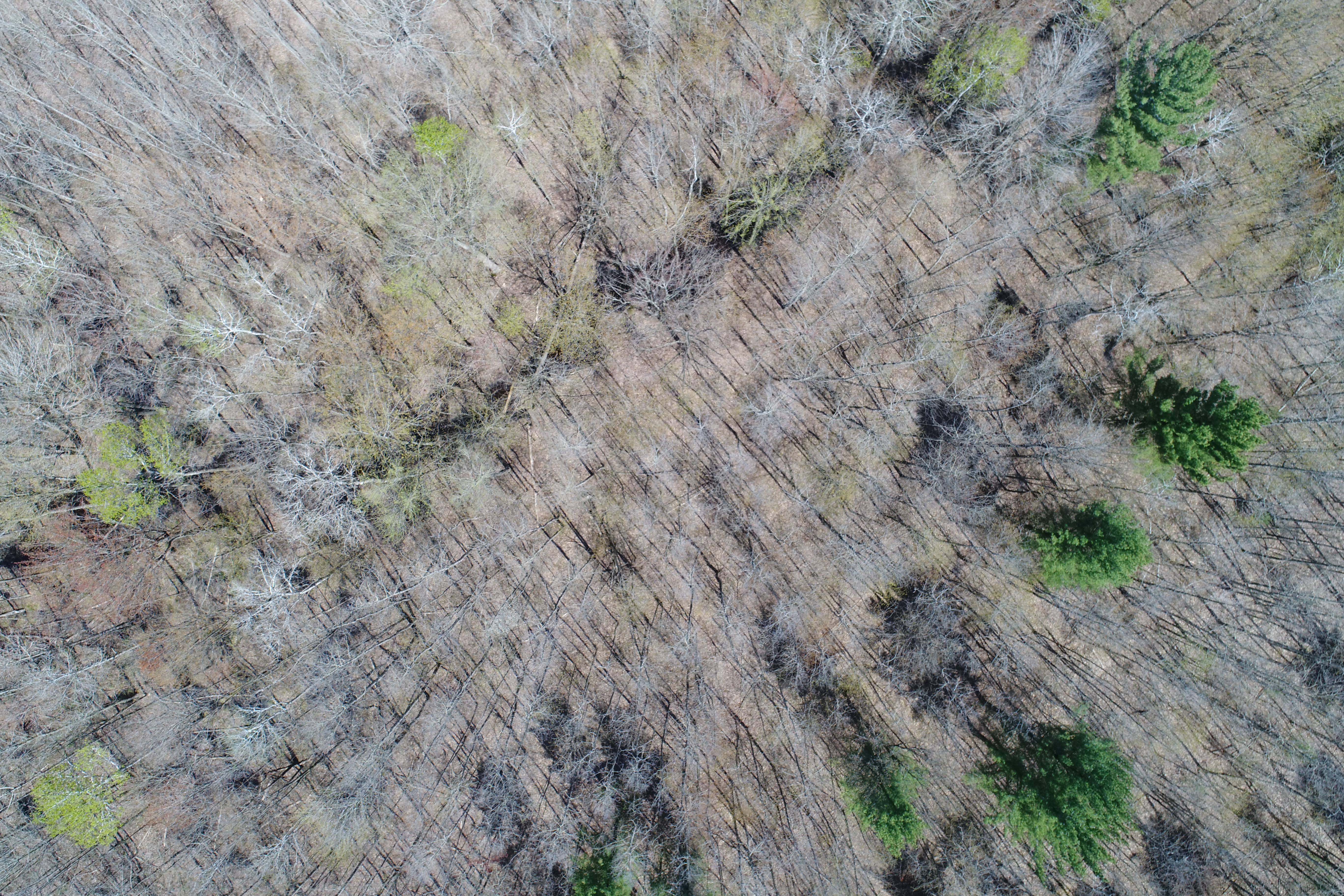
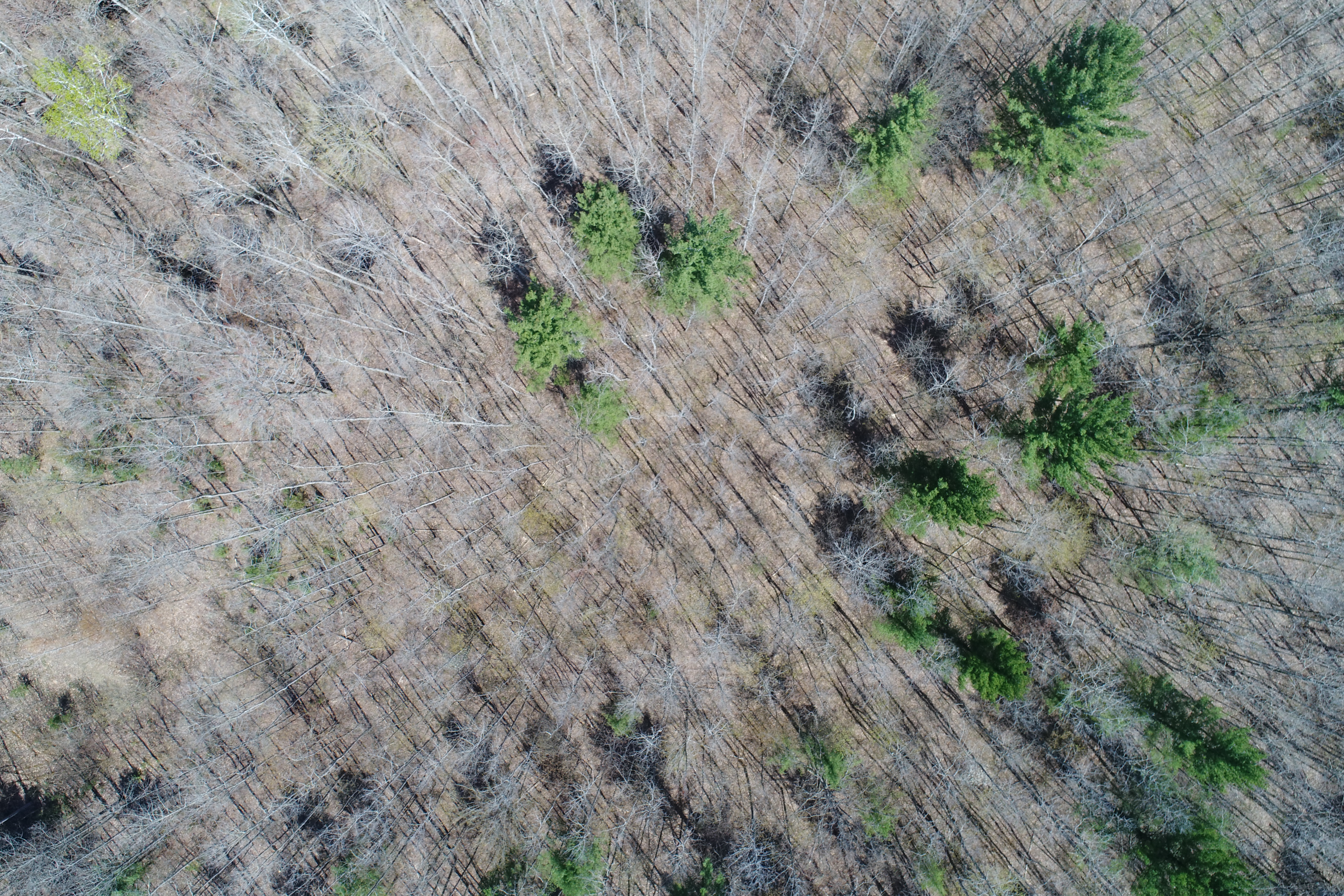
We have been having this issue as well. We are fly with a 80 by 80 percent overlap at 300 feet with a Inspire 2. Our issue comes in mainly when we fly over forested areas.

I can not see a difference in image quality between the photos that work, and the ones that do not calibrate.
- Mark as New
- Bookmark
- Subscribe
- Mute
- Subscribe to RSS Feed
- Permalink
- Report Inappropriate Content
Kelly,
Try to change the calibration method in the processing options to Alternative.
Processing options—Drone2Map for ArcGIS Help | ArcGIS
This is the preferred method when your images are homogeneous and lack the necessary features to generate key points and matches.
Additionally use the 2D Mapping template when creating the project to make sure you are generating enough keypoints.
Thanks
Tony
- Mark as New
- Bookmark
- Subscribe
- Mute
- Subscribe to RSS Feed
- Permalink
- Report Inappropriate Content
I have the same issue but with XT2 RGB dataset. There is nothing wrong with the image quality. I need to change the camera calibration settings...I am able to do so in pix4d. See photo...How can I do this in Drone2Map?
- Mark as New
- Bookmark
- Subscribe
- Mute
- Subscribe to RSS Feed
- Permalink
- Report Inappropriate Content
Gary
see Editing the camera model—ArcGIS Help | Documentation
Cody B