- Home
- :
- All Communities
- :
- Products
- :
- ArcGIS GeoPlanner
- :
- ArcGIS GeoPlanner Questions
- :
- Consensus Tool - Change Score and Consensus Score
- Subscribe to RSS Feed
- Mark Topic as New
- Mark Topic as Read
- Float this Topic for Current User
- Bookmark
- Subscribe
- Mute
- Printer Friendly Page
Consensus Tool - Change Score and Consensus Score
- Mark as New
- Bookmark
- Subscribe
- Mute
- Subscribe to RSS Feed
- Permalink
- Report Inappropriate Content
Hi all,
I am following getting started in GeoPlanner and following the exercises from GeoPlanner for ArcGIS | ArcGIS
I have some questions on the Consensus Tool.
1) What is the difference between change score and consensus score?
2) From the documentation of change score and consensus score (Consensus—GeoPlanner for ArcGIS | ArcGIS ), "interested area" was mentioned. Is this the map extent? If not, could it be explained further?
3) How are the change score and consensus score calculated? For example, "The change score is computed by dividing the count of features for an area by the total count of participating scenarios and then mapping the result to a 1-to-9 scale. For example, 10 scenarios participate in a consensus process, and 6 out of 10 scenarios cover the interested area. The change score is computed as 6 divided by 10, which is 0.6. This score is then mapped to a 1-to-9 scale, with a final change score of 6." Is the change score calculated by dividing the features/scenarios or scenarios/scenarios? Applies to consensus score as well.
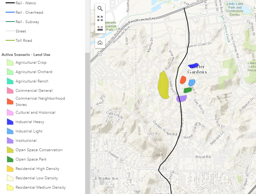
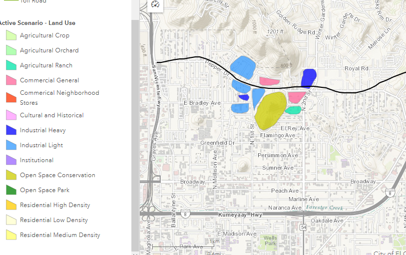
I have attached both of my scenarios (Scenario A and Scenario B).
Scenario A
Scenario B
I ran a Consensus on the polygon feature layer with only Scenario B checking only Industrial Light and the output as follow

I also tried running it on both scenarios but only on Industrial Light:

Thanks in advance.
- Mark as New
- Bookmark
- Subscribe
- Mute
- Subscribe to RSS Feed
- Permalink
- Report Inappropriate Content
Hello KC Lee,
Planners may want to develop a certain patch of land (polygon in Geoplanner) in a town/city in a certain way that may reflect their stakes or priorities such as decreasing traffic congestion, reducing pollution etc. In the context of Geoplanner, the Change Score indicates the degree of interest among stakeholders in a given patch of land (polygon). Each scenario represents a stakeholder's interest. For example, let us say that there is a patch of land near a freeway in which out of 10 scenarios/stakeholders who want to develop it to serve their priority, 9 are interested in developing that patch of land in a certain way (examples could be shopping mall, recreational park etc.). Geoplanner calculates the change score as the ratio of number of scenarios or stakeholders willing to develop it to the total number of scenarios, which in this case is 9/10 for that patch of land, implying that on a scale of 1-9, this will probably map very close to 9 indicating a very high degree of interest.
However, these scenarios/stakeholders may not agree to develop the land in a certain way because of competing priorities, and may want to develop land in different ways (landuse types for the polygon design layer). For example, if out of 9 scenarios/stakeholders, let us say that all 9 want to develop it into shopping malls - this will suggest complete agreement among the stakeholders or scenarios to develop that patch of land. In this case, the consensus is 9/9 or 1 and will map to 9 on a scale of 1-9. But let us say that all stakeholders did not want to develop the land as shopping malls. Instead, 5 stakeholders/scenarios want to develop it as recreational park, 3 want to develop it as shopping mall, and 1 want to develop it as a university campus. In this case, consensus score is the ratio of the number of stakeholders with most preferred land use (recreational park) to the total number of stakeholders. In this case, the consensus score is calculated as 5/9 = 0.55 and will map to a consensus score of 5 on a scale of 1-9.
Hope this helps.
Amit Sinha
- Mark as New
- Bookmark
- Subscribe
- Mute
- Subscribe to RSS Feed
- Permalink
- Report Inappropriate Content
Hi Amit,
Thanks, this explanation is much better.
You might want consider improving the documentation to help users get started. Thanks.
- Mark as New
- Bookmark
- Subscribe
- Mute
- Subscribe to RSS Feed
- Permalink
- Report Inappropriate Content
"interested area" is not the same as "area of interest" which is typically used to define the map extent of a project.