- Home
- :
- All Communities
- :
- User Groups
- :
- Elevation Data
- :
- Questions
- :
- Incorporating Breaklines: Terrain Datasets
- Subscribe to RSS Feed
- Mark Topic as New
- Mark Topic as Read
- Float this Topic for Current User
- Bookmark
- Subscribe
- Mute
- Printer Friendly Page
Incorporating Breaklines: Terrain Datasets
- Mark as New
- Bookmark
- Subscribe
- Mute
- Subscribe to RSS Feed
- Permalink
- Report Inappropriate Content
I'm trying to incorporate breaklines along canals and unlined rivers so that the elevation between the breaklines is filled based on the breaklines. I've tried to follow the concept that ESRI describes within the following help article: Incorporate breaklines with LiDAR. The article doesn't explain in detail the requirements of the feature class that will be used within the LiDAR to achieve the following.
The approach that I've used so far is to generate polylines that represent the location of the breaklines that I wish to use within my Terrain. I then used 3D Analyst tool: Interpolate Shape. to extract the elevation levels from the terrain. I then added the following to my Terrain as SFType : Hardline.
My current results don't represent the results that I'm expecting that is explained within the Incorporate breaklines with LiDAR documentation.
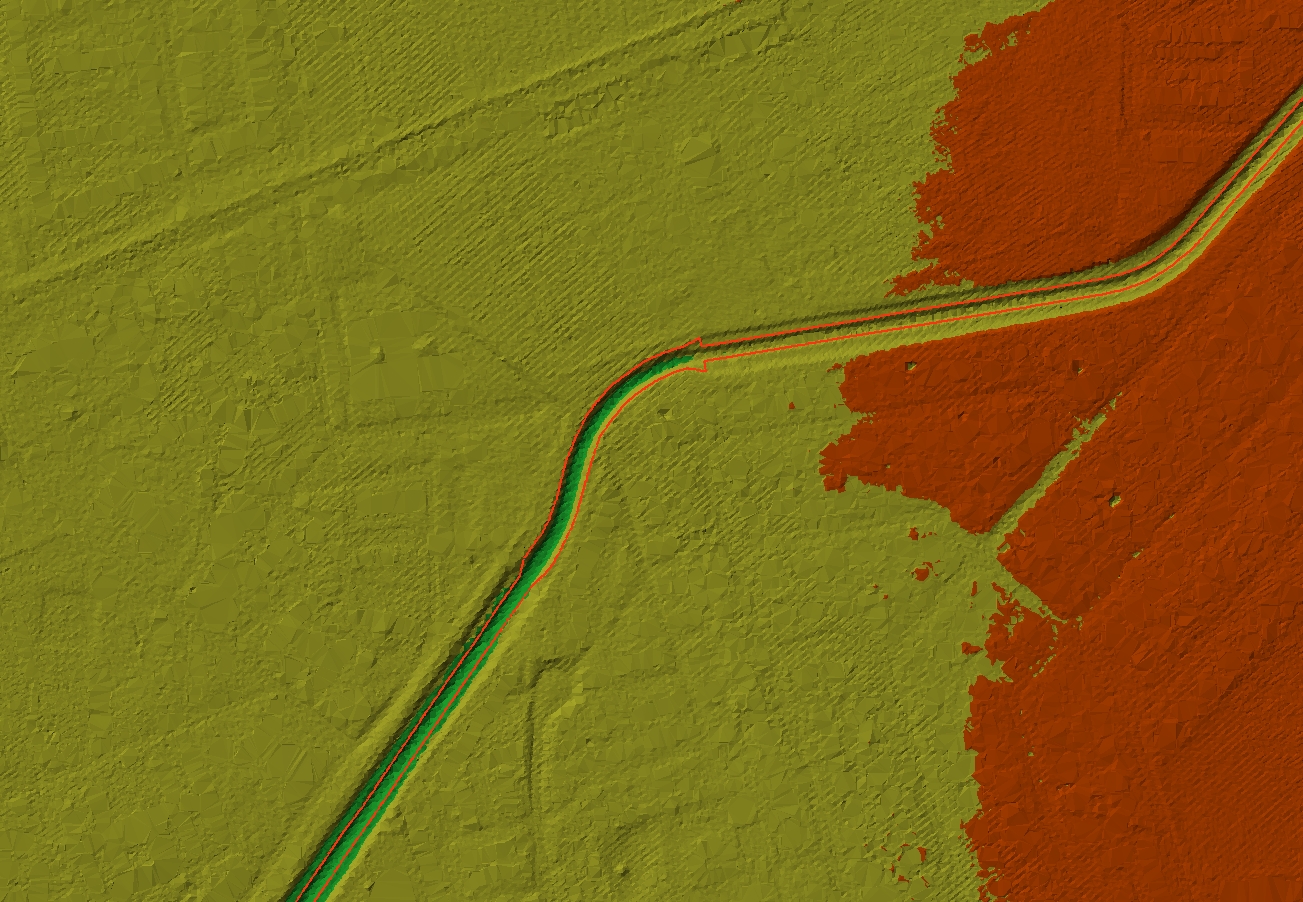
Current Results with breaklines, canals are not filled

Incorporate breaklines with LiDAR documentation: Filled River Section.
Any help in what step that I'm missing the achieve the following will be appreciated.