- Home
- :
- All Communities
- :
- Products
- :
- 3D
- :
- 3D Questions
- :
- Trying sort out Lidar Data I took
- Subscribe to RSS Feed
- Mark Topic as New
- Mark Topic as Read
- Float this Topic for Current User
- Bookmark
- Subscribe
- Mute
- Printer Friendly Page
Trying sort out Lidar Data I took
- Mark as New
- Bookmark
- Subscribe
- Mute
- Subscribe to RSS Feed
- Permalink
- Report Inappropriate Content
Hi Everyone,
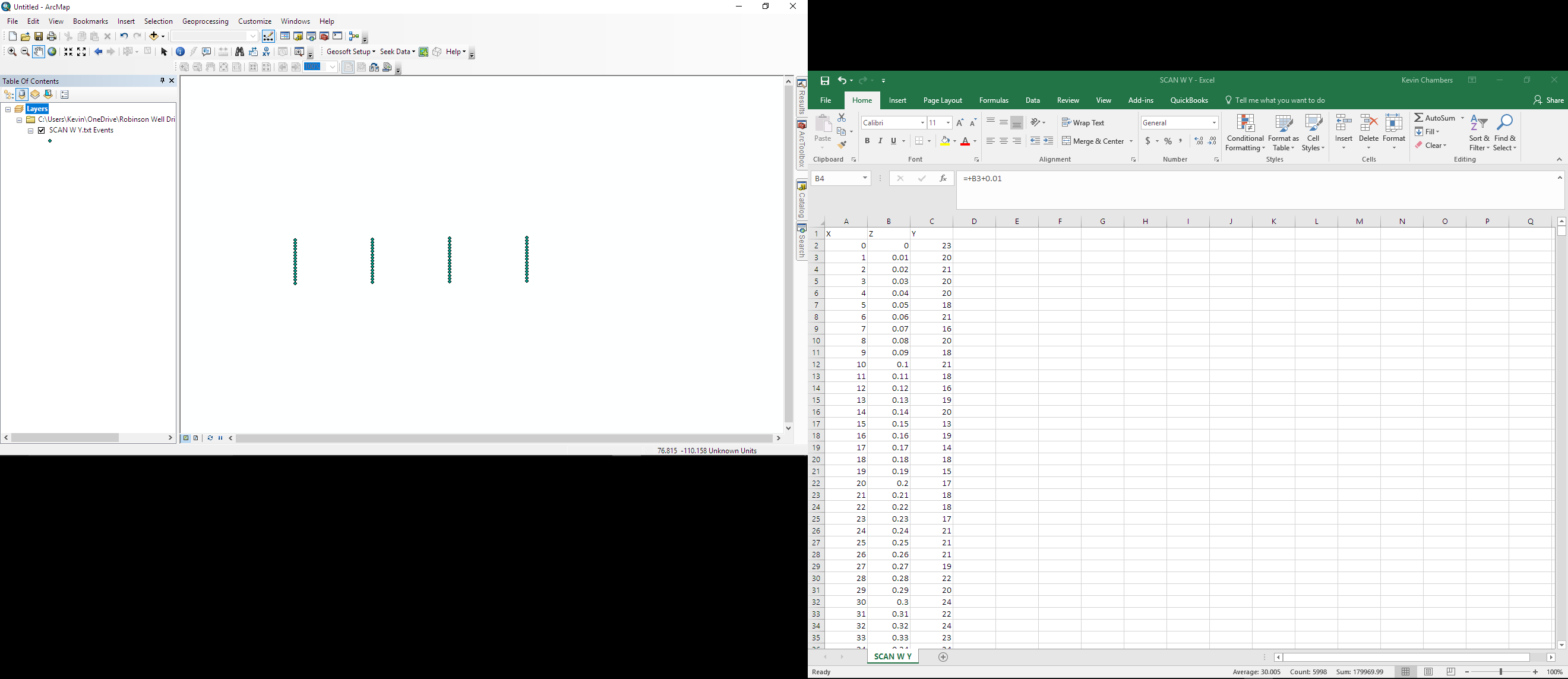
I have a lidar device with the purpose designed to go down various holes to create a 3D image. X is the position of the rotation, where Y is the distance measured from the lidar unit, and Z is the height. All data is saved into a text file to import to ARCMAP. After which the plan is to convert to a layer package, to a las, to raster. However, when I import the file, I get the attached image, you can also see the excel spreadsheet, which was saved as a .txt
Few questions that I need help with, is there a better way to create a 3D image / better process? Why is the data when importing into ARCMAP displaying the way it is, when it at least should be a flat cylinder? When I created fake data before, it showed as a flat cylinder.
- Mark as New
- Bookmark
- Subscribe
- Mute
- Subscribe to RSS Feed
- Permalink
- Report Inappropriate Content
Remember that X and Y in your case do not represent "X" and "Y". The angle of rotation/bearing (X) and distance (Y) can be translated to X and Y coordinates if you have the location of the origin or simply by using for instance 0, 0 as origin. The Z is height and probably does not need any processing (unless it is the height from a certain pont of reference).
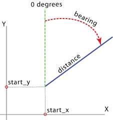
(image taken from: Bearing Distance To Line—Help | ArcGIS for Desktop )
In arcpy the PointGeometry—Help | ArcGIS for Desktop class has a method pointFromAngleAndDistance (angle, distance, {method}) which could be used to create the actual 3D geometry. If you are willing to share a small part of the data, I can show you how.