- Home
- :
- All Communities
- :
- Products
- :
- Mapping and Charting Solutions
- :
- Mapping and Charting Questions
- :
- Georeferencing Map with Paris Meridian
- Subscribe to RSS Feed
- Mark Topic as New
- Mark Topic as Read
- Float this Topic for Current User
- Bookmark
- Subscribe
- Mute
- Printer Friendly Page
Georeferencing Map with Paris Meridian
- Mark as New
- Bookmark
- Subscribe
- Mute
- Subscribe to RSS Feed
- Permalink
- Report Inappropriate Content
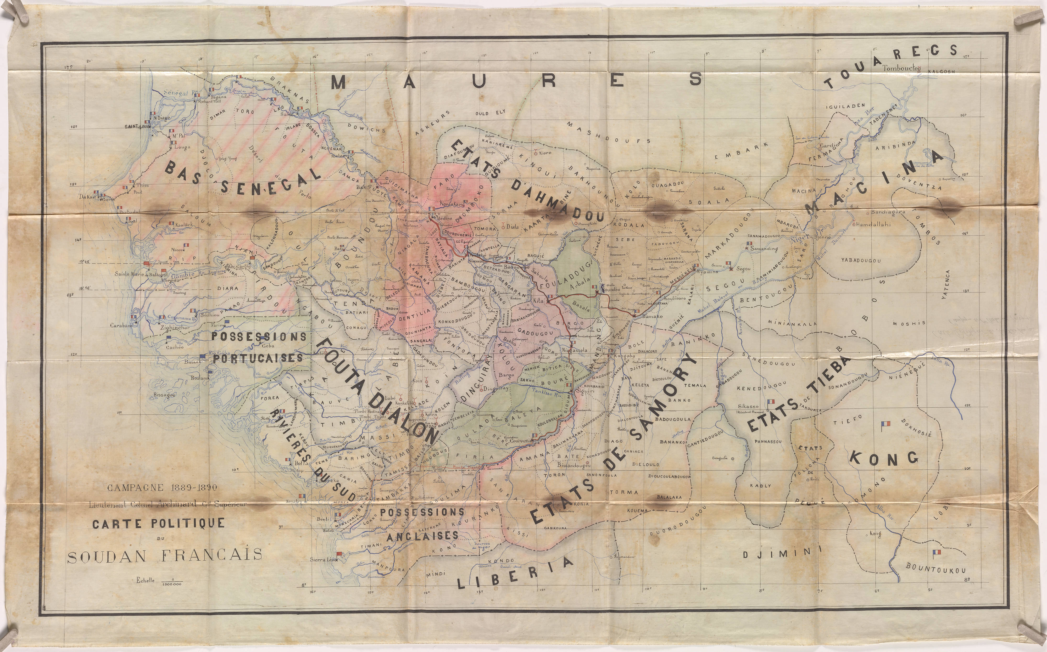
Hello everyone,
First off, please excuse my ignorance on this topic. I am working on a project for a professor that involves georeferencing a historical map of Africa. It seemed easy enough until I realized my map was consistently 2.33 degrees off. Upon looking through the projections in ArcMap, I noticed that there was a projection called Voirol 1879 Paris. I also noticed that there are projections that use degrees and ones that use grads. I'm pretty sure that the map uses the Paris meridian, but I am unsure of how to tell if it is in grads or degrees. So I have three questions:
1. Is there a way to tell if the map is in grads or degrees?
2. Would I be able to reference it using the Voirol 1879 Paris projection and then transform it to a projection that uses the Greenwich meridian?
3. If it is possible, what would be the best way of accomplishing this?
I have attached the map in question. Any help would be greatly appreciated!
- Mark as New
- Bookmark
- Subscribe
- Mute
- Subscribe to RSS Feed
- Permalink
- Report Inappropriate Content
when you did the georeferencing did you not reference it to a map with current coordinates? That would have handled transformation to the current reference space. Do you still have the control points? If so you should be able to adjust for the discrepancy
- Mark as New
- Bookmark
- Subscribe
- Mute
- Subscribe to RSS Feed
- Permalink
- Report Inappropriate Content
Thank you! Yes, I still have the control points and was able to do the adjustments.
- Mark as New
- Bookmark
- Subscribe
- Mute
- Subscribe to RSS Feed
- Permalink
- Report Inappropriate Content
Glad it worked
- Mark as New
- Bookmark
- Subscribe
- Mute
- Subscribe to RSS Feed
- Permalink
- Report Inappropriate Content
Fascinating old map you have there Joshua.