- Home
- :
- All Communities
- :
- User Groups
- :
- Coordinate Reference Systems
- :
- Questions
- :
- Georeference-Choosing right Coordinate System
- Subscribe to RSS Feed
- Mark Topic as New
- Mark Topic as Read
- Float this Topic for Current User
- Bookmark
- Subscribe
- Mute
- Printer Friendly Page
Georeference-Choosing right Coordinate System
- Mark as New
- Bookmark
- Subscribe
- Mute
- Subscribe to RSS Feed
- Permalink
- Report Inappropriate Content
First of all this is my first post here and also the first post about GIS so sorry if i'll talk nonsense here.
I have an large jpeg and also tiff which are the same map(image) 45568x37632 which i have downloaded it from Google Earth with Google Maps Downloader.
I want to georeference one of those(jpeg or tiff file) in ArcMap 10.4
With Google Maps Downloader you can create a georeferenced tiff;so i opened this in ArcMap but it came stretched horizontally like that
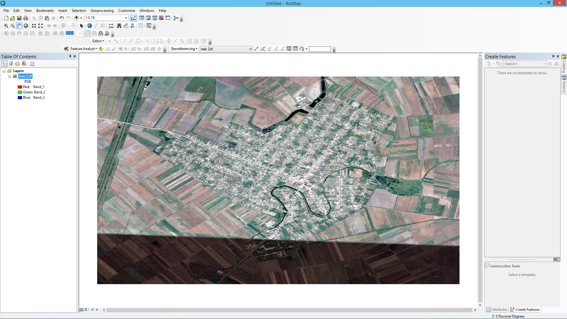
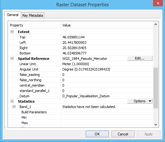
Here are the properties:
I tried also with the jpeg which was not georeferenced in Google Maps Downloader
I understand that Google Maps use WGS1984 Coordinate System so i used that with the jpeg.
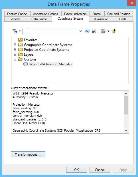
The Data Frame Properties is also set to WGS1984
I used control points with coordinates taken from Google Earth in Decimal Degrees,but after I applied them(georeference)
the jpeg layer came stretched like the georeferenced tiff with Google Maps Downloader.
Here is the original jpeg:
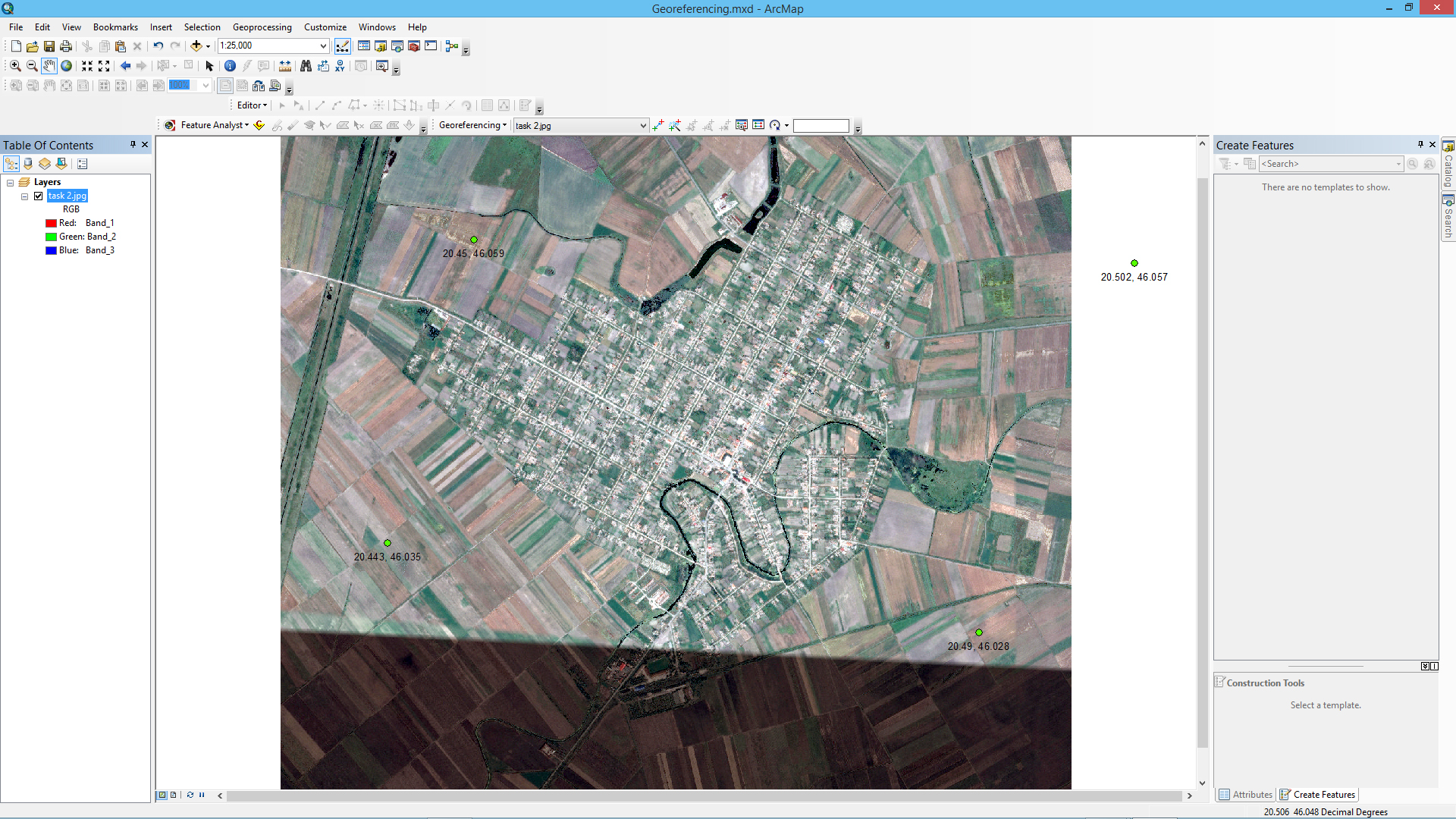
and here is after using control points:

So what's the catch here?What I'm doing wrong?
Second issue: I tried to rectify the georeferenced tiff(which has 1.63 GB) and it took 10 hours to save it,and the result was only black tiff,over 12 GB.
Is that normal? I'm on Windows 8.1 Pro,I74790,16gb ram,GTX 770
Third issue:Does anybody knows by the way,why this image has that darkened bottom part in Google Earth? because in Google Maps it doesn't have it.
Or if somebody knows a way to download very high resolution images like this one,from Google Earth/Maps but to be able to download from historical imagery?
Thank You and I apologize if I'm asking too much.
- Mark as New
- Bookmark
- Subscribe
- Mute
- Subscribe to RSS Feed
- Permalink
- Report Inappropriate Content
Total noob here, so this might just be the blind leading the blind but here goes nothing:
The short: It might just be your current coordinate system, try setting the data frame to something else. (Why? I have no idea, but here's what I've noticed...)
The long:
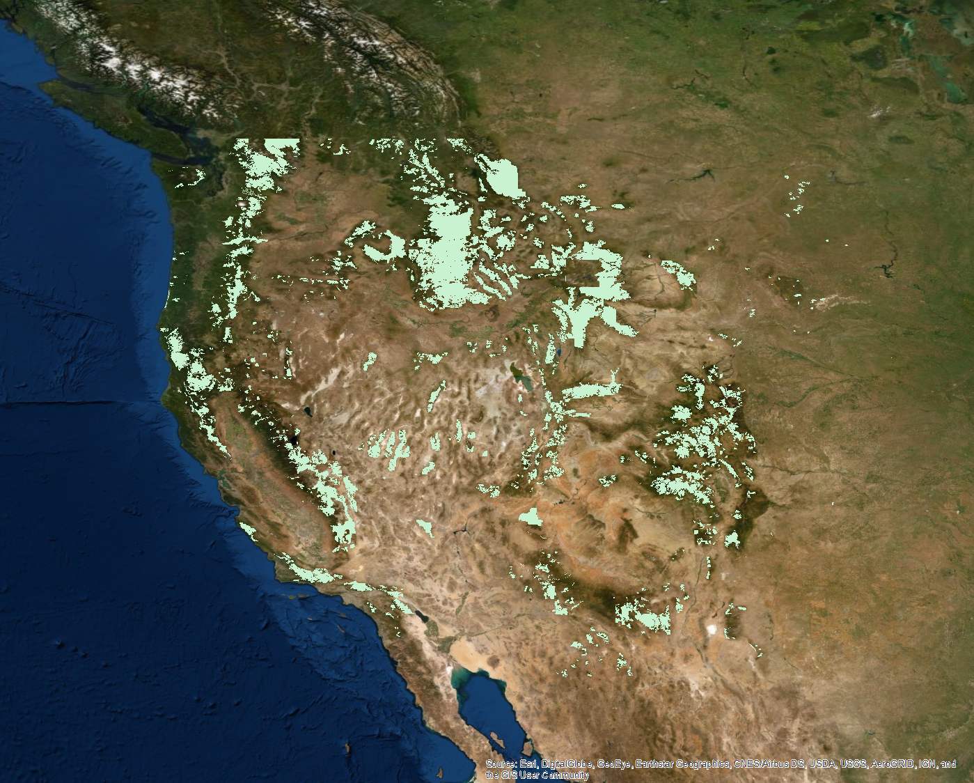
I have a lot of data downloaded from the US National Forest Service which all uses GCS_North_American_1983. I've noticed the same exact thing about working in that coordinate system, everything seems stretched horizontally/squashed vertically.
But when I say everything, I literally mean everything. If I add a satellite imagery base map from arc online, it too will be stretched horizontally. The same goes for any other data from any other source I add to the map, including KML's exported from Google Earth.
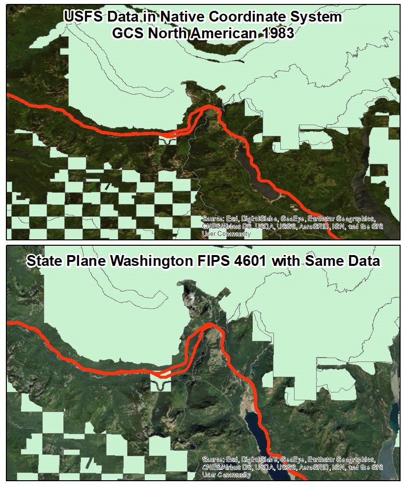
US National Forest Boundary Data in its native projection GCS_North_American_1983. ESRI Imagery basemap underneath. 1:12,000,000 scale.
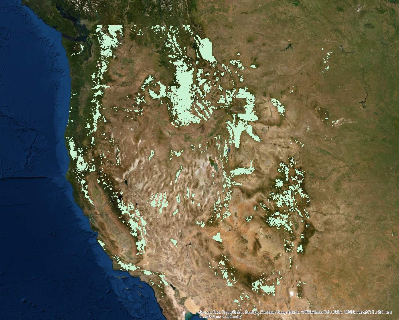
It's only until I switch my coordinate system for the data frame (for example, to a state plane projection) that things get un-squashed/stretched and look right.
Data Frame Set to WGS_1984_Web_Mercator_Auxiliary_Sphere. (This is the projected coordinate system that the ESRI Imagery basemap is native to). 1:12,000,000 scale.
Similarly, here's another example. This is zoomed into i90 on Snoqualmie Pass in Washington state. The only difference between these two maps is the projection. Pretty stark difference.