- Home
- :
- All Communities
- :
- Products
- :
- ArcGIS GeoPlanner
- :
- ArcGIS GeoPlanner Questions
- :
- GeoPlanner and Green Infrastructure Planning
- Subscribe to RSS Feed
- Mark Topic as New
- Mark Topic as Read
- Float this Topic for Current User
- Bookmark
- Subscribe
- Mute
- Printer Friendly Page
GeoPlanner and Green Infrastructure Planning
- Mark as New
- Bookmark
- Subscribe
- Mute
- Subscribe to RSS Feed
- Permalink
- Report Inappropriate Content
Interested in planning and Green Infrastructure? GeoPlanner has a new template you can use to plan and test scenarios using Green Infrastructure. The template has many authoritative layers to help you identify valuable landscapes, prioritize which to protect, and plan connections to those landscapes so you can visualize and plan for development before it happens.
Symbols available for sketching and design include Green Infrastructure and Land Use types. A subset of those types are shown in the following graphic:

How do you get started with this template? It's easy -
- Go to geoplanner.arcgis.com and sign in. (note: You'll need to configure a license in your org)
- Click Create New and choose the GeoPlanner Template for Green Infrastructure Planning.
- Zoom into an area of interest
- Open the contents pane by clicking the
 contents button. Check out all the Green Infrastructure data you have access to! Many of these layers can be used in GeoPlanner's dashboard to inform your plans and designs.
 - Click Explore > Add Data and add your land use data. If this is your first time using this tool, pick a smaller dataset to help you learn how to work with scenarios.
- Click the Scenario dropdown link in the upper left corner of the app and choose Import.

- Work through the Import Scenario wizard to add your land use data to a scenario. Open the dashboard and review your indicators!
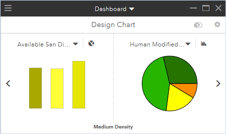
GeoPlanner dashboard showing a summary of the Human Modified Index by land use types
Check it out on geoplanner.arcgis.com! ArcGIS Online trials include GeoPlanner in case you don't have it already.