- Home
- :
- All Communities
- :
- Developers
- :
- Native Maps SDKs
- :
- Runtime SDK WPF (Retired) Ques
- :
- Odd rendering of polygons across Date line on maps
- Subscribe to RSS Feed
- Mark Topic as New
- Mark Topic as Read
- Float this Topic for Current User
- Bookmark
- Subscribe
- Mute
- Printer Friendly Page
Odd rendering of polygons across Date line on maps
- Mark as New
- Bookmark
- Subscribe
- Mute
- Subscribe to RSS Feed
- Permalink
- Report Inappropriate Content
Hi All,
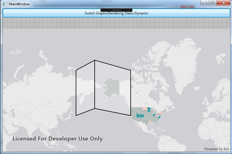
I have noticed some odd rendering differences when using a GraphicsOverlay with Dynamic vs Static GraphicsRenderingMode setting with Geometries across the international date line.
I have a small application to demo this effect (attached) - The first map I connected to was the following:
http://www.arcgis.com/home/item.html?id=2d6fa24b357d427f9c737774e7b0f977
The application renders a Polygon over the international Date line with a GraphicsOverlay and GraphicsRenderingMode as Static - the polygon is altered and looks almost as if its been normalised (and looks like a folded book with incorrect y coordinates). Switching to Dynamic renders this correctly as a Square polygon with no changes.
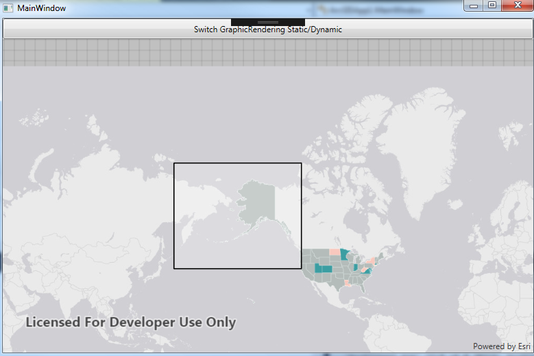
I tried the same on another map (http://www.arcgis.com/home/item.html?id=ee80391f71a4452ebaa19ad518db3b8d ) and noticed different results again. The polygon was rendered with a line down the centre (almost like its been normalised for the date line - eg. GeometryEngine.NormalizeCentralMeridian) - this happens on both Dynamic and Static for this map.
I have attached some screenshots and a demo application to demonstrate what is going on, if you need to replicate this quickly.
Does anyone have any explanation as to why Static vs Dynamic has differences when rendering a simple polygon? Any help would be appreciated. Our deployed application uses static for rendering due to issues with dynamic rendering and hence we found this oddity.
Regards,
David