- Home
- :
- All Communities
- :
- Products
- :
- ArcGIS Enterprise
- :
- ArcGIS Enterprise Questions
- :
- A way / tool to count the number of allocated max\...
- Subscribe to RSS Feed
- Mark Topic as New
- Mark Topic as Read
- Float this Topic for Current User
- Bookmark
- Subscribe
- Mute
- Printer Friendly Page
A way / tool to count the number of allocated max\min instances for all published services
- Mark as New
- Bookmark
- Subscribe
- Mute
- Subscribe to RSS Feed
- Permalink
- Report Inappropriate Content
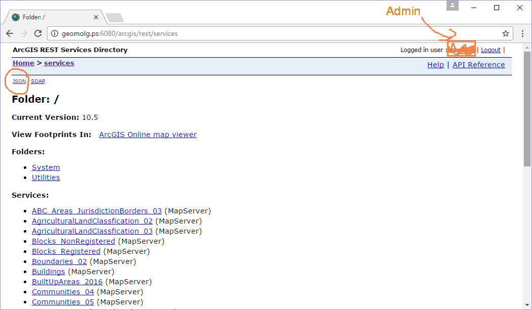
I couldn’t figure out if there are a tool or a way to count the number of allocated max\min instances for all published services. See below
.jpg)
Best Regards,
Rawan
Solved! Go to Solution.
Accepted Solutions
- Mark as New
- Bookmark
- Subscribe
- Mute
- Subscribe to RSS Feed
- Permalink
- Report Inappropriate Content
Good Morning Rawan,
Check and download the attached python file and try to run it.
No need to spend time on format this code.
https://community.esri.com/docs/DOC-9922-arcgis-server-map-service-properties
- Mark as New
- Bookmark
- Subscribe
- Mute
- Subscribe to RSS Feed
- Permalink
- Report Inappropriate Content
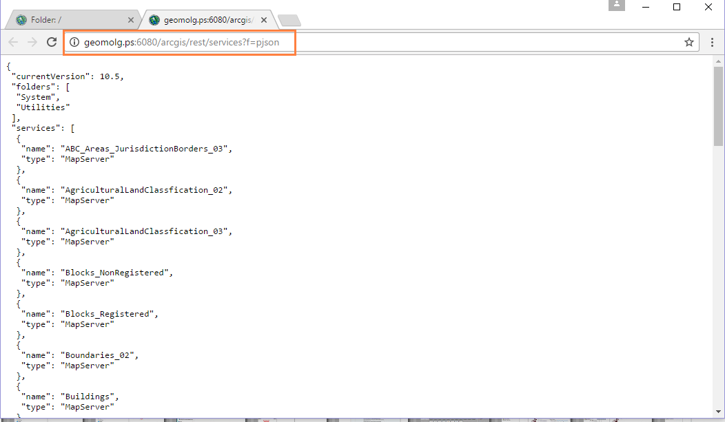
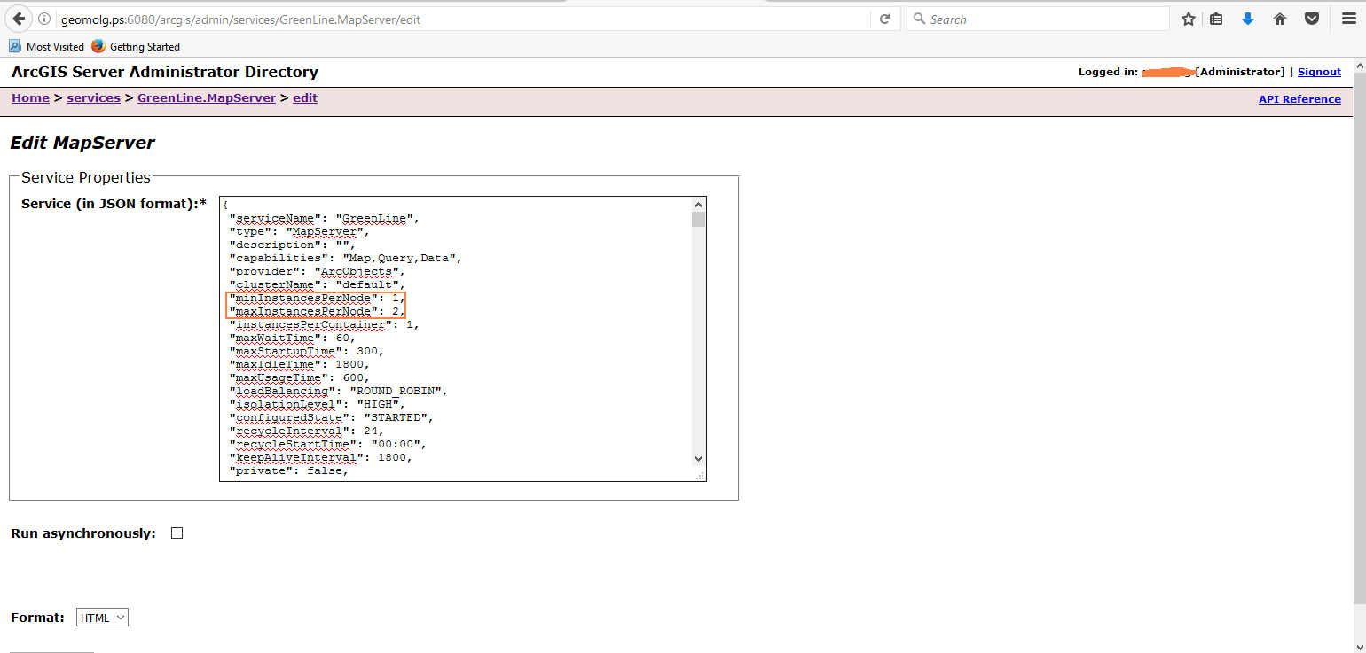
You can look into writing a python script to get the "minInstancesPerNode" and "maxInstancesPerNode" properties from the Admin API:

https://<server>.<domain>.com:6443/arcgis/admin/services/SampleWorldCities.MapServer?f=pjson
- Mark as New
- Bookmark
- Subscribe
- Mute
- Subscribe to RSS Feed
- Permalink
- Report Inappropriate Content
Dear Jonthan,
Thanks for you reply,I need this to be applied on all services.
How could I add a python script to get the "minInstancesPerNode" and "maxInstancesPerNode" properties from the Admin API:?
I opened this link, and logins as admin but I couldn’t made any changes, maybe I misunderstand this point.
Best Regards,
Rawan
- Mark as New
- Bookmark
- Subscribe
- Mute
- Subscribe to RSS Feed
- Permalink
- Report Inappropriate Content
You're at the Rest API, not the Admin API:
https://<server>.<domain>.com:6443/arcgis/admin/services/SampleWorldCities.MapServer?f=pjson
The bolded section is the URL to the Admin API. Log in with administrative credentials to make changes.
I would start with looking at the overview of scripting administration of your Server, and the specific examples of editing service properties and checking a folder for stopped services for pieces of code you can use.
- Mark as New
- Bookmark
- Subscribe
- Mute
- Subscribe to RSS Feed
- Permalink
- Report Inappropriate Content
Dear Jonathan,
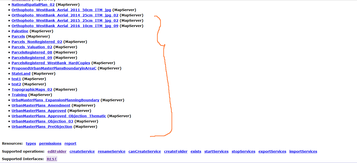
Thanks for your help, I can access to the Admin API but I need to count the number of allocated max\min instances for all published services, not for a specific one.
How could I do apply this for all of them in one go?
Best,
Rawan
- Mark as New
- Bookmark
- Subscribe
- Mute
- Subscribe to RSS Feed
- Permalink
- Report Inappropriate Content
Have you been able to review the samples I mentioned, specifically checking a folder for stopped services?
# Loop through each service in the folder and stop or start it
for item in dataObj['services']:
fullSvcName = item['serviceName'] + "." + item['type']
# Construct URL to stop or start service, then make the request
statusURL = "/arcgis/admin/services/" + folder + fullSvcName + "/status"The section above is where it will loop through every service, construct the URL to the service, and check the status. You'll want to modify that to grab the JSON of the service, loop through the key:value pairs to find the keys you need, and return them by printing them or writing them to a file.
- Mark as New
- Bookmark
- Subscribe
- Mute
- Subscribe to RSS Feed
- Permalink
- Report Inappropriate Content
Dear Jonthan,
many thanks for your answer, actually I walked through them but I couldn’t deal with them.
I will try to do this. Today. & update you.
Best,
Rawan
- Mark as New
- Bookmark
- Subscribe
- Mute
- Subscribe to RSS Feed
- Permalink
- Report Inappropriate Content
Dear Jonathan,
I could be noisy, but when I tried to login in Generate token to write the python it gives me the following error.
What could be the reason for that.
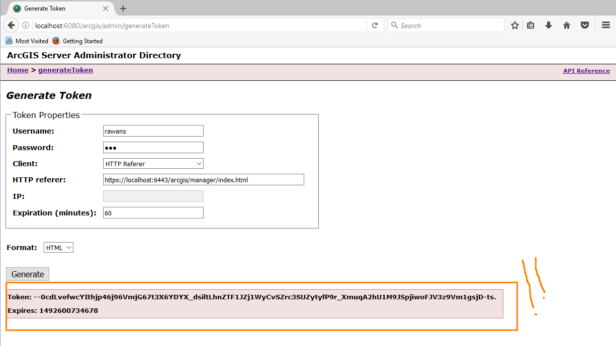
Best,
Rawan
- Mark as New
- Bookmark
- Subscribe
- Mute
- Subscribe to RSS Feed
- Permalink
- Report Inappropriate Content
That's not an error, that's the token. You can append the token to requests to the Admin API to authenticate.
- Mark as New
- Bookmark
- Subscribe
- Mute
- Subscribe to RSS Feed
- Permalink
- Report Inappropriate Content
Dear Jonathan,
Thank you for your reply, but I struggling with the begin.
I ‘m not sure from where I can add my code to get my information.
Any advice?
Best,
Rawan