Turn on suggestions
Auto-suggest helps you quickly narrow down your search results by suggesting possible matches as you type.
Cancel
- Home
- :
- All Communities
- :
- Industries
- :
- Water Resources
- :
- Water Resources Questions
- :
- Flood Plain Mapping using HEC-GeoRAS and ArcMap 10...
Options
- Subscribe to RSS Feed
- Mark Topic as New
- Mark Topic as Read
- Float this Topic for Current User
- Bookmark
- Subscribe
- Mute
- Printer Friendly Page
Flood Plain Mapping using HEC-GeoRAS and ArcMap 10.3
Subscribe
1481
0
04-16-2017 10:54 PM
04-16-2017
10:54 PM
- Mark as New
- Bookmark
- Subscribe
- Mute
- Subscribe to RSS Feed
- Permalink
- Report Inappropriate Content
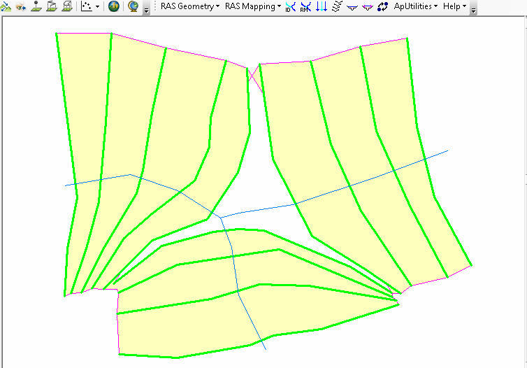
How can I get complete bounding polygon of XS CutLines for flood plain mapping (Flood Inundation Mapping) using HEC-GeoRAS and ArcMap 10.3?
When I tried to perform this task, the bounding polygon formed was in an unexpected manner:

I want to get the bounding polygon without the gap that is visible around the river junction.
0 Replies