- Home
- :
- All Communities
- :
- Products
- :
- ArcGIS Online
- :
- ArcGIS Online Questions
- :
- Include my own basemap, control order
- Subscribe to RSS Feed
- Mark Topic as New
- Mark Topic as Read
- Float this Topic for Current User
- Bookmark
- Subscribe
- Mute
- Printer Friendly Page
- Mark as New
- Bookmark
- Subscribe
- Mute
- Subscribe to RSS Feed
- Permalink
- Report Inappropriate Content
I would like to include additional aerial imagery in my map, but I'd like for it to be underneath the other ESRI base maps, so that I can show a street map or topo, for example, over the top of this other imagery.
All I seem to be able to do is place this imagery on top of the ESRI basemap. If I add it as a basemap, then it is still on top of the topo. It seems like I ought to be able to control the draw order of this.
Solved! Go to Solution.
Accepted Solutions
- Mark as New
- Bookmark
- Subscribe
- Mute
- Subscribe to RSS Feed
- Permalink
- Report Inappropriate Content
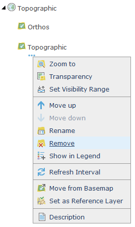
Apparently, there have been a few changes in the last version! When a layer is set as "Reference layer", it will appear over the other basemap layer. So if the "Move up" button is greyed out, you have to set your own tile layer as "Reference layer" to move it on top of an ESRI layer.
- Mark as New
- Bookmark
- Subscribe
- Mute
- Subscribe to RSS Feed
- Permalink
- Report Inappropriate Content
Hi,
I was wondering the same, here's the way to do it:
1. You add your imagery to the map, and click "Move to basemap"
2. Delete the ESRI basemap
3. Add the ESRI basemap you want as a normal layer like this:
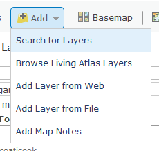
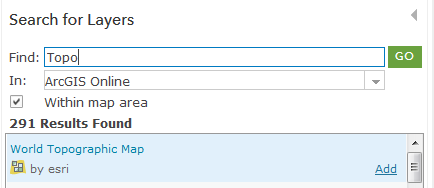
And here you go! Like you said, if there is two maps in the basemap layer, the one from ESRI will be on top.
But be carefull, if there's only your basemap in the basemap layer, the map scales will be restricted to the ones available in your tile layer.
- Mark as New
- Bookmark
- Subscribe
- Mute
- Subscribe to RSS Feed
- Permalink
- Report Inappropriate Content
I just found out you can also simply use the "move down" button. I was used to the older version of AGO that was only supporting one basemap, so I was used to set other ESRI maps as layers.

- Mark as New
- Bookmark
- Subscribe
- Mute
- Subscribe to RSS Feed
- Permalink
- Report Inappropriate Content
Apparently, there have been a few changes in the last version! When a layer is set as "Reference layer", it will appear over the other basemap layer. So if the "Move up" button is greyed out, you have to set your own tile layer as "Reference layer" to move it on top of an ESRI layer.
- Mark as New
- Bookmark
- Subscribe
- Mute
- Subscribe to RSS Feed
- Permalink
- Report Inappropriate Content
My original question is how to move my layer under the ESRI layer. "On top" happens by default rather it is added to the map, as a base map, or as a reference layer. I want to see the Topographic layer, for example, on top of my aerial imagery layer.
The Move Up and Move Down options are grayed out for me. I'm not sure why they would be showing up for someone else.