- Home
- :
- All Communities
- :
- Products
- :
- Imagery and Remote Sensing
- :
- Imagery Questions
- :
- Getting rid of white "noise" along border of an ae...
- Subscribe to RSS Feed
- Mark Topic as New
- Mark Topic as Read
- Float this Topic for Current User
- Bookmark
- Subscribe
- Mute
- Printer Friendly Page
Getting rid of white "noise" along border of an aerial
- Mark as New
- Bookmark
- Subscribe
- Mute
- Subscribe to RSS Feed
- Permalink
- Report Inappropriate Content
I'm having issues with a new aerial image of our city we recently received. When the new aerial image is placed over an a different aerial image with a greater extent, there is white "noise" along the border of the new image. This is very distracting and I can't seem to get rid of it. Ultimately, I need to use both the new aerial image and the greater extent aerial to produce a map with full aerial coverage for the whole extent.
Here's a visual of what I'm running into. The new city aerial is in the lower right-hand side (the greener part). The background aerial (browner one) is a NAIP image.

Here's the overall extent of the new aerial image:
(note the data frame has been set to gray and the Display Background Value set to pink to emphasize the image shape)

Same image, zoomed in to the Northwest corner. Note the problem - the white "noise". The issue seems to be entirely with the new aerial image.
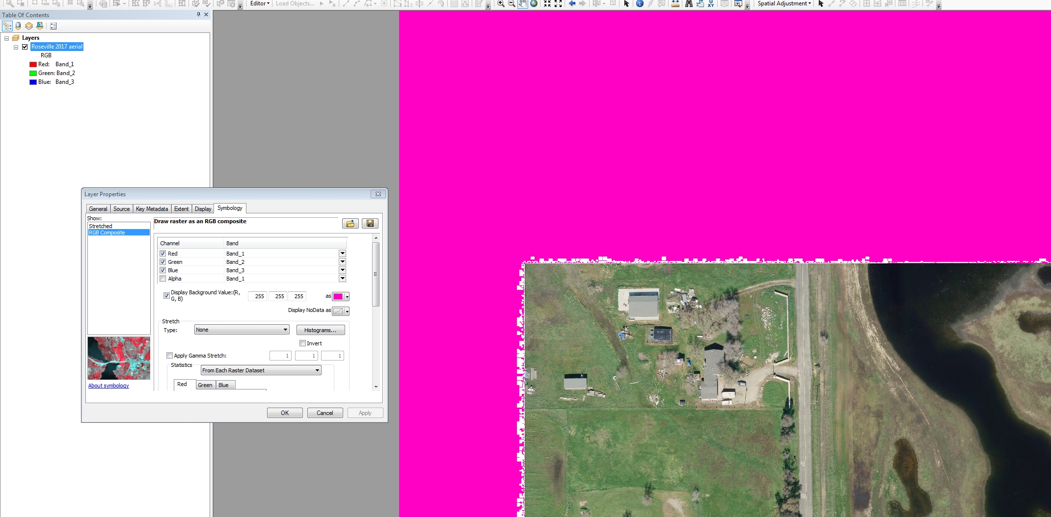
Same image, but with the Display Background Value now set to white (data frame still gray):

Here are the new aerial image properties:

The image is being viewed in ArcGIS 10.2.1
Any idea how to resolve this so the white "noise" is eliminated?
One idea - Is there a way to trim back the new image slightly to eliminate the white noise? Unfortunately, the new aerial image is not nice and rectangular, so cutting it back might be tricky.
Another option - is there a way to blend the two aerials using a moving window to fill in the white noise areas (but not affect the white areas in other parts of the aerials?
Chris Donohue, GISP
- Mark as New
- Bookmark
- Subscribe
- Mute
- Subscribe to RSS Feed
- Permalink
- Report Inappropriate Content
Hi Chris,
If you identify the white noise, what are the returning pixel values? Is this the same for all areas, or do they vary?
- Mark as New
- Bookmark
- Subscribe
- Mute
- Subscribe to RSS Feed
- Permalink
- Report Inappropriate Content
The white noise pixels vary slightly in RGB values. Many are R: 254, G: 255, B: 254, but the Red values range from 251 to 255, the Green values are 254 and 255, and the Blue values range from 250 to 255.
One example:
![]()
Chris Donohue, GISP
- Mark as New
- Bookmark
- Subscribe
- Mute
- Subscribe to RSS Feed
- Permalink
- Report Inappropriate Content
One thing you can do is digitize a feature class boundary around the new imagery to exclude the white noise. You can then add the imagery to a mosaic dataset and apply the Clip function. This will clip the imagery to the feature class you digitized.