- Home
- :
- All Communities
- :
- Products
- :
- ArcGIS Spatial Analyst
- :
- ArcGIS Spatial Analyst Questions
- :
- Rasters with different extents
- Subscribe to RSS Feed
- Mark Topic as New
- Mark Topic as Read
- Float this Topic for Current User
- Bookmark
- Subscribe
- Mute
- Printer Friendly Page
- Mark as New
- Bookmark
- Subscribe
- Mute
- Subscribe to RSS Feed
- Permalink
- Report Inappropriate Content
Currently I am working with elevation data for a site that is getting developed. I have the current elevations and I am trying to to subtract them from the elevations for after the site gets graded for development. This is to calculate how much dirt needs to be taken out. I started with elevation shape files I converted to tins, then converted the tins > rasters. I exported the two rasters to have the same cell size. The problem I am having is how can I get the rasters to overlap consistently so I can get the right calculations using raster calculator?
I guess my question is:
How can I get my rasters of different extents to overlap properly? And, is the method I seem to be using going to be accurate?
Any help is much appreciated!
Solved! Go to Solution.
Accepted Solutions
- Mark as New
- Bookmark
- Subscribe
- Mute
- Subscribe to RSS Feed
- Permalink
- Report Inappropriate Content
One key thing to consider employing when working with rasters is a Snap Raster. There is a setting for this found in the Environments.
Tools that honor the Snap Raster environment will adjust the extent of output rasters so that they match the cell alignment of the specified snap raster.
Snap Raster (Environment setting)—Help | ArcGIS for Desktop
Example:
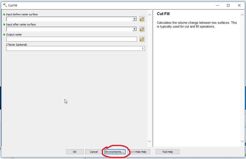
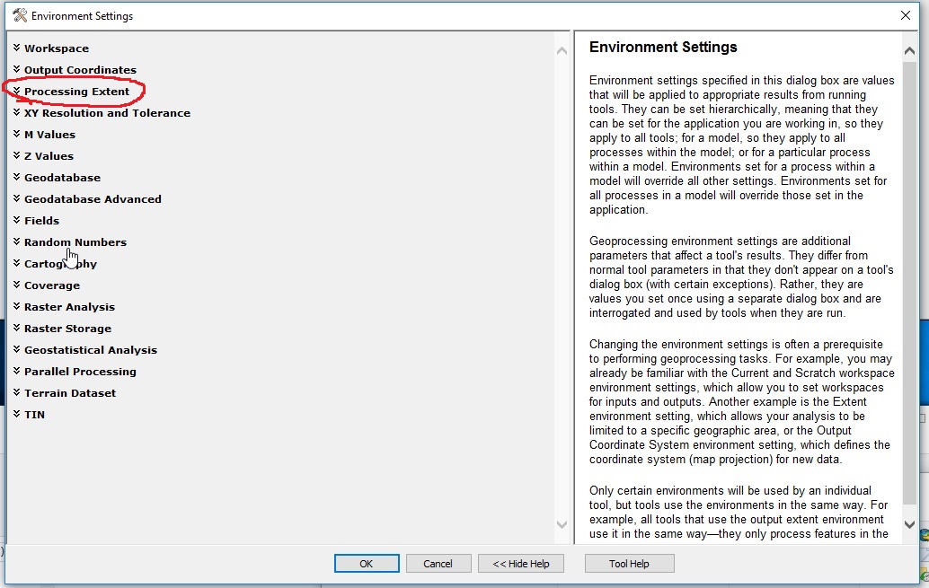
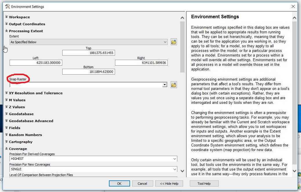
Chris Donohue, GISP
- Mark as New
- Bookmark
- Subscribe
- Mute
- Subscribe to RSS Feed
- Permalink
- Report Inappropriate Content
One key thing to consider employing when working with rasters is a Snap Raster. There is a setting for this found in the Environments.
Tools that honor the Snap Raster environment will adjust the extent of output rasters so that they match the cell alignment of the specified snap raster.
Snap Raster (Environment setting)—Help | ArcGIS for Desktop
Example:
Chris Donohue, GISP