- Home
- :
- All Communities
- :
- Products
- :
- ModelBuilder
- :
- ModelBuilder Questions
- :
- How to use Set Null in Model Builder?
- Subscribe to RSS Feed
- Mark Topic as New
- Mark Topic as Read
- Float this Topic for Current User
- Bookmark
- Subscribe
- Mute
- Printer Friendly Page
How to use Set Null in Model Builder?
- Mark as New
- Bookmark
- Subscribe
- Mute
- Subscribe to RSS Feed
- Permalink
- Report Inappropriate Content
I am trying to emulate the raster calculator that takes a flow accumulation raster and turns it into a stream raster. Where the number "849840" is the threshold value.
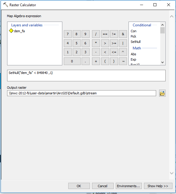
How would I use the Set Null tool in the model builder that will give me the same results?

What would I put in the fields?
- Mark as New
- Bookmark
- Subscribe
- Mute
- Subscribe to RSS Feed
- Permalink
- Report Inappropriate Content
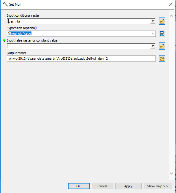
If I remember correctly, SetNull (Spatial Analyst) would be done like this to complete your task:
The Input Conditional Raster: dem_fa . (your source raster to operate on)
Expression (optional) would be: VALUE > 849840 . (values above 849840 are evaluated by the tool as True, so will become Null)
Input File raster or constant value: 1 . (constant value to set if False/Not Null, ie your streams will have a value of 1)
Output raster: (your output file name goes here)

Note: be sure to set the Environments (button at bottom of tool). Also, I would avoid using the Default Geodatabase (Default.gdb) and instead set up a geodatabase specifically for this data and its processing.
Chris Donohue, GISP
- Mark as New
- Bookmark
- Subscribe
- Mute
- Subscribe to RSS Feed
- Permalink
- Report Inappropriate Content
Alternatively, you can add the Raster Calculator tool in Model Builder and use it the same way you used it interactively.