Turn on suggestions
Auto-suggest helps you quickly narrow down your search results by suggesting possible matches as you type.
Cancel
- Home
- :
- All Communities
- :
- Industries
- :
- Gas and Pipeline
- :
- Gas and Pipeline Questions
- :
- Export pipe network civil 3D (2017) to shapefile
Options
- Subscribe to RSS Feed
- Mark Topic as New
- Mark Topic as Read
- Float this Topic for Current User
- Bookmark
- Subscribe
- Mute
- Printer Friendly Page
08-17-2017
07:22 AM
- Mark as New
- Bookmark
- Subscribe
- Mute
- Subscribe to RSS Feed
- Permalink
- Report Inappropriate Content
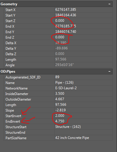
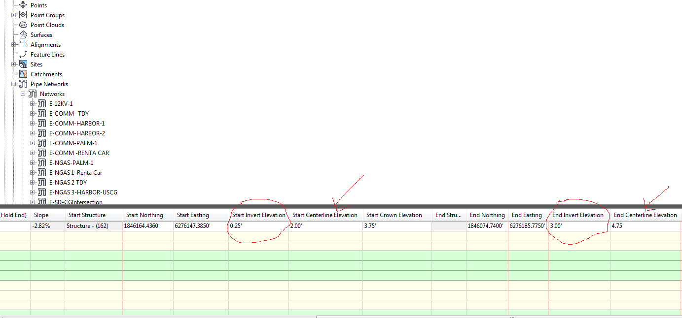
I am trying to export a pipe network 3D drawing into shapefile, and I am using this following method: "Use ExporttoSDF command, Start a new drawing, then use MapImport to import that .sdf file. I am making sure to create object data during import." Everything works fine but when importing the sdf in the new drawing, the start/end z values of the pipe is replaced by 0, and the the start/end Invert elevations of the pipe is replaced by the values of the original start and end z values. it will be great if someone can help me find a solution to keep the original start/end values in addition to the original StartInvert/ EndInvert elevation when importing the sdf to autocad civil 3D.
PS: I am using Autocad civil 3D 2017.
2 Replies
08-17-2017
03:41 PM
- Mark as New
- Bookmark
- Subscribe
- Mute
- Subscribe to RSS Feed
- Permalink
- Report Inappropriate Content
08-17-2017
03:42 PM
- Mark as New
- Bookmark
- Subscribe
- Mute
- Subscribe to RSS Feed
- Permalink
- Report Inappropriate Content