Using Esri Basemaps in Education
- Subscribe to RSS Feed
- Mark as New
- Mark as Read
- Bookmark
- Subscribe
- Printer Friendly Page
- Report Inappropriate Content
Most users of Esri technology are familiar with the 10 or so base maps that are available through the Basemaps tool on www.arcgis.com - ArcGIS Online. But did you know that there are many other wonderful basemaps available for your use and that these choices not only continue to expand, but are becoming more responsive to draw and are increasingly rich with content? And probably the hottest topic in base mapping right now is the advent of vector basemap. Vector basemaps have several benefits over their raster counterparts. One is their ability to customize the vector map style by changing colors, line attributes, and even fonts. Another benefit of vector maps is their ability to support updated data, such as the content contributed by communities through the Community Maps Program.
The vector basemap group currently contains several dozen web maps and layers. One of my favorites is the imagery hybrid, which shows satellite imagery and a vector layer with streets and other features; in other words, a best of both worlds, which is very useful when you are wanting a basemap underneath your field-collected data. This layer even provides the date of the satellite image, the source, the resolution, and the accuracy. The sample vector tile layers group in ArcGIS Online contains some interesting and different basemaps for you to try. One of my favorites is the colored pencil basemap shown in the banner of this blog essay, which reminds me of the maps I made as a teenager using my own colored pencils. I also like the Modern Antique map (shown below), the newspaper map, and the clever snow-filled Merry Christmas basemap shown below and described here. Each can be added to your existing or new maps in ArcGIS Online simply by using the Add button and referencing the layer name.
The best way to keep up with these developments is to read the GeoNet blogs related to basemaps. For example, a new basemap supporting the mapping of human geography themes was recently published, described here.
Consider examining these with your students in your cartography units, show them to your art teacher colleagues, and make use of them - they are all at your fingertips!

Modern Antique Basemap
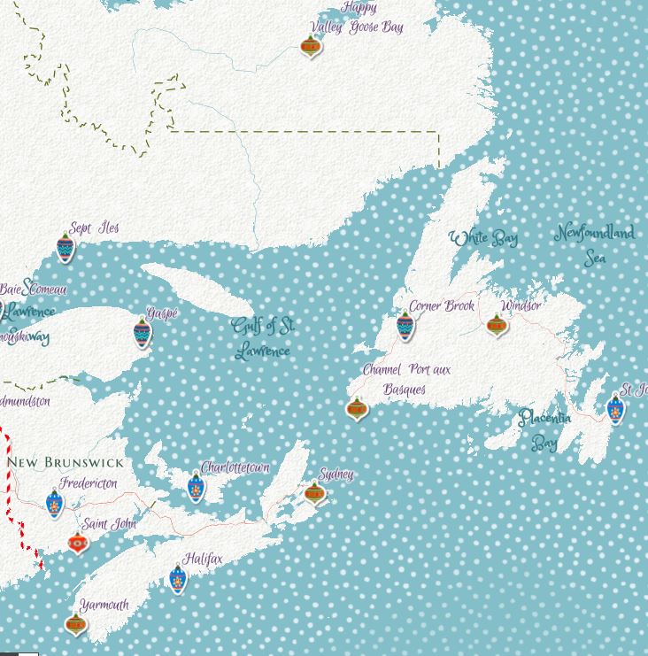
Merry Christmas basemap
You must be a registered user to add a comment. If you've already registered, sign in. Otherwise, register and sign in.
-
Administration
39 -
Announcements
45 -
Career & Tech Ed
1 -
Curriculum-Learning Resources
180 -
Education Facilities
24 -
Events
47 -
GeoInquiries
1 -
Higher Education
520 -
Informal Education
266 -
Licensing Best Practices
47 -
National Geographic MapMaker
17 -
Pedagogy and Education Theory
187 -
Schools (K - 12)
282 -
Schools (K-12)
185 -
Spatial data
24 -
STEM
3 -
Students - Higher Education
232 -
Students - K-12 Schools
86 -
Success Stories
22 -
TeacherDesk
1 -
Tech Tips
83
- « Previous
- Next »