- Home
- :
- All Communities
- :
- Products
- :
- ArcGIS Drone2Map
- :
- ArcGIS Drone2Map Questions
- :
- Re: Cannot Import GCPs
- Subscribe to RSS Feed
- Mark Topic as New
- Mark Topic as Read
- Float this Topic for Current User
- Bookmark
- Subscribe
- Mute
- Printer Friendly Page
Cannot Import GCPs
- Mark as New
- Bookmark
- Subscribe
- Mute
- Subscribe to RSS Feed
- Permalink
- Report Inappropriate Content
- Mark as New
- Bookmark
- Subscribe
- Mute
- Subscribe to RSS Feed
- Permalink
- Report Inappropriate Content
Hello Heena,
I have encountered the same error before. At that time, the difference of GCPs' geometry coordinate and attribute field values of [Field Mappings] was the cause.
Do you import GCPs from File Geodatabase or Hosted Feature Layer? Try check on [Use Feature Geometry] under [Point feature (Class)] if it appears when you import GCPs.
Cheers,
Miki
- Mark as New
- Bookmark
- Subscribe
- Mute
- Subscribe to RSS Feed
- Permalink
- Report Inappropriate Content
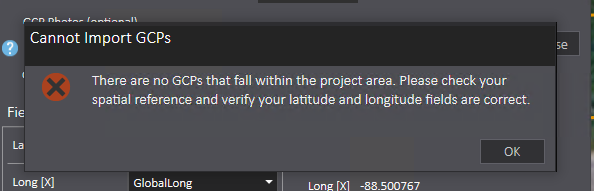
I imported from CSV file. I tried importing from a feature service, it still didn't work. With a help from ESRI support, I was able to import GCPs as GCS WGS 1984 rather than State Plane. This worked for one project. I've tried the same setting with another project. It didn't work. Drone2Map was able to generate 1 m contours only. I would like to have 1 ft contours. So far, Drone2Map was able to generate 1 ft contours without importing GCPs.