- Home
- :
- All Communities
- :
- Products
- :
- ArcGIS Drone2Map
- :
- ArcGIS Drone2Map Questions
- :
- Re: How do I fix the elevation of my 3D drone2map ...
- Subscribe to RSS Feed
- Mark Topic as New
- Mark Topic as Read
- Float this Topic for Current User
- Bookmark
- Subscribe
- Mute
- Printer Friendly Page
How do I fix the elevation of my 3D drone2map maps?
- Mark as New
- Bookmark
- Subscribe
- Mute
- Subscribe to RSS Feed
- Permalink
- Report Inappropriate Content
How do I fix the elevation of my 3D drone2map maps? I have a few image sets that do not have ground control points. The 3D maps end up pushed up or down depending on my takeoff location. I've found the "Image Altitude" setting under "Flight Data" but after changing "Adjust Using", "Constant Elevation", "Takeoff Elevation" by 2 meters it only changes the altitude of the points and doesn't seem to change the map level. Do I need to reprocess the project or change something in those settings to make this change?
- Mark as New
- Bookmark
- Subscribe
- Mute
- Subscribe to RSS Feed
- Permalink
- Report Inappropriate Content
After additional testing, I've found that it will change the elevation of the map but I have to totally reprocess the data. Is there a fast way to do this? Also, right now I'm using trial and error to get the map at the right level but I feel like there has to be a faster way. Any ideas?
- Mark as New
- Bookmark
- Subscribe
- Mute
- Subscribe to RSS Feed
- Permalink
- Report Inappropriate Content
Chris
I've been intending to reply but just juggling a lot of tasks. this will be brief, will probably need more discussion.
Yes you need to reprocess unless you're publishing in ArcGIS Online - in the web we can apply a simple vertical offset.
you said "3D maps" so I assume you mean the mesh and/or point cloud? if you mean the DSM/DTM then adjusting a raster is different, and does NOT need to go through reprocessing (although that may be advised).
Last, do you expect precise Z alignment, or are you just seeking to get close enough to the default Esri world terrain so the drone products are visible and not obviously 'floating'?
Have you tried adding control points from the map? That extracts Z values from the default Esri world terrain but if you're in an area of natural vegetation I appreciate finding the correct (x,y) is a challenge and you don't want to shift your data horizontally with a sloppy control point...
Can you let me know the original vertical offset (before you attempted adjustment)? It may be the difference between ellipsoidal (GPS) vs. orthometric height for your site, based on the quality & settings of GPS from your drone. if true, that's a method to analytically determine the Z offset
Cody
- Mark as New
- Bookmark
- Subscribe
- Mute
- Subscribe to RSS Feed
- Permalink
- Report Inappropriate Content
For the most part I'm working with a 3D mesh and 3D DTM but in some of my projects, I would like to do measurements of sand loss so I may need to use one of the other options.
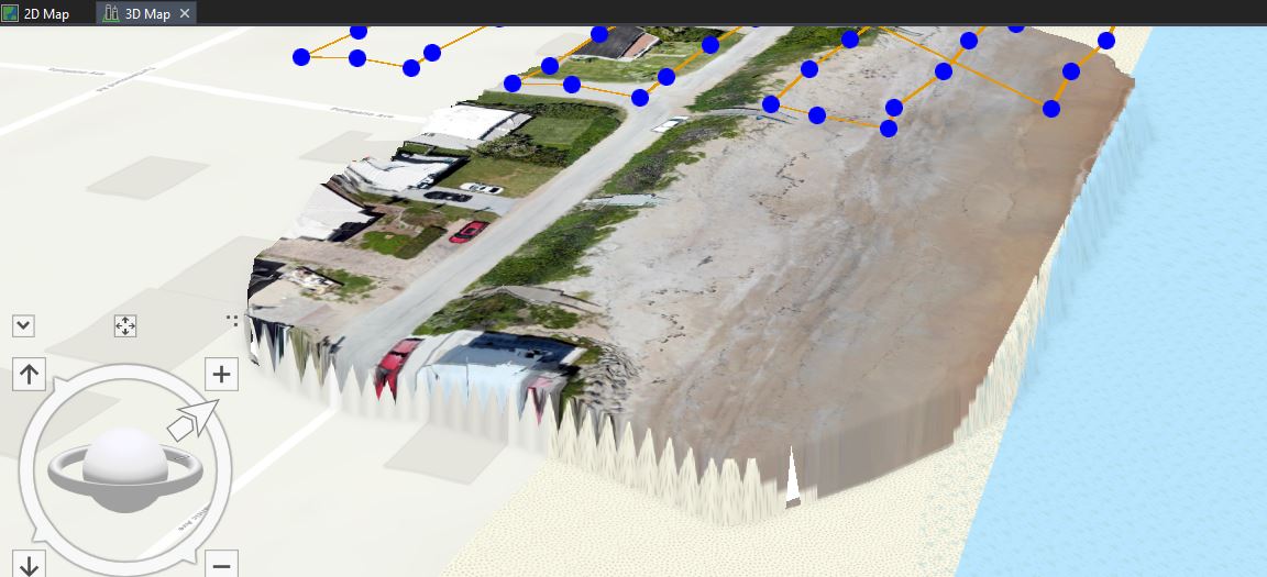
So in most cases, I don't think I need precise Z alignment. It would be nice if there was a way to determine the elevation of the base map in a given location. Then I could use that elevation as my offset/control point. I take off from the street so that's easy to pick out of the map. right now I'm just going off the trial and error strategy but it's not a reasonable method. I wish I had the ability to implement control points but I didn't for all of my projects so far. Apparently, I also don't know how to share the 3D DTM but here is what I could share: https://volusiacountyfl.maps.arcgis.com/home/webmap/viewer.html?webmap=62418d8d0e954968bdade8230f3c1...
- Mark as New
- Bookmark
- Subscribe
- Mute
- Subscribe to RSS Feed
- Permalink
- Report Inappropriate Content
Chris
thanks, this helps understand the context - however I'm concerned about trying to advise you with an ad-hoc workaround that may ultimately lead to bad results.
If you're trying to measure volumes of sand on a beach, accurate data products in (x,y,z) will be critical - and my advice is "this is impossible without high quality GPS for ground control". Further, you said "sand loss" which implies you have a "before" dataset - either from a prior drone flight or perhaps lidar? I don't believe you can hope to compare two datasets without high accuracy control points, and ideally use the same control for "before" and "after" or if the earlier dataset is lidar, perhaps you can use that for control (although I'm thinking it would only be usable along the road where you have hard structures, and if your control is limited to one side of a project, the other side can still drift up/down leading to measurement errors).
Do you have a professional surveyor you can include in the project for advice?
Cody B.
- Mark as New
- Bookmark
- Subscribe
- Mute
- Subscribe to RSS Feed
- Permalink
- Report Inappropriate Content
Sorry I did let this question bleed a bit. My main problem at this point is just to get a 3D mesh DTM to look right on the Esri base map. Could I use the road as a control point so that it matched with the base map? I know it hasn't changed.
Comparing two 3D maps was a related though and yes, I have before and after flight using the same mission. So the maps look similar but the elevation near the water, and the foot of the dune, changed a bit. It's not important to me at this point to make a measurement.