- Home
- :
- All Communities
- :
- Products
- :
- ArcGIS GeoStatistical Analyst
- :
- ArcGIS GeoStatistical Analyst Questions
- :
- Re: loop through geostatistical layers in a folder
- Subscribe to RSS Feed
- Mark Topic as New
- Mark Topic as Read
- Float this Topic for Current User
- Bookmark
- Subscribe
- Mute
- Printer Friendly Page
loop through geostatistical layers in a folder
- Mark as New
- Bookmark
- Subscribe
- Mute
- Subscribe to RSS Feed
- Permalink
- Report Inappropriate Content
Hello everyone,
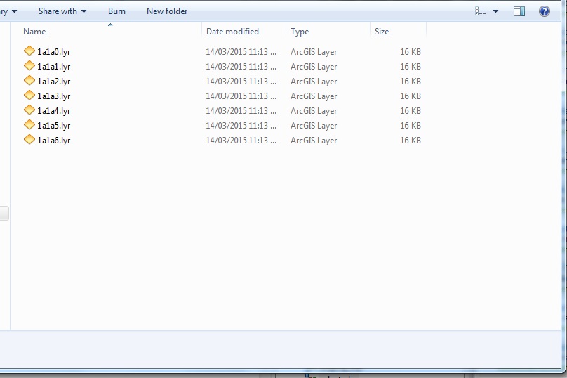
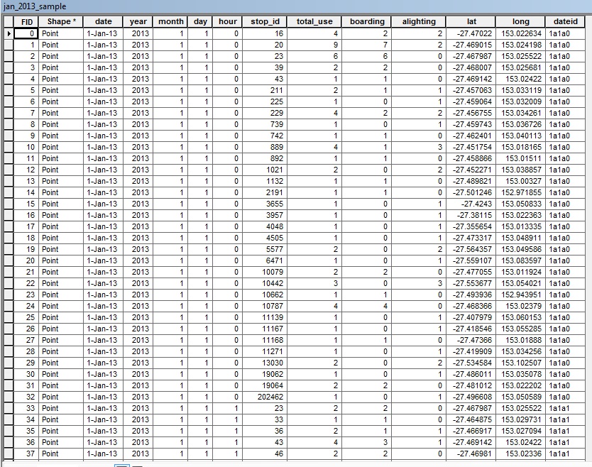
I'm trying to write a python script to loop through geostatistical layers in a folder (a snapshot is attached below), then loop through another folder which contains a point shapefile (a snapshot attached as well), find the match between the two based on names (e.g., 1a1a0.lyr vs 1a1a0 in the 'dateid' field), and last, use a 'GA layer to point' to the matching points. So how can I accomplish this task? More specifically, how do I create a nested loop to match the layers with the points of one shapefile?
Many thanks,
Sui
These are a sample of layers
This is the attribute table of points
Solved! Go to Solution.
Accepted Solutions
- Mark as New
- Bookmark
- Subscribe
- Mute
- Subscribe to RSS Feed
- Permalink
- Report Inappropriate Content
I'm not sure of an arcpy method to list lyrs, but you can do so with os.listdir(). Then, loop through the list, creating a where clause. Finally, Select tool using where clause to extract matching points.
- Mark as New
- Bookmark
- Subscribe
- Mute
- Subscribe to RSS Feed
- Permalink
- Report Inappropriate Content
In 10.2 we introduced a Python class GeostatisticalDatasets which will make it easier for you to match up the datasets.
ga_layer = r"c:\temp\kriging.lyr"
geo_datasets = arcpy.GeostatisticalDatasets(ga_layer)
print geo_datasets
>>dataset1='c:\temp\myfc.shp' dataset1Field='ELEVATION'
-Steve
- Mark as New
- Bookmark
- Subscribe
- Mute
- Subscribe to RSS Feed
- Permalink
- Report Inappropriate Content
Hi, I want to know if Python class GeostatisticalDatasetsalso existed in version 10.
Thank you!
- Mark as New
- Bookmark
- Subscribe
- Mute
- Subscribe to RSS Feed
- Permalink
- Report Inappropriate Content
It was first released in ArcGIS 10.2. It is not in 10 or 10.1.
- Mark as New
- Bookmark
- Subscribe
- Mute
- Subscribe to RSS Feed
- Permalink
- Report Inappropriate Content
Hello, here, we can do the loop? I mean I can chang dataset1 every time, then do the interpolation for the different dataset1?
- ga_layer = r"c:\temp\kriging.lyr"
- geo_datasets = arcpy.GeostatisticalDatasets(ga_layer)
- print geo_datasets
- >>dataset1='c:\temp\myfc.shp' dataset1 Field='ELEVATION'
- Mark as New
- Bookmark
- Subscribe
- Mute
- Subscribe to RSS Feed
- Permalink
- Report Inappropriate Content
If you are using ArcGIS 10 or 10.1, you will need to pass the datasets using strings. The GeostatisticalDatasets object will not work because it does not exist in 10 or 10.1.
For an example of the syntax of the string, see the code samples at the bottom of the ArcGIS 10 help topic:
- Mark as New
- Bookmark
- Subscribe
- Mute
- Subscribe to RSS Feed
- Permalink
- Report Inappropriate Content
Thanks a lot. I download Version 10.3 and I solved the problem.
- Mark as New
- Bookmark
- Subscribe
- Mute
- Subscribe to RSS Feed
- Permalink
- Report Inappropriate Content
Thanks guys for the reply.
Darren's answer is closer to what I want to achieve.
Cheers,
Sui