- Home
- :
- All Communities
- :
- Products
- :
- ArcGIS GeoStatistical Analyst
- :
- ArcGIS GeoStatistical Analyst Questions
- :
- Re: WGS 1984 Web Mercator Auxiliary Sphere & Geost...
- Subscribe to RSS Feed
- Mark Topic as New
- Mark Topic as Read
- Float this Topic for Current User
- Bookmark
- Subscribe
- Mute
- Printer Friendly Page
WGS 1984 Web Mercator Auxiliary Sphere & Geostatistical Analysis
- Mark as New
- Bookmark
- Subscribe
- Mute
- Subscribe to RSS Feed
- Permalink
- Report Inappropriate Content
Using the WGS 1984 Web Mercator Auxiliary Sphere coordinate system, how do I use the Geostatistical Analysis wizard to interpolate data from latitude and longitude points?
Solved! Go to Solution.
- Mark as New
- Bookmark
- Subscribe
- Mute
- Subscribe to RSS Feed
- Permalink
- Report Inappropriate Content
So what you are say is that if I just do the data interpolation first then change the coordinate system it would work?
Sent from Outlook
- Mark as New
- Bookmark
- Subscribe
- Mute
- Subscribe to RSS Feed
- Permalink
- Report Inappropriate Content
A csv file won't have a defined coordinate system. If you have added to arcmap using the File, add data, addxy data and it shows and then right click on the layer and export it to a shapefile at a minimum. Then if the coordinates are in decimal degrees use the Define Projection tool to establish its coordinate system (perhaps a GCS aka unprojected coordinate system, with a WGS or NAD83 datum). Once you have that done, then I would recommend projecting it so that you are working with planar coordinates rather than spherical ones. UTM for your area will do quite nicely for your area.
Then you are on to the task of interpolating, you should never use the defaults or only use them as a conscious decision to do so, paying particular attention to interpolation extents, cell size and parameters particular to your data and interpolation method.
- Mark as New
- Bookmark
- Subscribe
- Mute
- Subscribe to RSS Feed
- Permalink
- Report Inappropriate Content
So what as a non-project coordinate system would you suggest that is similar to WGS 1984 Web Mercator Auxiliary Sphere? The only reason I'm using this one is because it looks best.
GCS WGS 1984:
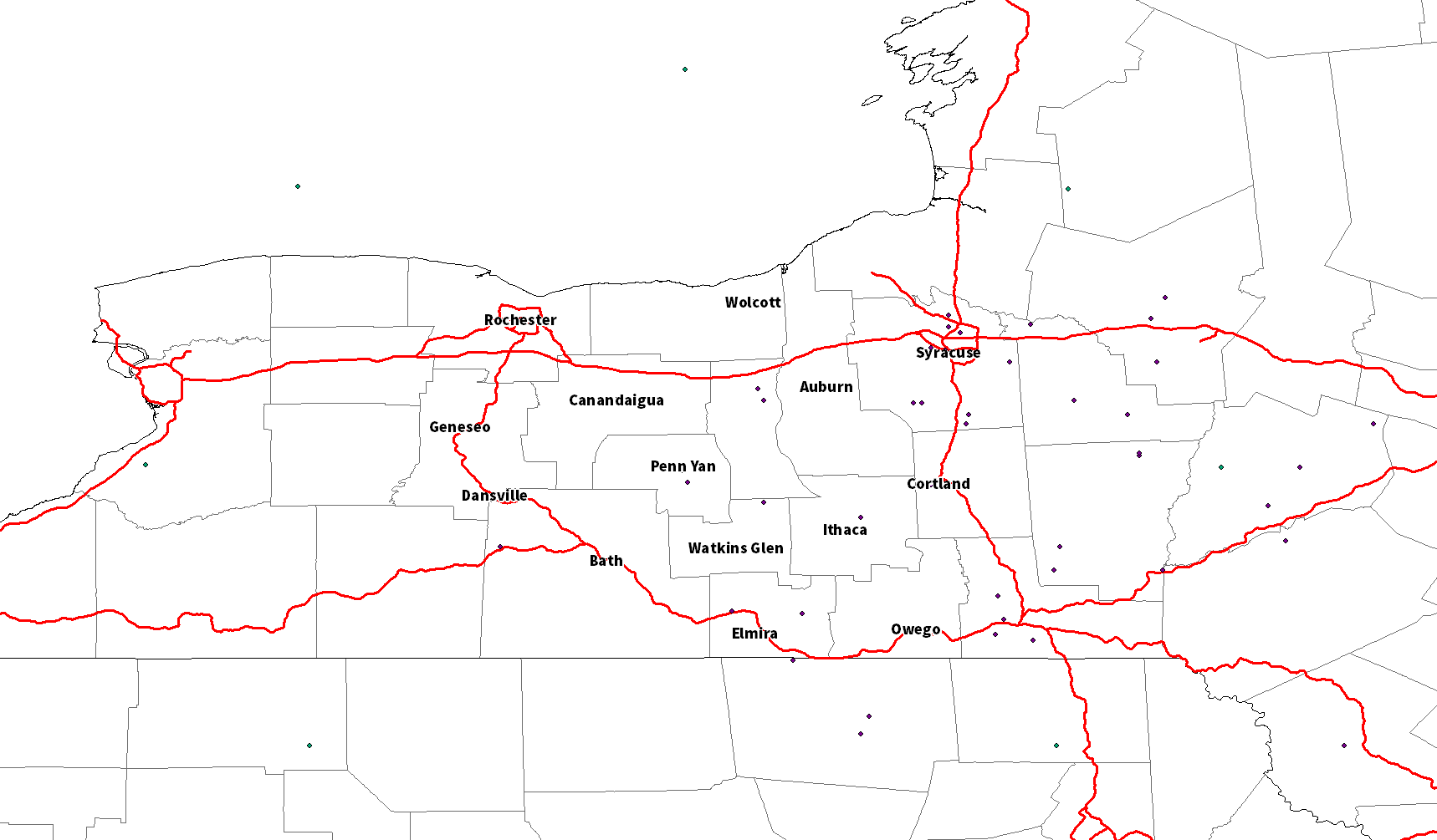
WGS 1984 Web Mercator Auxiliary Sphere:

See the difference?
- Mark as New
- Bookmark
- Subscribe
- Mute
- Subscribe to RSS Feed
- Permalink
- Report Inappropriate Content
I made my suggestion yesterday regarding projection options. If was hoping that something in that link would be useful should you wish to tie your data in with State data at some point. I would be less concerned about how your data looks and its projection that I would be about the sparseness of your data in the western half of your study area. But one issue at a time.
- Mark as New
- Bookmark
- Subscribe
- Mute
- Subscribe to RSS Feed
- Permalink
- Report Inappropriate Content
I'm aware of the sparseness in the western areas, I just used some sample data that was only Central NY/Northeast PA for an example. I just want to be able to interpolate my data into a coordinate system that doesn't flatten my shapefile like the GCS WGS 1984 system does or most of the other unprojected ones.
- Mark as New
- Bookmark
- Subscribe
- Mute
- Subscribe to RSS Feed
- Permalink
- Report Inappropriate Content
I have tagged Melita Kennedy who might be able to resolve your concerns on projections then, perhaps she has better suggestions.
- Mark as New
- Bookmark
- Subscribe
- Mute
- Subscribe to RSS Feed
- Permalink
- Report Inappropriate Content
Ok, thanks for your help.
- Mark as New
- Bookmark
- Subscribe
- Mute
- Subscribe to RSS Feed
- Permalink
- Report Inappropriate Content
Hi Carter,
When we display data that's using a geographic coordinate system, we treat the angular units (degrees) as if they're linear, so you get a stretched out look. It's really more stretched east-west because the meridians/longitude lines should be converging, not straight up-and-down. The web Mercator definition stretches north-and-south more so I think it looks more balanced to you.
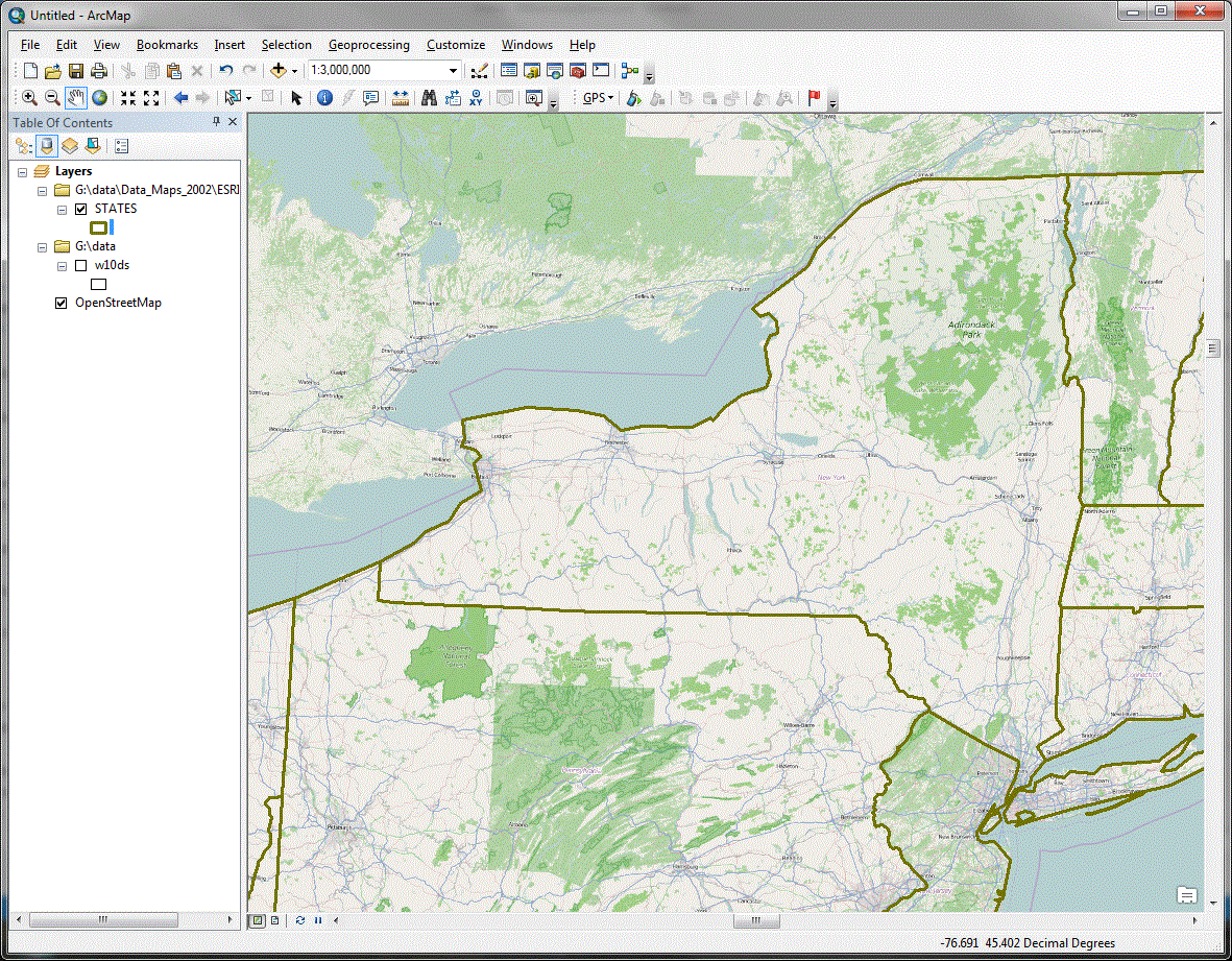
Just about any projected coordinate system that's appropriate for the area will look more balanced to you. Here's NAD 1983 UTM zone 18 North, which Dan Patterson recommended (me too).
UTM uses transverse Mercator which is a conformal projection (so is Mercator used by web Mercator pcs) which maintains shapes and angles.
Melita
- Mark as New
- Bookmark
- Subscribe
- Mute
- Subscribe to RSS Feed
- Permalink
- Report Inappropriate Content
Ok...so how do I get my data to show up?
- Mark as New
- Bookmark
- Subscribe
- Mute
- Subscribe to RSS Feed
- Permalink
- Report Inappropriate Content
For your csv/Excel data, you can use the Add XY Data tool: File menu, Add Data, Add XY Data. After you browse to the file and select it, the tool will default the coordinate system to that of the maps. You probably instead want to override that and choose Geographic Coordinate System, North America, NAD 1983 (or North American 1983 depending on ArcGIS version).
Once the XY layer is created, you can right-click the layer and choose data, export data. In that tool, you can write the data out to a feature class, or a shapefile. There's an option to use the data's coordinate system (NAD 1983) or use the data frame's coordinate system.
To set the data frame's coordinate system to NAD 1983 UTM 18 North, choose projected coordinate system, UTM, NAD 1983. Or in the search box, type in 26918, which should select it for you.
Melita