- Home
- :
- All Communities
- :
- Products
- :
- Mapping and Charting Solutions
- :
- Mapping and Charting Questions
- :
- Re: Can anyone help me in how to create a grid sha...
- Subscribe to RSS Feed
- Mark Topic as New
- Mark Topic as Read
- Float this Topic for Current User
- Bookmark
- Subscribe
- Mute
- Printer Friendly Page
Can anyone help me in how to create a grid shapefile superimposed on a certain area and indexed?
- Mark as New
- Bookmark
- Subscribe
- Mute
- Subscribe to RSS Feed
- Permalink
- Report Inappropriate Content
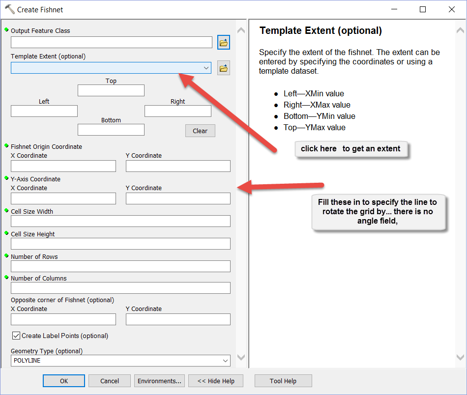
I also have to rotate it to true North. I am having a hard time with fishnet and create spatial grid since it is not very intuitive but if anyone has an easier way, let me know.
- Mark as New
- Bookmark
- Subscribe
- Mute
- Subscribe to RSS Feed
- Permalink
- Report Inappropriate Content
fishnet is the tool..what is the problem you are having?
- Mark as New
- Bookmark
- Subscribe
- Mute
- Subscribe to RSS Feed
- Permalink
- Report Inappropriate Content
Well it comes out larger than the area even though I specify the extent using another shapefile and I cannot figure out how to rotate it to true North. My whole page is rotated but the net does not rotate.
- Mark as New
- Bookmark
- Subscribe
- Mute
- Subscribe to RSS Feed
- Permalink
- Report Inappropriate Content
typically you want to use a projected dataset/data frame when you create a fishnet, but then the x-axis will not be north-south (that is, the longitude will not be static). I've run into this recently myself. My thought is to try to create it using a geographic coord system, then project it. (Have not had the time to try this yet).
Another note, If trying to have a rotated grid, sometimes the rotation can cause the grid to not cover the full extent of you area (e.g if odd shaped polygon). So, when I have rotated, I make my extent larger, rotate, and then for my use, clip by my study area polygon.
if you can supply a picture showing the options you are trying, and a clip of the area you are covering, it may be easier to provide feedback on you input parameters.
- Mark as New
- Bookmark
- Subscribe
- Mute
- Subscribe to RSS Feed
- Permalink
- Report Inappropriate Content
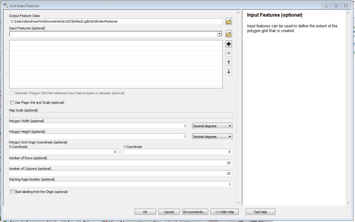
Another option is to use the Grid Index Feature (Cartography) geoprocessing tool. To get the proper extent, one can add a feature class that covers the extent needed to the Input Features (optional) part. Use the Environments button on the bottom to set an appropriate projection/coordinate system that will line up with True North.
Grid Index Features—Help | ArcGIS for Desktop
Chris Donohue, GISP
- Mark as New
- Bookmark
- Subscribe
- Mute
- Subscribe to RSS Feed
- Permalink
- Report Inappropriate Content
They both have the option for the extent setting. The problem seems to be that they are looking for an angle to rotate by, but in fact they need to specify a pivot line using a starting x, y and an ending line coordinate to form the line to pivot by. I have posted code called PyshNet on my blog... but that required code familiarity. Anyway, here if Fishnet