- Home
- :
- All Communities
- :
- Products
- :
- ArcGIS Pro
- :
- ArcGIS Pro Questions
- :
- How to create a built up area / settlements map?
- Subscribe to RSS Feed
- Mark Topic as New
- Mark Topic as Read
- Float this Topic for Current User
- Bookmark
- Subscribe
- Mute
- Printer Friendly Page
How to create a built up area / settlements map?
- Mark as New
- Bookmark
- Subscribe
- Mute
- Subscribe to RSS Feed
- Permalink
- Report Inappropriate Content
Hi
I have a basic question about raster processing;
How can I extract built up / developed area from non-built up area in a NDBI raster data set?
I used ArcGIS Pro NDPI Index to distinguish builtin-up area from other land use/covers in a Landsat 8 image. I guess the index supposed to produce a raster image with pixel values from -1 to 1 in which (based on a document) value from -.51 to .75 represent built-up lands. However, the value of almost all the pixels of my NDBI data set fall in that range and considered as built-up lands. I tried to use supervised pixel based classification (Random Trees and other methods) with the original landsat 8, (10 bands composite) image, and with the produced NDBI raster using the most accurate training samples that I could create, but I did not get accurate result. I have same problem with detecting Tamarisk trees using a NDVI.
Can anybody help me with this?
Thank you
- Mark as New
- Bookmark
- Subscribe
- Mute
- Subscribe to RSS Feed
- Permalink
- Report Inappropriate Content
What does the result look like?
How is it not accurate? any visual examples?
- Mark as New
- Bookmark
- Subscribe
- Mute
- Subscribe to RSS Feed
- Permalink
- Report Inappropriate Content
Hi Dan,
I'm so sorry! I didn't see your reply. I hope it's not too late to reply.
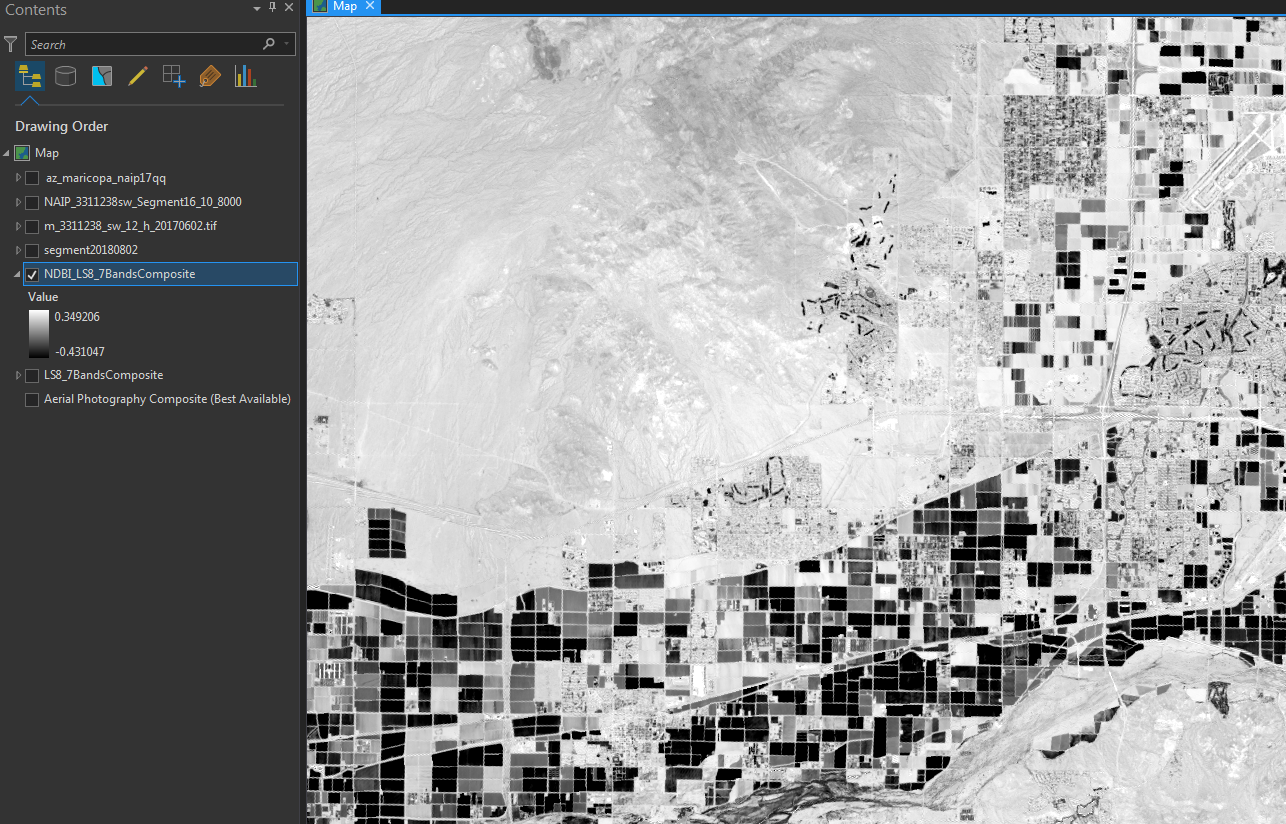
This is a screenshot of the image. As you see, pixel values start from -0.431 and limit to 0.349. I don't know how to extract built up area out of this raster file.
Thank you

- Mark as New
- Bookmark
- Subscribe
- Mute
- Subscribe to RSS Feed
- Permalink
- Report Inappropriate Content
Does NDBI give better results for built-up density for a small city (say, for Area <100 sq.km) or should I go for the classification techniques?