Turn on suggestions
Auto-suggest helps you quickly narrow down your search results by suggesting possible matches as you type.
Cancel
- Home
- :
- All Communities
- :
- Products
- :
- ArcGIS Spatial Analyst
- :
- ArcGIS Spatial Analyst Questions
- :
- Flow Direction tool produces erroneous lines in ou...
Options
- Subscribe to RSS Feed
- Mark Topic as New
- Mark Topic as Read
- Float this Topic for Current User
- Bookmark
- Subscribe
- Mute
- Printer Friendly Page
Flow Direction tool produces erroneous lines in output raster
Subscribe
2549
2
04-19-2013 02:49 PM
by
Anonymous User
Not applicable
04-19-2013
02:49 PM
- Mark as New
- Bookmark
- Subscribe
- Mute
- Subscribe to RSS Feed
- Permalink
- Report Inappropriate Content
Original User: jonathankoehler
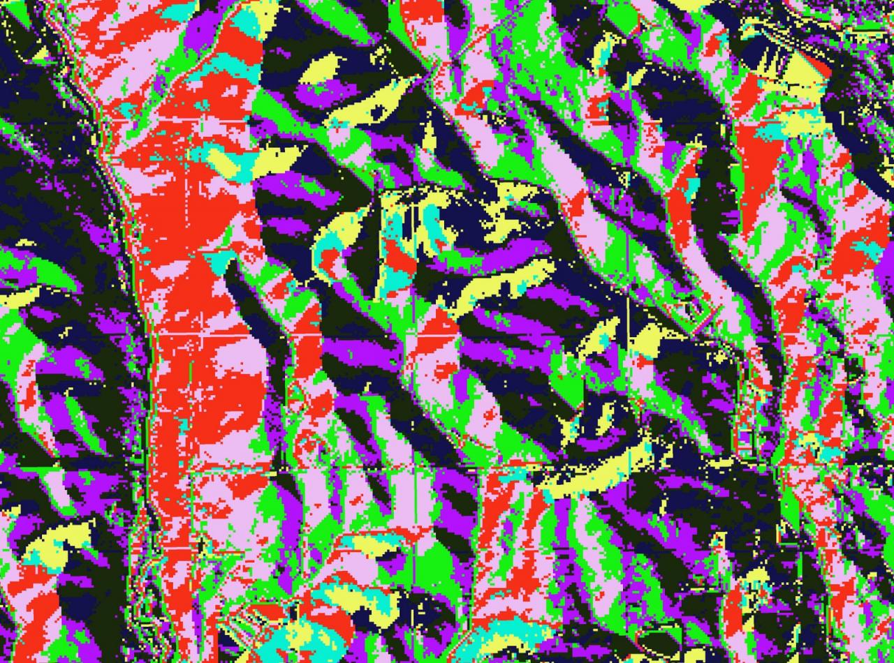
I am running the Flow Direction tool on a seamless bare-earth NED raster elevation grid. The tool runs fine, but the output raster has a series of horizontal and vertical lines - like a grid - that contain erroneous flow directions, and therefore make the layer useless for generating watersheds. Attached are a couple of picture of what the output rasters look like - one is from a 1m DEM and the other is from a 10m. These lines are not visible in the raw DEM file, so it appears that something about the Flow Direction tool brings them out or creates them.
I have tried running Flow Direction with several DEM resolutions including 10m, 30m, and 1m LiDAR with the same results. I have also tried running it with and without first using the Fill tool to clean it up - it doesn't seem to make any difference.
I'm using using ArcGIS Desktop 10 SP 5, ArcInfo license. Any help would be greatly appreciated. Thanks,
Jonathan
[ATTACH=CONFIG]23682[/ATTACH][ATTACH=CONFIG]23683[/ATTACH]
2 Replies
by
Anonymous User
Not applicable
04-19-2013
03:54 PM
- Mark as New
- Bookmark
- Subscribe
- Mute
- Subscribe to RSS Feed
- Permalink
- Report Inappropriate Content
Original User: MBoucher21
I've seen this problem addressed in the Forum before. From a quick search I couldn't find that post.
I've seen this problem addressed in the Forum before. From a quick search I couldn't find that post.
04-22-2013
11:39 AM
- Mark as New
- Bookmark
- Subscribe
- Mute
- Subscribe to RSS Feed
- Permalink
- Report Inappropriate Content
Please show us a Hillshade from that DEM. If it is gridded like your flow direction raster then you or someone has most likely projected the data with Nearest Neighbor resampling. If it wasn't projected, and some other resampling was done to change cell sizes, using Nearest would still cause this. The NED FAQ has a topic on this.
http://ned.usgs.gov/faq.asp#RESAMPLE
If your DEM is "old" by USGS standards, then striping can be there too. See http://ned.usgs.gov/about.asp
ArcGIS doesn't cause these artifacts.
Best,
Eric
http://ned.usgs.gov/faq.asp#RESAMPLE
If your DEM is "old" by USGS standards, then striping can be there too. See http://ned.usgs.gov/about.asp
ArcGIS doesn't cause these artifacts.
Best,
Eric