- Home
- :
- All Communities
- :
- Products
- :
- ArcGIS Spatial Analyst
- :
- ArcGIS Spatial Analyst Questions
- :
- Zonal Statistics: wrong MIN, MAX, MEAN values
- Subscribe to RSS Feed
- Mark Topic as New
- Mark Topic as Read
- Float this Topic for Current User
- Bookmark
- Subscribe
- Mute
- Printer Friendly Page
Zonal Statistics: wrong MIN, MAX, MEAN values
- Mark as New
- Bookmark
- Subscribe
- Mute
- Subscribe to RSS Feed
- Permalink
- Report Inappropriate Content
Hello!
I'm trying to run the Zonal Statistics as Table function using the following parameters:
- Input source: vector polygon feature class with neighborhoods in a city
- Zone field: OBJECTID
- Input raster: euclidean distance of a railway raster
- statistics type: ALL
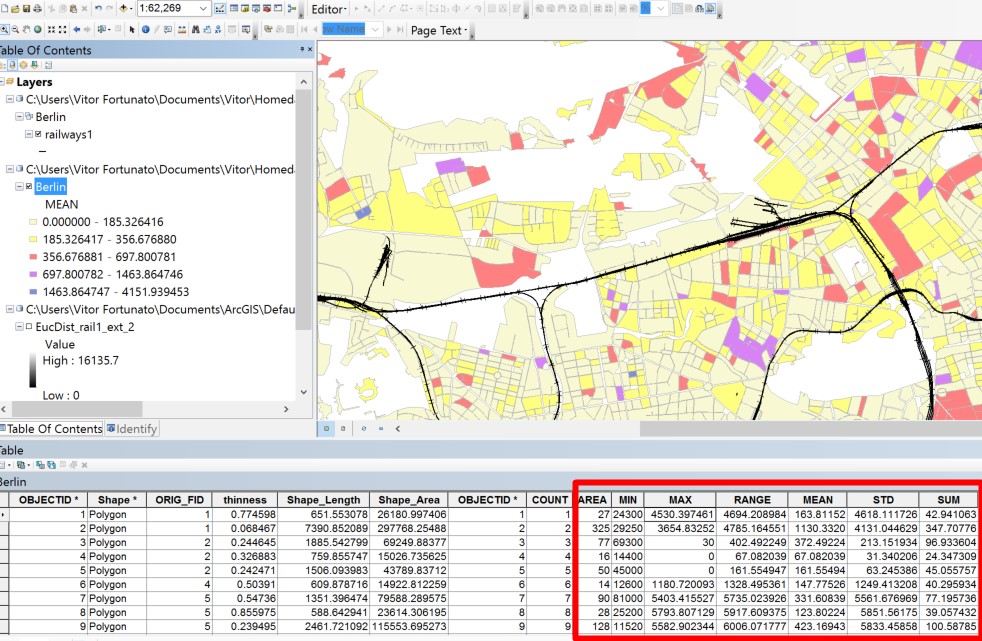
However, all the statistics values seem wrong, as the vast majority of them have MIN value higher than the MAX value, which is impossible. That being said, all other values are wrong as well: RANGE, MEAN, STD and SUM.
What am I doing wrong?
here is a print screen of the evidence:
- Mark as New
- Bookmark
- Subscribe
- Mute
- Subscribe to RSS Feed
- Permalink
- Report Inappropriate Content
The result from Zonal Statistics as Table is a table, and that table will has one required OBJECTID.
in your picture the table has two required OBJECTID.
so I think that the table is modified.
try again the tool and snapshot the original result.
- Mark as New
- Bookmark
- Subscribe
- Mute
- Subscribe to RSS Feed
- Permalink
- Report Inappropriate Content
You're not alone. This is a bug.
See: Major bug in ArcGIS Zonal statistics? - Geographic Information Systems Stack Exchange
Edit: I think this is more like it: Wrong min value from ArcGIS 10.4 zonal statistics as table - Geographic Information Systems Stack Ex...
- Mark as New
- Bookmark
- Subscribe
- Mute
- Subscribe to RSS Feed
- Permalink
- Report Inappropriate Content
BUG-000095650 Zonal tools using the FID field gives incorrect results.
BUG-000095651 The Zonal Statistics tool is crashing ArcMap and ArcCatalog when the input zone data does not have a raster attribute table. have been fixed in 10.5
I hope that table is the result of a join after the zonal statistics was calculated and not before it was calculated. And every thing is in the same projection I hope? and it is projected and not in geographic coordinates... the list of places things can go wrong are numerous.