Turn on suggestions
Auto-suggest helps you quickly narrow down your search results by suggesting possible matches as you type.
Cancel
- Home
- :
- All Communities
- :
- Products
- :
- Data Management
- :
- Data Management Questions
- :
- Re: How the �??transformation method�?� is differe...
Options
- Subscribe to RSS Feed
- Mark Topic as New
- Mark Topic as Read
- Float this Topic for Current User
- Bookmark
- Subscribe
- Mute
- Printer Friendly Page
How the ???transformation method??? is different from ???resample type????
Subscribe
05-23-2012
10:12 AM
- Mark as New
- Bookmark
- Subscribe
- Mute
- Subscribe to RSS Feed
- Permalink
- Report Inappropriate Content
How the ???transformation method??? is different from ???resample type????
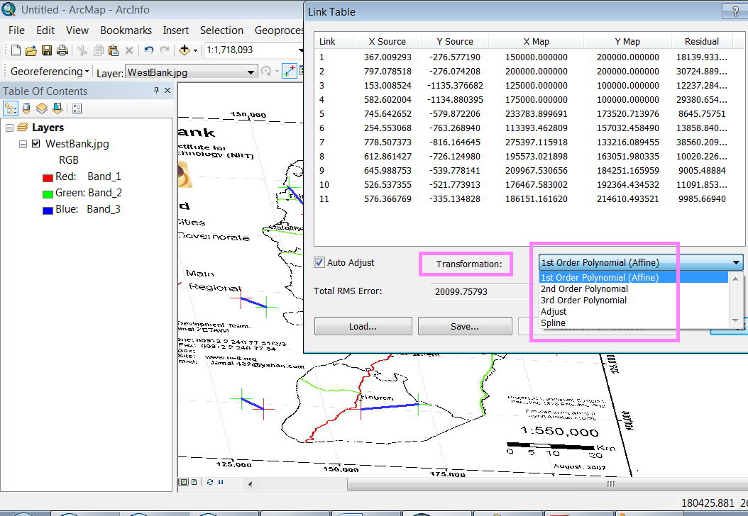
I???m wondering based on which equations the ArcGIS perform sthe transformation. What is meant by ???adjust??? that exists as a transformation method (screenshot below)?
[ATTACH=CONFIG]14573[/ATTACH], [ATTACH=CONFIG]14574[/ATTACH]
What is the effect of the ???transformation method??? and ???resample type??? on the produced georeferenced raster?
Thank you for the help,
Best
Jamal
----------------------------------------
Jamal Numan
Geomolg Geoportal for Spatial Information
Ramallah, West Bank, Palestine
Jamal Numan
Geomolg Geoportal for Spatial Information
Ramallah, West Bank, Palestine
Solved! Go to Solution.
1 Solution
Accepted Solutions
05-23-2012
12:38 PM
- Mark as New
- Bookmark
- Subscribe
- Mute
- Subscribe to RSS Feed
- Permalink
- Report Inappropriate Content
Hi Jamal,
You may want to look at the Fundamentals for georeferencing a raster dataset Web Help.
Patrick
You may want to look at the Fundamentals for georeferencing a raster dataset Web Help.
Patrick
2 Replies
05-23-2012
12:38 PM
- Mark as New
- Bookmark
- Subscribe
- Mute
- Subscribe to RSS Feed
- Permalink
- Report Inappropriate Content
Hi Jamal,
You may want to look at the Fundamentals for georeferencing a raster dataset Web Help.
Patrick
You may want to look at the Fundamentals for georeferencing a raster dataset Web Help.
Patrick
by
Anonymous User
Not applicable
05-23-2012
02:49 PM
- Mark as New
- Bookmark
- Subscribe
- Mute
- Subscribe to RSS Feed
- Permalink
- Report Inappropriate Content
Original User: ebowman
Hi Jamal,
Patrick has a great link to the help for this topic.
The transformation is for warping the image within coordinate space and creating a world file. The default method is affine that has scale, skew, rotate. The x and y axis are independent of each other. The 2nd and 3rd order polynomials are more complex calculations for dealing with skew. These methods are used to make the image line up in coordinate space so that world file can be created.
The resample is used for exporting out an georeferenced image to be rectified. The help lists this useful for other programs that cannot read an external world file. I typically don't rectify it but stop after doing the transformation. If you use the what's this button on the resample, it will explain what each of those methods are.
Hope this helps.
Eric