- Home
- :
- All Communities
- :
- Products
- :
- Data Management
- :
- Data Management Questions
- :
- Re: Raster Projection: what king of grid is it?
- Subscribe to RSS Feed
- Mark Topic as New
- Mark Topic as Read
- Float this Topic for Current User
- Bookmark
- Subscribe
- Mute
- Printer Friendly Page
- Mark as New
- Bookmark
- Subscribe
- Mute
- Subscribe to RSS Feed
- Permalink
- Report Inappropriate Content
Hello,
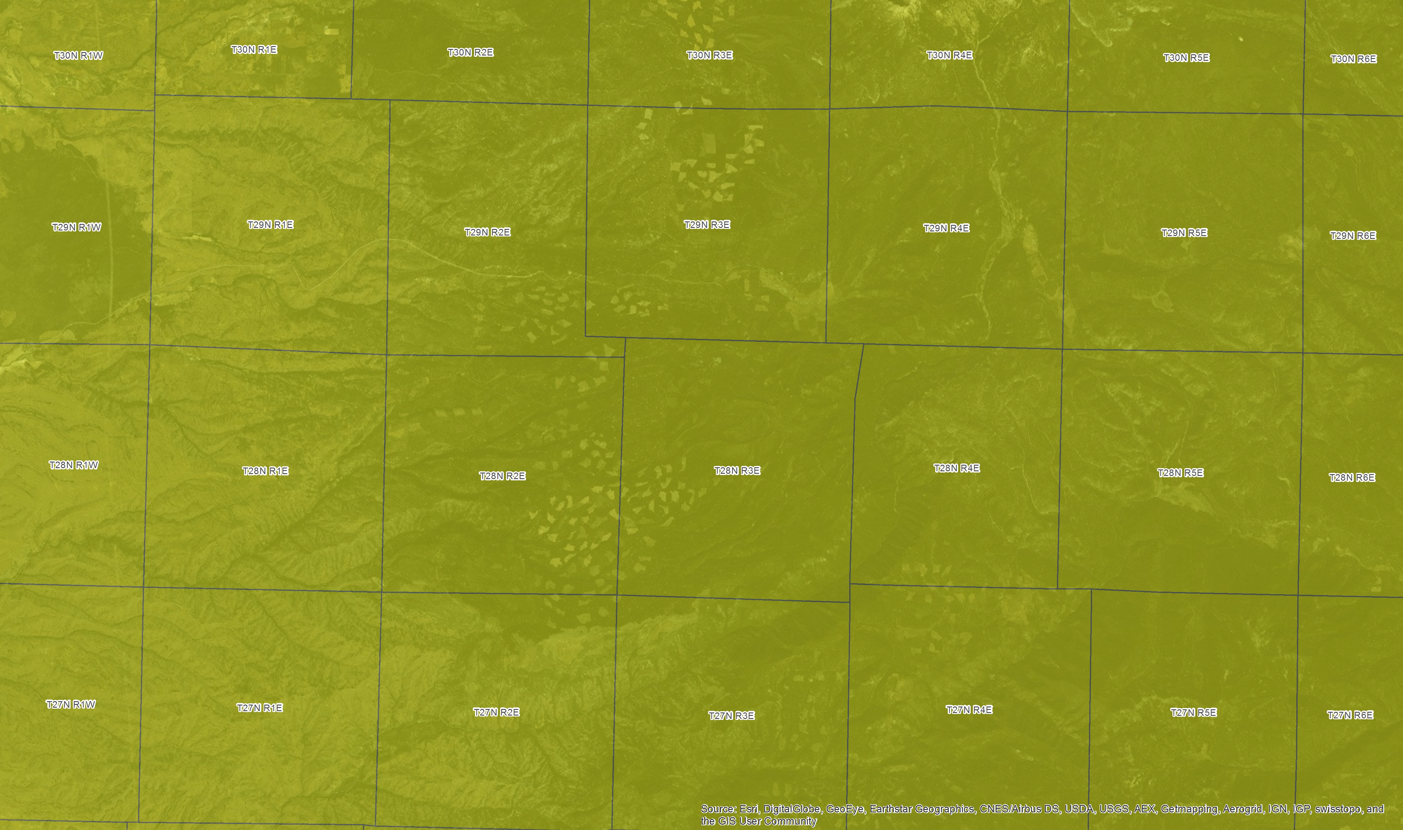
I am trying to reference a raster map from USGS in Wyoming, and on it there are only a Grid and some coordinates. I don't know the projection, so I would like to use the grid to project my raster.
Here is a screenshot of a part of that raster.
Unfortunately, I am not able to find what this grid correspond to...
Does anyone has a referenced shapefile of this grid or is able to tell me where I could find it?`
Many thanks!
Pierre
Solved! Go to Solution.
Accepted Solutions
- Mark as New
- Bookmark
- Subscribe
- Mute
- Subscribe to RSS Feed
- Permalink
- Report Inappropriate Content
Good afternoon Pierre,
The grid is based on the Public Land Survey System (PLSS). The layer used to be included in streetmaps, but you can also download the layer (for Wyoming) at Public Land Survey System Download
The twnshp layer has your information. See the label field, and query 8N 4W to get you lined up.
Then use the grid as reference points to georeference.
Lance
- Mark as New
- Bookmark
- Subscribe
- Mute
- Subscribe to RSS Feed
- Permalink
- Report Inappropriate Content
The grid looks like footprints for another dataset, but can't know for sure without a legend or finding someone who's used this data before. Is there any information in the surround of the raster? Are there enough intersecting lat/long points that you could use to georeference the image yourself?
- Mark as New
- Bookmark
- Subscribe
- Mute
- Subscribe to RSS Feed
- Permalink
- Report Inappropriate Content
Good afternoon Pierre,
The grid is based on the Public Land Survey System (PLSS). The layer used to be included in streetmaps, but you can also download the layer (for Wyoming) at Public Land Survey System Download
The twnshp layer has your information. See the label field, and query 8N 4W to get you lined up.
Then use the grid as reference points to georeference.
Lance
- Mark as New
- Bookmark
- Subscribe
- Mute
- Subscribe to RSS Feed
- Permalink
- Report Inappropriate Content
Hi Pierre, as Lance said, the Grid is PLSS, with tonwship and range numbers. I'm not sure what you mean by "reference" your raster though. Do you mean georeference? I doubt the grid needs georeferencing, if you got it from USGS it should be georefenced already. Is it just an image, like a picture? Please try to clarify what you're trying to do a little better.
- Mark as New
- Bookmark
- Subscribe
- Mute
- Subscribe to RSS Feed
- Permalink
- Report Inappropriate Content
Some practical tidbits to add regarding using Public Land Survey System (PLSS) data:
- You may notice parts of the PLSS "grid" to be missing. This is because not all areas were surveyed.
- In some areas, the "grid" becomes distorted and linework expected to be parallel converge to some extent. Instead of a uniform grid of repeating rectangles, there are other geometric forms. This is due to inaccuracies of the surveying. Note the offset and "bent" lines in this example from Northern California:
Also, here's some history and explanation of common terms used in the survey.
Public Land Survey System - Wikipedia, the free encyclopedia
- Mark as New
- Bookmark
- Subscribe
- Mute
- Subscribe to RSS Feed
- Permalink
- Report Inappropriate Content
What's the source of the raster map? I really would be surprised if we put a spatial dataset out there without georeferencing. Perhaps you have a pdf version of something you could get in a GIS format? Please post a link and I can help you find the "source" raster that you need.
- Mark as New
- Bookmark
- Subscribe
- Mute
- Subscribe to RSS Feed
- Permalink
- Report Inappropriate Content
Oh you work for USGS Curtis? Neat!
- Mark as New
- Bookmark
- Subscribe
- Mute
- Subscribe to RSS Feed
- Permalink
- Report Inappropriate Content
Yes, it is a map I found in a USGS publication in a pdf format.
Here is where I found it:
No problem for me to georeference it now that I know the grid is the PLSS!
Do you know if those maps are downloadable in a shapefile format?