- Home
- :
- All Communities
- :
- Developers
- :
- Developers - General
- :
- Developers Questions
- :
- Re: ArcGIS Online Labels with Arcade Custom Expres...
- Subscribe to RSS Feed
- Mark Topic as New
- Mark Topic as Read
- Float this Topic for Current User
- Bookmark
- Subscribe
- Mute
- Printer Friendly Page
ArcGIS Online Labels with Arcade Custom Expression Won't Render in App
- Mark as New
- Bookmark
- Subscribe
- Mute
- Subscribe to RSS Feed
- Permalink
- Report Inappropriate Content
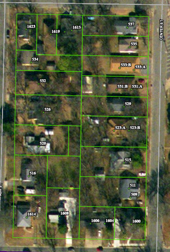
I'm trying to label address points (with the ArcGIS Online labeling functionality) for one of our city's webmaps. Some of the addresses have unit numbers, some don't. I put together an Arcade expression that checks the "unit" field for values so that all points will be labeled correctly.
var unitVal = $feature.unit
var stVal = $feature.snumber
function mainfunc(unitVal,stVal){
if (unitVal == ' '){
return stVal
}
else {
return Concatenate([stVal,unitVal], ':')
}
}
mainfunc(unitVal,stVal);The labels appear correctly in ArcGIS Online, but will not draw in a web application that calls on that AGO map. Has anyone come across the same issue?
- Mark as New
- Bookmark
- Subscribe
- Mute
- Subscribe to RSS Feed
- Permalink
- Report Inappropriate Content
Michael,
Have you tried adding semicolons at the end of your first two lines?
--- Rod
- Mark as New
- Bookmark
- Subscribe
- Mute
- Subscribe to RSS Feed
- Permalink
- Report Inappropriate Content
Hi Rod,
Just tried that, and no change, unfortunately.
Thanks for looking into it
- Mark as New
- Bookmark
- Subscribe
- Mute
- Subscribe to RSS Feed
- Permalink
- Report Inappropriate Content
I'm looking into this as well... will reply if I learn anything.
FYI, the expression could also be condensed to the following (but it doesn't really matter. Depends on your preference):
var unitVal = $feature.unit;
var stVal = $feature.snumber;
IIF(unitVal == ' ', stVal, Concatenate([stVal,unitVal], ':'));- Mark as New
- Bookmark
- Subscribe
- Mute
- Subscribe to RSS Feed
- Permalink
- Report Inappropriate Content
Which version of the JS API are you using, 4.x or 3.x? Labeling isn't supported in 4.x yet. I was able to verify this in a 4.x app, but noticed the expected behavior in 3.x...
4.x test case: JS Bin - Collaborative JavaScript Debugging
3.x test case: JS Bin - Collaborative JavaScript Debugging