- Home
- :
- All Communities
- :
- Products
- :
- Imagery and Remote Sensing
- :
- Imagery Questions
- :
- Re: How To Create Multi-Visibility Raster
- Subscribe to RSS Feed
- Mark Topic as New
- Mark Topic as Read
- Float this Topic for Current User
- Bookmark
- Subscribe
- Mute
- Printer Friendly Page
- Mark as New
- Bookmark
- Subscribe
- Mute
- Subscribe to RSS Feed
- Permalink
- Report Inappropriate Content
I used the visibility tool to create four separate visibility rasters from four different locations. I now need to create a raster showing only the areas that all four of the visibility points can see. Does anyone know what tool I should use to create this kind of raster?
Solved! Go to Solution.
Accepted Solutions
- Mark as New
- Bookmark
- Subscribe
- Mute
- Subscribe to RSS Feed
- Permalink
- Report Inappropriate Content
Great! Can you mark my answer as CORRECT so it flags this thread as finished?
Washoe County GIS
- Mark as New
- Bookmark
- Subscribe
- Mute
- Subscribe to RSS Feed
- Permalink
- Report Inappropriate Content
You can do this with #raster calculator in Desktop. Assuming each of your visibility rasters contain values of 0 (non-visible) and 1(visible), if you add all the rasters together, the resulting raster will have values ranging from 0 to 4, where the integer indicates how many visibility points can see each cell.
Alternatively, the Visibility tool will let you use multiple observer points and will do all the work for you:
Observer Points—Help | ArcGIS Desktop
Washoe County GIS
- Mark as New
- Bookmark
- Subscribe
- Mute
- Subscribe to RSS Feed
- Permalink
- Report Inappropriate Content
doing that shows all the viewsheds at once, but I need to show only the areas that all four of these observation points can see together in one viewshed
- Mark as New
- Bookmark
- Subscribe
- Mute
- Subscribe to RSS Feed
- Permalink
- Report Inappropriate Content
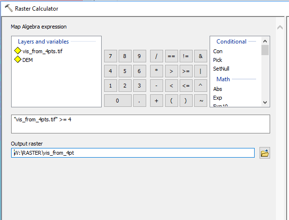
STEP ONE: Run visibility tool with all observer points in a single shapefile.

This yields a raster showing what is visible from ANY of the obervers, but also with cell values ranging from 0 to 4, indicating how MANY observers can see each cell.

STEP TWO: Use Raster Calculator to generate a raster that only includes cells visible from 4 observers:
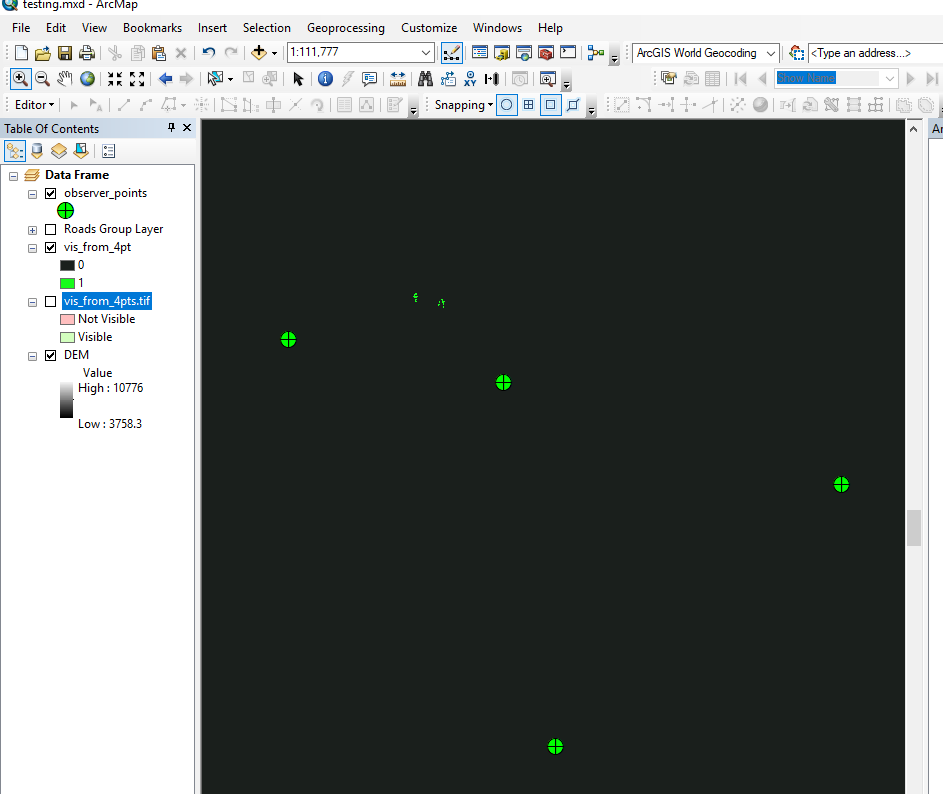
In my example there are only a few cells that are actually visible from all 4 observers, shown by the green cells. Black indicates not visible.
Jay
Washoe County GIS
- Mark as New
- Bookmark
- Subscribe
- Mute
- Subscribe to RSS Feed
- Permalink
- Report Inappropriate Content
That worked, Thank you very much. I appreciate it!!!
- Mark as New
- Bookmark
- Subscribe
- Mute
- Subscribe to RSS Feed
- Permalink
- Report Inappropriate Content
Great! Can you mark my answer as CORRECT so it flags this thread as finished?
Washoe County GIS
- Mark as New
- Bookmark
- Subscribe
- Mute
- Subscribe to RSS Feed
- Permalink
- Report Inappropriate Content
another way to put it, i need to know the areas on the ground that have a visual of all 4 of the observations points.