- Home
- :
- All Communities
- :
- Products
- :
- Imagery and Remote Sensing
- :
- Imagery Questions
- :
- Issue with changing background imagery in an older...
- Subscribe to RSS Feed
- Mark Topic as New
- Mark Topic as Read
- Float this Topic for Current User
- Bookmark
- Subscribe
- Mute
- Printer Friendly Page
Issue with changing background imagery in an older storymap.
- Mark as New
- Bookmark
- Subscribe
- Mute
- Subscribe to RSS Feed
- Permalink
- Report Inappropriate Content
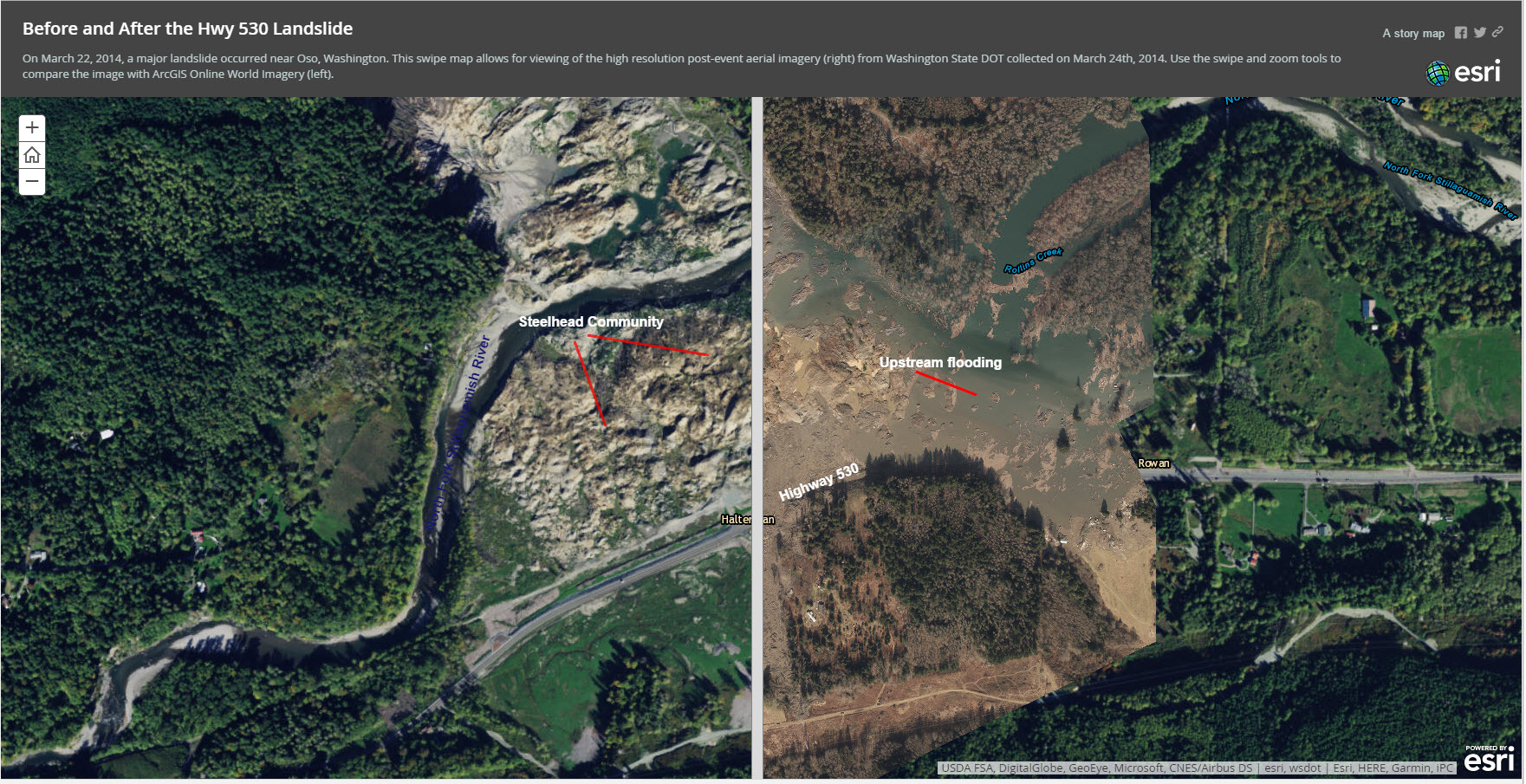
Unfortunately, with ArcGIS Online updating the World Imagery, this story map now no longer shows what it did previously.
(see attached screen shot, or view the site) In the left hand part of the image, which is using the ArcGIS Online World Imagery, the area labeled Steelhead Community showed, in the past, the residential Steelhead community with the houses and streets. Now, because the imagery has been updated, the labeled area shows the landslide debris that destroyed the community and is now becoming partially vegetated. The slider bar, either in screen shot or on site, shows the post landslide imagery collected immediately after the event in the right hand panel of the image.
Really unfortunate that this story map is no longer useful because of the reliance on a background dataset that changes.
Would love to know if there is a way to recover this site to the original pre-slide imagery.
For story map developers, this should be a concern about using background data that is beyond the developers control and the longevity of their project.
Appreciate any thoughts on this.
Thanks,
Dave
- Mark as New
- Bookmark
- Subscribe
- Mute
- Subscribe to RSS Feed
- Permalink
- Report Inappropriate Content
Hi Dave, It might be good to post this one in the Living Atlas of the World Discussion Group or Imagery and Remote Sensing
Rupert