- Home
- :
- All Communities
- :
- Industries
- :
- State & Local Government
- :
- State & Local Government Questions
- :
- Re: How RoadCenterlines drawn
- Subscribe to RSS Feed
- Mark Topic as New
- Mark Topic as Read
- Float this Topic for Current User
- Bookmark
- Subscribe
- Mute
- Printer Friendly Page
- Mark as New
- Bookmark
- Subscribe
- Mute
- Subscribe to RSS Feed
- Permalink
- Report Inappropriate Content
Have had a question on how a roadcenterline is drawn when there are different speed limits on the travel paths that go both directions. Are there 2 lines drawn and connect back up where the travel paths converge with 1 speed limit.
Thanks
Charline
Solved! Go to Solution.
Accepted Solutions
- Mark as New
- Bookmark
- Subscribe
- Mute
- Subscribe to RSS Feed
- Permalink
- Report Inappropriate Content
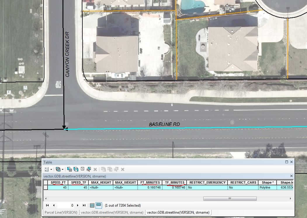
A single centerline can be used for situations where the speed limit is different in both directions by having different attributes to account for the different speeds. For example, here at the City we have centerlines with a "To From" Speed Limit and a "From To" Speed Limit, which refer to the speed limit for each direction based on the line directionality. We also have fields for "To From" Minutes and "From To" Minutes that are populated with the time it takes to transit that segment based on the speed for that direction. Part of the reason it was set up this way is so we can maintain a Network Dataset.
We also do have "divided highways", where the travel lanes are defined as one-way, but those are in specific cases where there is a central barrier divides the road into essentially 2 one-way streets.
So I guess one question back to you is, what is the context that goes with your question? Are you looking to do Network analysis?
One caveat - we are not doing the Local Government Information Model (I noticed you tagged this post with LGM, so I am guessing you are using that).
Chris Donohue, GISP
- Mark as New
- Bookmark
- Subscribe
- Mute
- Subscribe to RSS Feed
- Permalink
- Report Inappropriate Content
This is exactly what I was looking for. Thanks