Turn on suggestions
Auto-suggest helps you quickly narrow down your search results by suggesting possible matches as you type.
Cancel
- Home
- :
- All Communities
- :
- Developers
- :
- ArcGIS API Silverlight (Retired)
- :
- ArcGIS API Silverlight Questions
- :
- Re: Constrain InfoWindow to window size
Options
- Subscribe to RSS Feed
- Mark Topic as New
- Mark Topic as Read
- Float this Topic for Current User
- Bookmark
- Subscribe
- Mute
- Printer Friendly Page
02-21-2012
11:28 AM
- Mark as New
- Bookmark
- Subscribe
- Mute
- Subscribe to RSS Feed
- Permalink
- Report Inappropriate Content
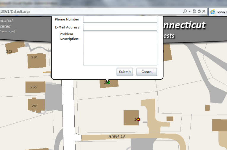
Is there a way to constrain the InfoWindow, when visible, to the size of the browser window? If a user clicks a point that is close to the top of the browser window, the InfoWindow expands past the top of the page.
[ATTACH=CONFIG]12103[/ATTACH]
Ideally I'd like to shift the map south so that the entire InfoWindow displays.
[ATTACH=CONFIG]12104[/ATTACH]
Any ideas?
[ATTACH=CONFIG]12103[/ATTACH]
Ideally I'd like to shift the map south so that the entire InfoWindow displays.
[ATTACH=CONFIG]12104[/ATTACH]
Any ideas?
Solved! Go to Solution.
21 Replies
03-12-2012
06:38 AM
- Mark as New
- Bookmark
- Subscribe
- Mute
- Subscribe to RSS Feed
- Permalink
- Report Inappropriate Content
Ok. I've set the ContentTemplate in code-behind. No changes.
1- I don't think my InfoWindow is opening behind the map. There's no zIndex set in myMap and looks like there's no zIndex property in the InfoWindow aswell.
2- Yes, my map is contained inside a Grid. I saw the thread you refer, but in my case the infowindow doesnt even appear, while in the other cases the infowindow is appearing in the wrong position...
Thanks for trying to help me.
Try setting a breakpoint in your MouseDown event and see if myinfowindow.isopen returns true. If it is true, then check the anchorpoint property and see if it falls within the extnent of your map.
by
Anonymous User
Not applicable
03-12-2012
07:08 AM
- Mark as New
- Bookmark
- Subscribe
- Mute
- Subscribe to RSS Feed
- Permalink
- Report Inappropriate Content
Original User: brunno14
OK.
The IsOpen property returns true.
Under the Anchor property, theres an Extent property with the following values:
XMax -46.6654243469238
XMin -46.6654243469238
YMax -23.5543193817139
YMin -23.5543193817139
And the height and width properties are 0.0, is it normal?
In the Extent property of myMap, there are the following values:
XMax -5188689.952898005
XMin -5195560.7625789493
YMax -2697750.5551072815
YMin -2701171.6058885315
Height 3421.05078125
Width 6870.8096809443086
Is there anything wrong?
Thanks
Try setting a breakpoint in your MouseDown event and see if myinfowindow.isopen returns true. If it is true, then check the anchorpoint property and see if it falls within the extnent of your map.
OK.
The IsOpen property returns true.
Under the Anchor property, theres an Extent property with the following values:
XMax -46.6654243469238
XMin -46.6654243469238
YMax -23.5543193817139
YMin -23.5543193817139
And the height and width properties are 0.0, is it normal?
In the Extent property of myMap, there are the following values:
XMax -5188689.952898005
XMin -5195560.7625789493
YMax -2697750.5551072815
YMin -2701171.6058885315
Height 3421.05078125
Width 6870.8096809443086
Is there anything wrong?
Thanks
03-12-2012
07:32 AM
- Mark as New
- Bookmark
- Subscribe
- Mute
- Subscribe to RSS Feed
- Permalink
- Report Inappropriate Content
OK.
The IsOpen property returns true.
Under the Anchor property, theres an Extent property with the following values:
XMax -46.6654243469238
XMin -46.6654243469238
YMax -23.5543193817139
YMin -23.5543193817139
And the height and width properties are 0.0, is it normal?
In the Extent property of myMap, there are the following values:
XMax -5188689.952898005
XMin -5195560.7625789493
YMax -2697750.5551072815
YMin -2701171.6058885315
Height 3421.05078125
Width 6870.8096809443086
Is there anything wrong?
Thanks
Based on your anchor point, it looks like you are somewhere in Brazil? But.... Is your map in a different spatial reference? The coords between the infowindow and the map extent don't seem to line up. The infowindow is opening, but somewhere else in the world! Make sure your map spatial ref is in WKID=4326
by
Anonymous User
Not applicable
03-12-2012
08:48 AM
- Mark as New
- Bookmark
- Subscribe
- Mute
- Subscribe to RSS Feed
- Permalink
- Report Inappropriate Content
Original User: brunno14
This seems to be the problem.
I want to show the InfoWindow when user clicks in a graphic, that is an image... This graphic has a spatial reference different than the map...
the spatial ref of myMap is 102100...
If I change the graphic's spatial ref to 102100, it appears in the middle of the ocean, but if I set to 4326 it appears in the right place...
What should I do?
Based on your anchor point, it looks like you are somewhere in Brazil? But.... Is your map in a different spatial reference? The coords between the infowindow and the map extent don't seem to line up. The infowindow is opening, but somewhere else in the world! Make sure your map spatial ref is inWKID=4326
This seems to be the problem.
I want to show the InfoWindow when user clicks in a graphic, that is an image... This graphic has a spatial reference different than the map...
                            Graphic graphic = new Graphic();
                            graphic.Geometry = new MapPoint(X, Y, new SpatialReference(4326));
                            graphic.Symbol = myImage;
the spatial ref of myMap is 102100...
If I change the graphic's spatial ref to 102100, it appears in the middle of the ocean, but if I set to 4326 it appears in the right place...
What should I do?
03-12-2012
09:01 AM
- Mark as New
- Bookmark
- Subscribe
- Mute
- Subscribe to RSS Feed
- Permalink
- Report Inappropriate Content
What is the source of your point-graphic data? If it's a feature class (shapefile, GeoDB, etc.) You can either project the source data from 4326 to 102100 or you can define 4326 as the spatial reference for your data frame and let ArcGIS project it on the fly.
Alternatively, you can use a GeometryService to project your graphics coords from 4326 to 102100 right in ArcGIS Server. See: http://help.arcgis.com/en/webapi/silverlight/samples/start.htm#Project
Use the geometry of your graphic (in 4326) as the input, and use the output(in 102100) as the anchor point of your info window.
by
Anonymous User
Not applicable
03-12-2012
12:39 PM
- Mark as New
- Bookmark
- Subscribe
- Mute
- Subscribe to RSS Feed
- Permalink
- Report Inappropriate Content
Original User: brunno14
I'm using a GeometryService now and my graphics coords are in 102100, just like myMap...
But no changes 😕
My InfoWindow doesnt show up...
I dont know what I'm doing wrong 😕
What is the source of your point-graphic data? If it's a feature class (shapefile, GeoDB, etc.) You can either project the source data from 4326 to 102100 or you can define 4326 as the spatial reference for your data frame and let ArcGIS project it on the fly.
Alternatively, you can use a GeometryService to project your graphics coords from 4326 to 102100 right in ArcGIS Server. See: http://help.arcgis.com/en/webapi/silverlight/samples/start.htm#Project
Use the geometry of your graphic (in 4326) as the input, and use the output(in 102100) as the anchor point of your info window.
I'm using a GeometryService now and my graphics coords are in 102100, just like myMap...
But no changes 😕
My InfoWindow doesnt show up...
I dont know what I'm doing wrong 😕
03-13-2012
04:21 AM
- Mark as New
- Bookmark
- Subscribe
- Mute
- Subscribe to RSS Feed
- Permalink
- Report Inappropriate Content
I was just looking back at some of the previous posts and I see you said you are trying to implement the infoWindow inside a userControl which is not the same page as your map. Have you tried to use it inside the same page as your map? Maybe see if you can get it to work in there. If you can, then maybe that'll give you some hints. I've never tried to implement the infoWindow on a page that's not the same as my map. I'm not sure why you would want to.
by
Anonymous User
Not applicable
03-13-2012
07:07 AM
- Mark as New
- Bookmark
- Subscribe
- Mute
- Subscribe to RSS Feed
- Permalink
- Report Inappropriate Content
Original User: brunno14
Let me explain why I need to implement the InfoWindow inside an UserControl....
In my project, I have the MainPage, which contains the map and a toolbar... At this moment, theres no graphics on my map, just the map...
When I click in an option in my toolbar, it shows a "pop up" with some options that I have to choose... The pop up is in a different page (another .xaml) than the map...
In this pop up, there's a button, and when I click on it, it creates a GraphicsLayer, adds the new GraphicsLayer in the Layers property of my Map, create the graphics and add those graphics to the GraphicsLayer...
This works fine...
The problem is that I need to display an InfoWindow when user clicks in any of those graphics...
Is there another way to do this?
I was just looking back at some of the previous posts and I see you said you are trying to implement the infoWindow inside a userControl which is not the same page as your map. Have you tried to use it inside the same page as your map? Maybe see if you can get it to work in there. If you can, then maybe that'll give you some hints. I've never tried to implement the infoWindow on a page that's not the same as my map. I'm not sure why you would want to.
Let me explain why I need to implement the InfoWindow inside an UserControl....
In my project, I have the MainPage, which contains the map and a toolbar... At this moment, theres no graphics on my map, just the map...
When I click in an option in my toolbar, it shows a "pop up" with some options that I have to choose... The pop up is in a different page (another .xaml) than the map...
In this pop up, there's a button, and when I click on it, it creates a GraphicsLayer, adds the new GraphicsLayer in the Layers property of my Map, create the graphics and add those graphics to the GraphicsLayer...
This works fine...
The problem is that I need to display an InfoWindow when user clicks in any of those graphics...
Is there another way to do this?
03-13-2012
07:56 AM
- Mark as New
- Bookmark
- Subscribe
- Mute
- Subscribe to RSS Feed
- Permalink
- Report Inappropriate Content
You don't need to implement the infowindow inside your usercontrol, you can do it right on the same page as the map (the MainPage).
Is your graphicslayer defined in your XAML or is it done via codebehind?
Is your graphicslayer defined in your XAML or is it done via codebehind?
by
Anonymous User
Not applicable
03-13-2012
08:22 AM
- Mark as New
- Bookmark
- Subscribe
- Mute
- Subscribe to RSS Feed
- Permalink
- Report Inappropriate Content
Original User: brunno14
via code-behind....
You don't need to implement the infowindow inside your usercontrol, you can do it right on the same page as the map (the MainPage).
Is your graphicslayer defined in your XAML or is it done via codebehind?
via code-behind....