Turn on suggestions
Auto-suggest helps you quickly narrow down your search results by suggesting possible matches as you type.
Cancel
- Home
- :
- All Communities
- :
- Products
- :
- ArcGIS Online
- :
- ArcGIS Online Questions
- :
- Re: Unable to remove a Image Service Layer
Options
- Subscribe to RSS Feed
- Mark Topic as New
- Mark Topic as Read
- Float this Topic for Current User
- Bookmark
- Subscribe
- Mute
- Printer Friendly Page
Unable to remove a Image Service Layer
Subscribe
507
1
12-12-2011 12:28 PM
12-12-2011
12:28 PM
- Mark as New
- Bookmark
- Subscribe
- Mute
- Subscribe to RSS Feed
- Permalink
- Report Inappropriate Content
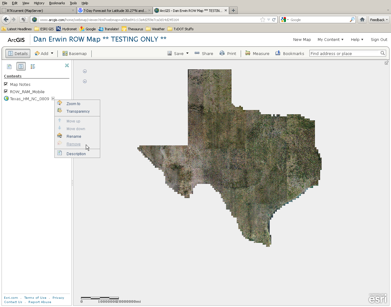
I am currently editing a map I created a few weeks ago and our office recently created an image server service for the State of Texas. We were having some issues with this image service so I attempted to remove this layer, however I am not able to do this at this time. The remove is greyed out.
How does one go about removing this or is this a glitch in the system? I will attach a image file so you can see what I am looking at.
How does one go about removing this or is this a glitch in the system? I will attach a image file so you can see what I am looking at.
1 Reply
12-12-2011
03:30 PM
- Mark as New
- Bookmark
- Subscribe
- Mute
- Subscribe to RSS Feed
- Permalink
- Report Inappropriate Content
You can't remove a basemap. You can change the basemap by selecting the Basemap option on the menu bar, or adding a new layer to the map and specifying it should be the basemap.
Thanks,
Mike
Thanks,
Mike